
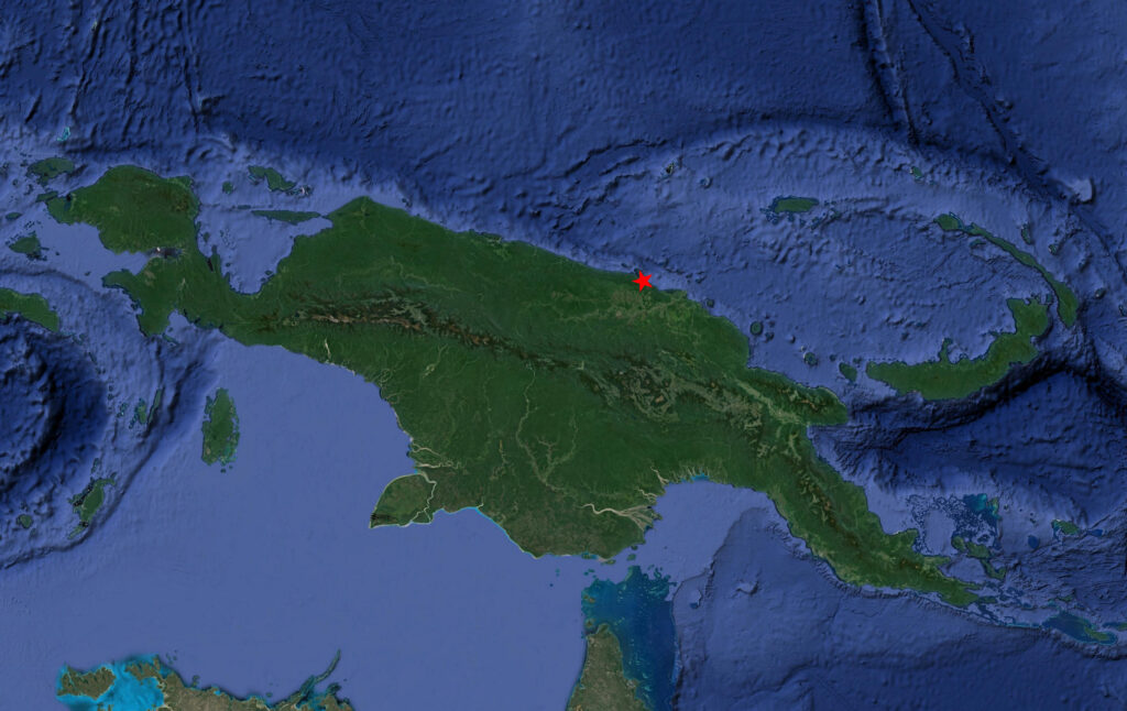
On the morning of September 27, 1943, the 345th Bomb Group rendezvoused with the 38th Bomb Group and 3rd Attack Group and headed to the north coast of New Guinea to raid the airdromes of Wewak and Boram. The 345th was scheduled to attack the airdromes after the 38th and 3rd groups made their runs. Three squadrons of the 345th would then make their bombing/strafing runs with a 30 second spacing between each of the squadrons. One squadron of the 345th was ordered to attack the Dagua airdrome, 25 miles farther west along the coast, while the other three attacked Wewak.
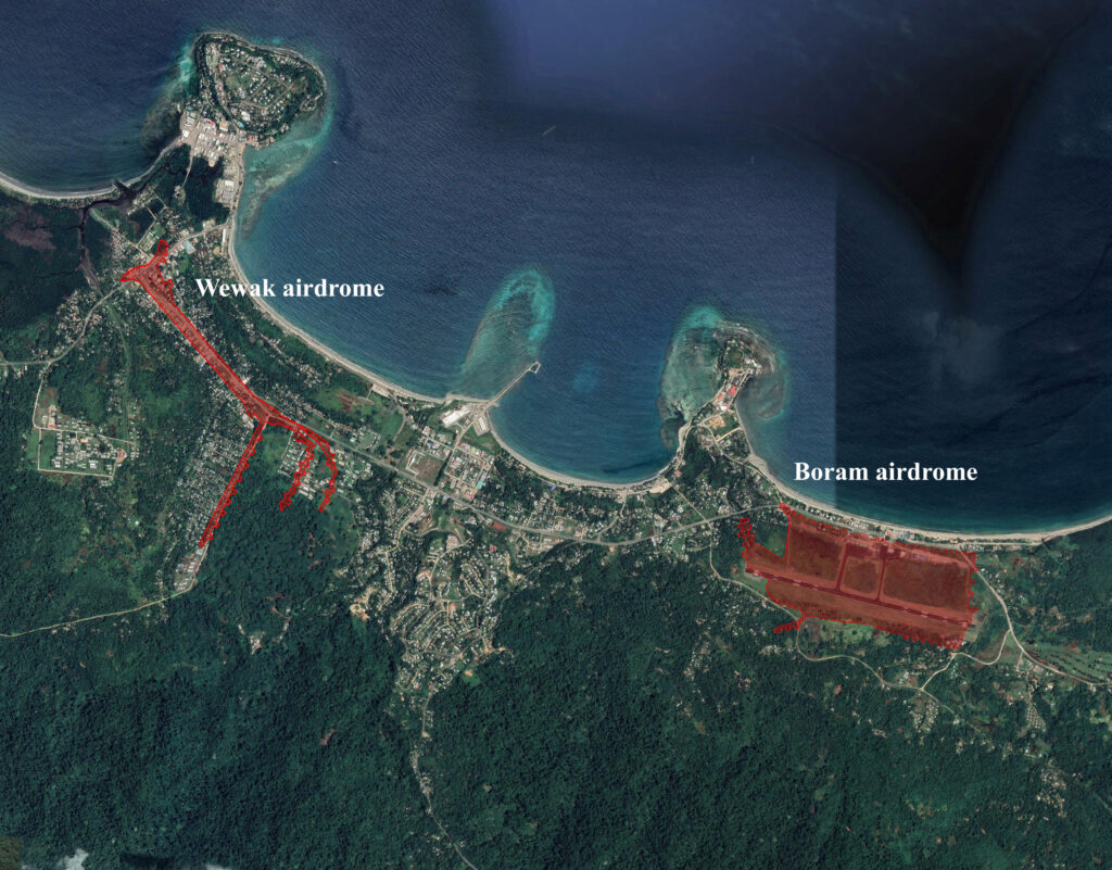
The Boram and Wewak airdromes were about three miles apart and were defended by fighter aircraft, anti-aircraft guns, machine gun emplacementss and the small arms of the troops garrisoned there. The Japanese units gathered there were the largest enemy force on the island.
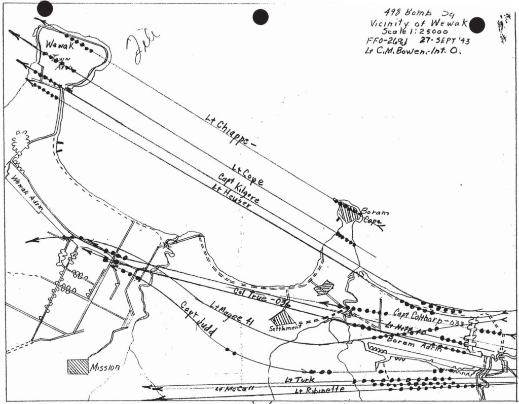
The mission reports of the 345th for this raid supply a good amount of detail about how each squadron conducted their wave of the attack. Two of the mission reports had mission maps included.
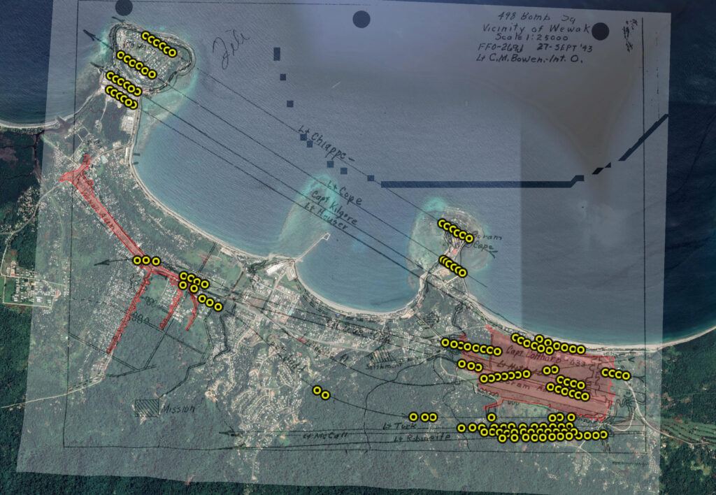
The map for the 498th Squadron supplied the most detailed information in that in addition to the flight paths of the 12 airplanes, the location of where each bomb was dropped was also indicated.
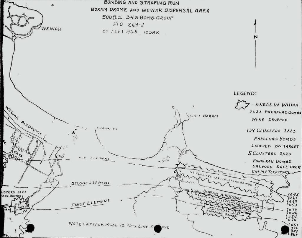
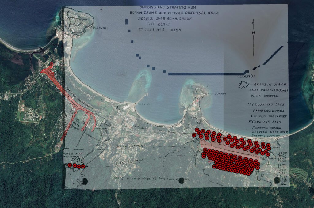
The mission map for the 500th Squadron had flight paths for each of the three flights of four airplanes that made up it’s wave of the attack and then indicated general areas where their bombs fell.
Using the 498th mission map as an overlay on satellite imagery allowed me to mark each bomb location and then to derive the modern coordinates for those places. The 498th flew in three flights of four planes abreast and dropped 140 clusters of parafrags on their target areas and returned four to base.
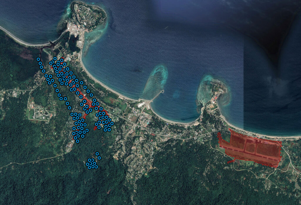
No mission map for the 499th was available, so I had to estimate their flight paths and targeting from the text of their mission report. They dropped 119 clusters of parafrags on the Wewak airdrome area, salvoed 13 off target and returned 12 to base. Two airplanes dropped no bombs but strafed, one airplane had a burned relay wire and could not strafe.
The 500th Squadron flew twelve airplanes abreast and dropped 134 clusters of parafrags on the Boram airdrome and Wirui Mission then salvoed 5 clusters off the target. Without flight paths for individual airplanes, I estimated the targeting by fitting the map dots into the described target area.
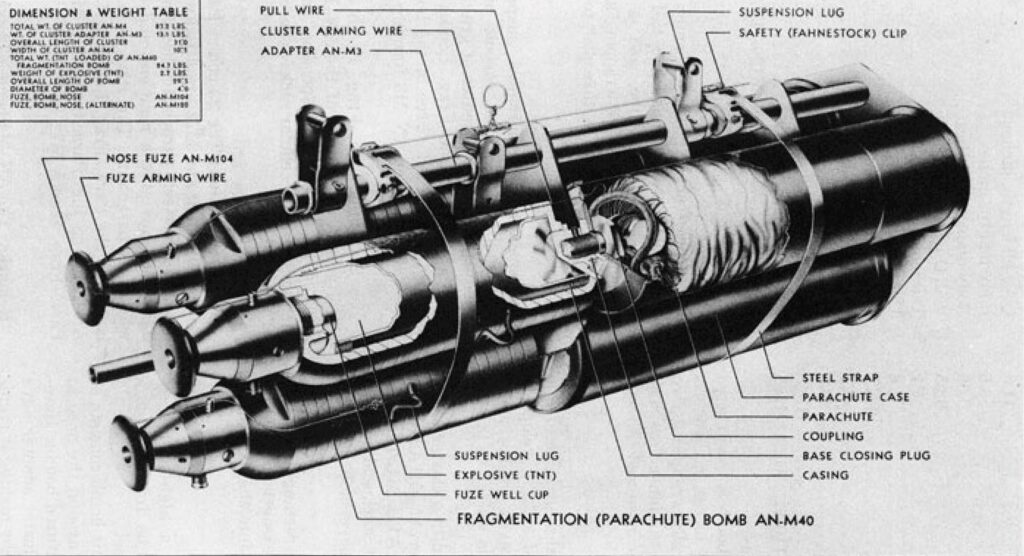
Each airplane carried twelve clusters of three 23 lb parafrag bombs. These clusters were formed by strapping three individual parafrag bombs onto an adapter which would allow the cluster to be dropped from a conventional style bomb rack. Parafrags could also be dropped as individual bombs when bomb rack modifications were made.
The map below is interactive in that it is zoomable and clicking on a map dot will produce a popup. Information in each popup gives the latitude and longitude of the location and a number indicating the three digit airplane tail number and the sequence number of the bomb. For example, 024-7 would indicate the seventh bomb dropped by airplane 024. Dot colors indicate the squadron of the airplanes and correspond to the engine cowl paint colors assigned to each squadron: yellow for 498th, blue for 499th, and red for 500th.
An interactive map of the September 27, 1943 raid on the Wewak area that was conducted by the 345th Bomb Group.
The results of this mission were impressive. Dozens of parked enemy airplanes were rendered unserviceable, several trucks and buildings were damaged, and barges along the exit route were heavily strafed. Overall, it helped to deplete the enemies hard-to-replace supply of aircraft.