
Rendering the mighty Japanese base at Rabaul, New Britain ineffective was perhaps the greatest single effort in which the 5th Air Force participated in 1943. With Rabaul bottled up, Japanese forces stationed on New Guinea and the surrounding islands could not be resupplied or reinforced and that made them more vulnerable to Allied air attacks and amphibious invasions. The Allies began their relentless drive toward Japan after Rabaul was out of the action.
An interactive 3D scene of Rabaul, New Britain as it would have been seen in mid-1943. Extruded buildings are from a June 1943 aerial photo. The view is from over the ridges between the Mother and North Daughter volcanoes, east of the town.
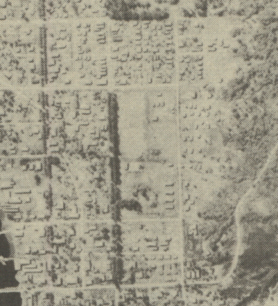
The aerial photo below was taken in June, 1943. A higher resolution version shows clearly the individual buildings that stood at that time. The city streets and peripheral roads remain much the same today as they were in 1943, and provide a good selection of control points for georeferencing.
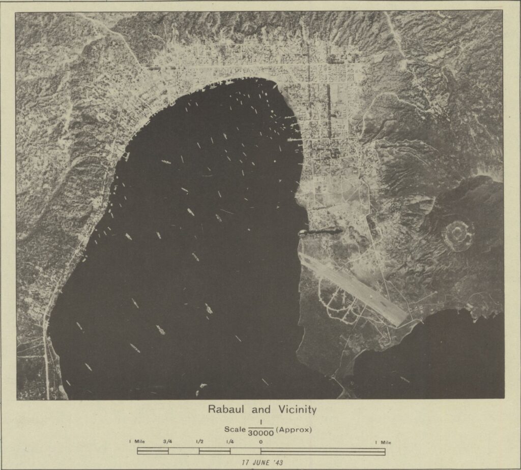
The aerial photo was georeferenced to satellite imagery using several widely separated street intersections as control points. While the streets and roads aligned very well, some of the shoreline in the northeast corner of the bay could not be aligned and suggests that the shoreline is encroaching into the bay. I would attribute this to the unimaginable quantities of volcanic ash that have been deposited on the area by the recent eruptions of the Tavurvur volcano, which is just off the bottom right of the imagery.
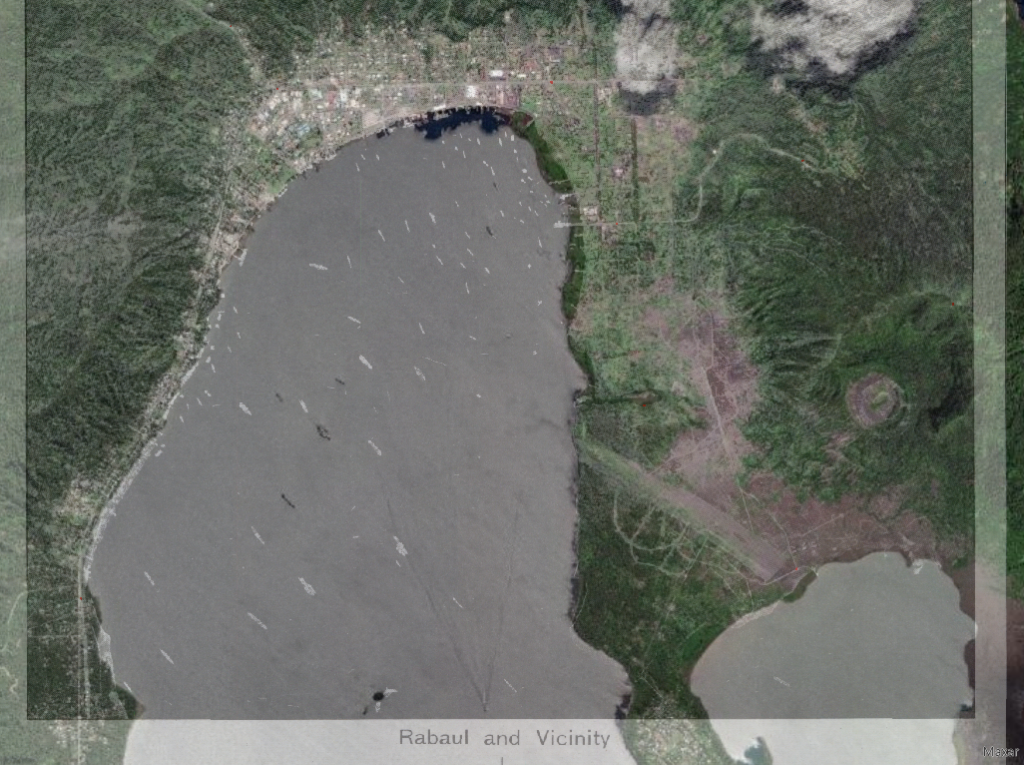
After georeferencing, the building footprints were traced and saved as features on the satellite imagery. The buildings were then extruded in a 3D view of Rabaul in order to show the targets that might have been available along the flight paths during minimum altitude missions. 3D images also provide a better picture of the terrain that pilots encountered during mininum altitude missions.
A product of a previous attempt at creating a 3D scene of the November 2, 1943 raid on Rabaul, the static image below shows a 3D view of the individual squadron flight lines over the 1943 layout of Rabaul. The flight lines were copied from mission maps included in the narrative reports for the mission. The viewpoint is from the northeast, over the ridges between the Mother and North Daughter volcanoes, which was the route the 345th followed to approached the target and where they encountered an intense flak barrage. Line color follows the engine cowl paint scheme for each squadron.
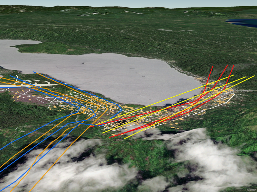
A static scene showing the flight lines of the 345th’s squadrons during the November 2, 1943 on Rabaul. Line colors represent the engine cowl paint scheme of the four squadrons. Satellite imagery courtesy of Esri.
Many bombing missions to Rabaul had already been flown by the 5th Air Force during 1942 and 1943. Heavy anti-aircraft fire was encountered whether they were daylight or nighttime raids. The November 1943 raids were highly coordinated and syncronized between the various bomb and fighter groups. Each group and squadron had designated targets and responsibilities. Some groups attacked surrounding airdromes to keep enemy fighters on the ground, some laid down a smoke screen, while others silenced anti-aircraft positions so that those going after the ships in the harbor could make more effective bomb runs. Fighters covered all the various bomb groups and dealt with enemy fighters. The result of all the planning was that Rabaul was no longer an impenetrable fortress. It was subsequently kept out of the war by occasional air raids that prevented any recovery.