
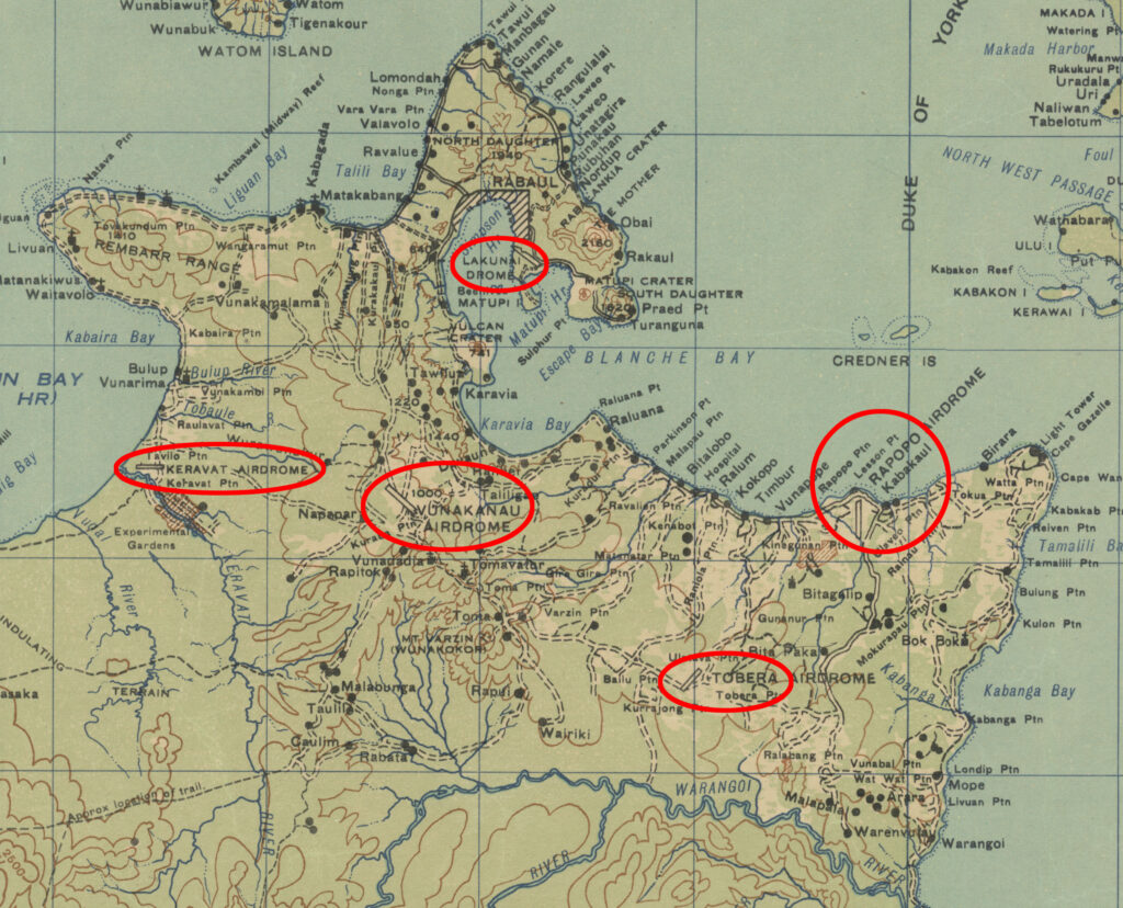
An interactive map showing the locations of the five Rabaul airdromes during WW2.
Five airdromes protected the Japanese base at the important deep-water harbor of Rabaul, New Britain. The 345th Bomb Group flew missions against three of them, with Keravat and Tobera being the ones left out. Many enemy fighter planes were based at these airfields and intercepted allied bombers in swarms whenever they approached Rabaul. The intent of the allied raids on these airfields was to not only make them unserviceable, but to also destroy as many of those enemy fighter planes as possible.
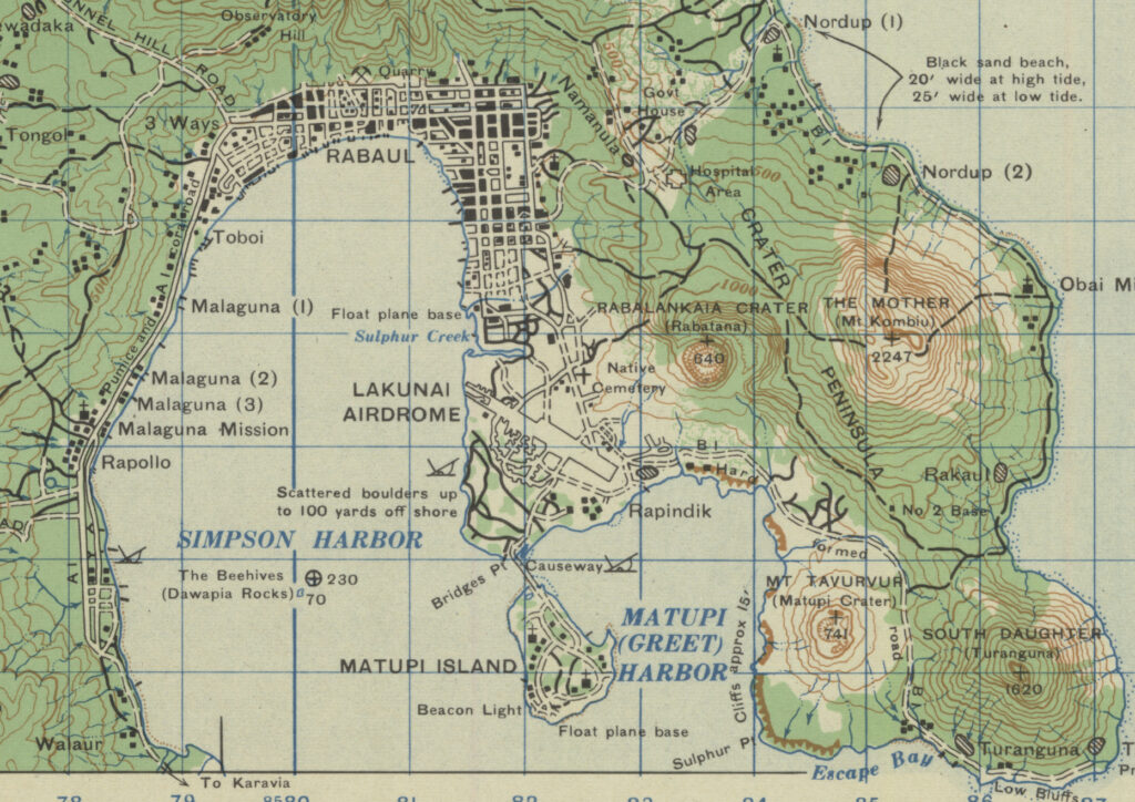
The map below is a section of a 1943 1:253,000 scale map of the Gazelle Peninsula of New Britain island. The five airdromes are circled in red to highlight their locations.
One reason why Rabaul was such an important target can be seen in the aerial photo shown below. In this June 1943 photo, which was incorporated into a map of the Rabaul area, there are dozens of ships in Simpson Harbor. At least two dozen of them are in excess of 500 feet in length, which makes them longer than a Liberty or Victory ship. Mission planners must have drooled over images like this one.
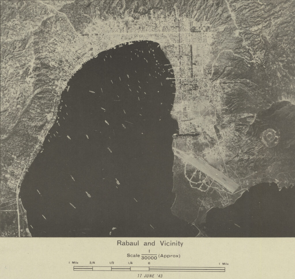
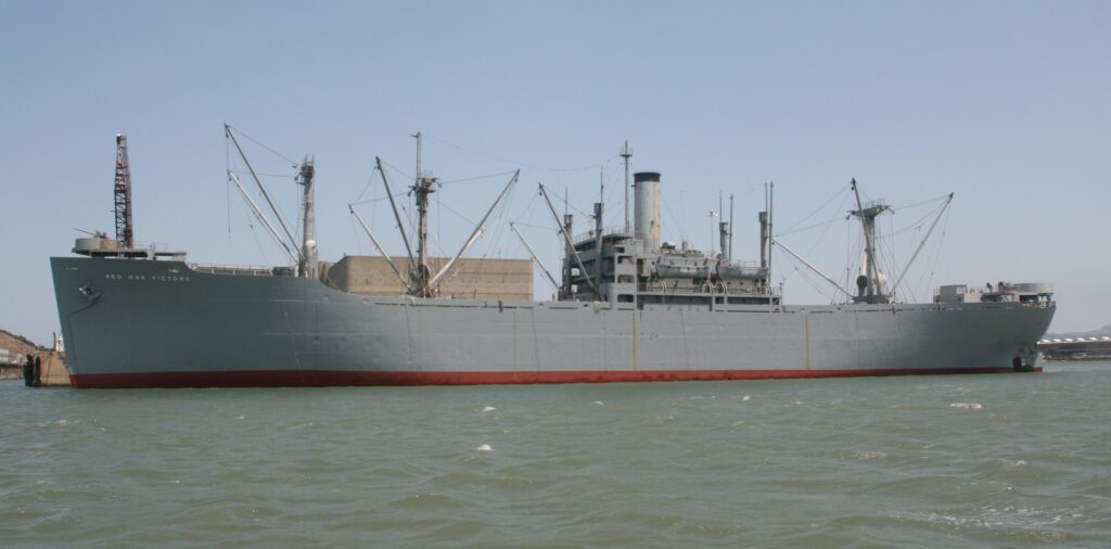
US Liberty and Victory ships ranged from 441 to 455 feet in length and were critical in shipping war supplies overseas. The larger ships shown in Simpson Harbor are up to 25% longer than the Victory ship shown below, making them long enough to be 10,000 gross tonnage merchant vessels or naval cruisers.
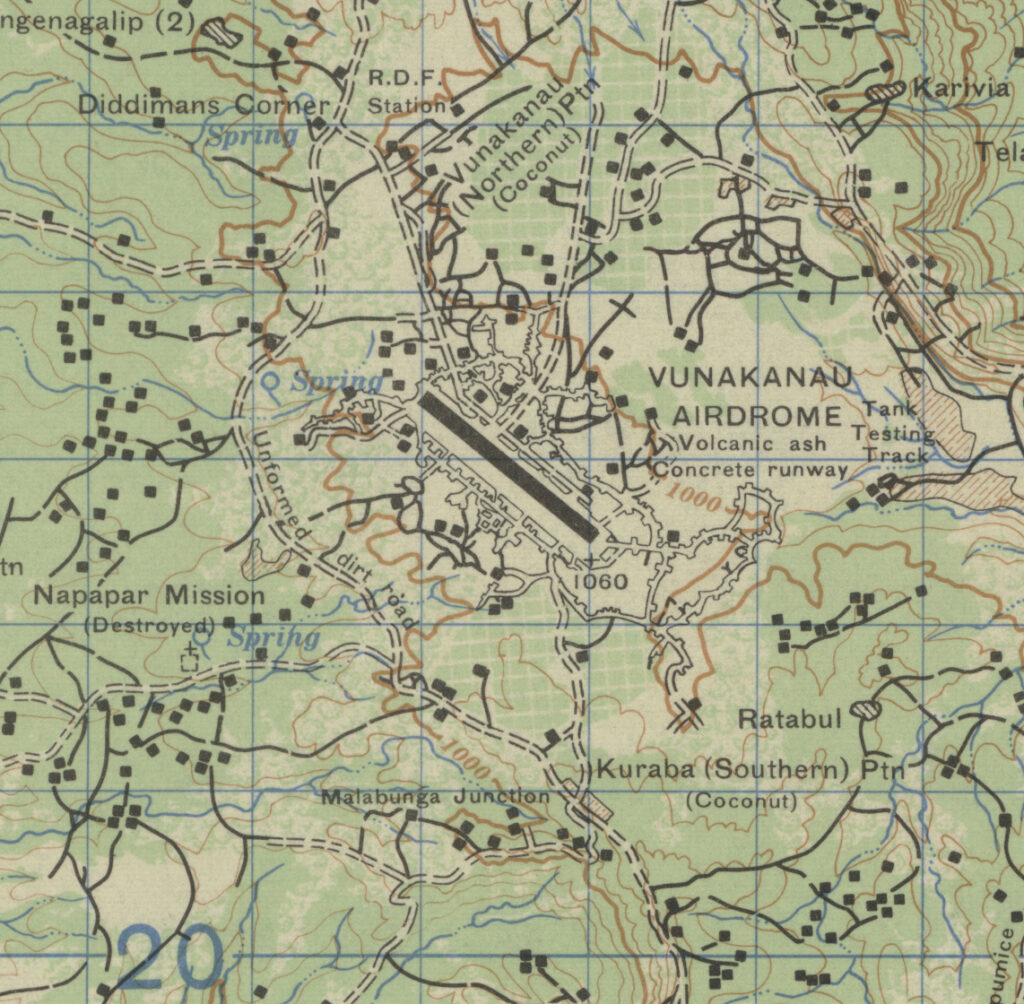
Vunakanao was the largest of the Rabaul airdromes and accomodated both bomber and fighter aircraft. As the war went on, it was expanded to two runways. Bombers from this airdrome could reach targets on New Guinea as well as in the Solomon Islands.
Lakunai drome was the only airfield in the Rabaul area before the war. It was built by the Australians and then expanded by the Japanese to be a fighter base while they built the other four airdromes.
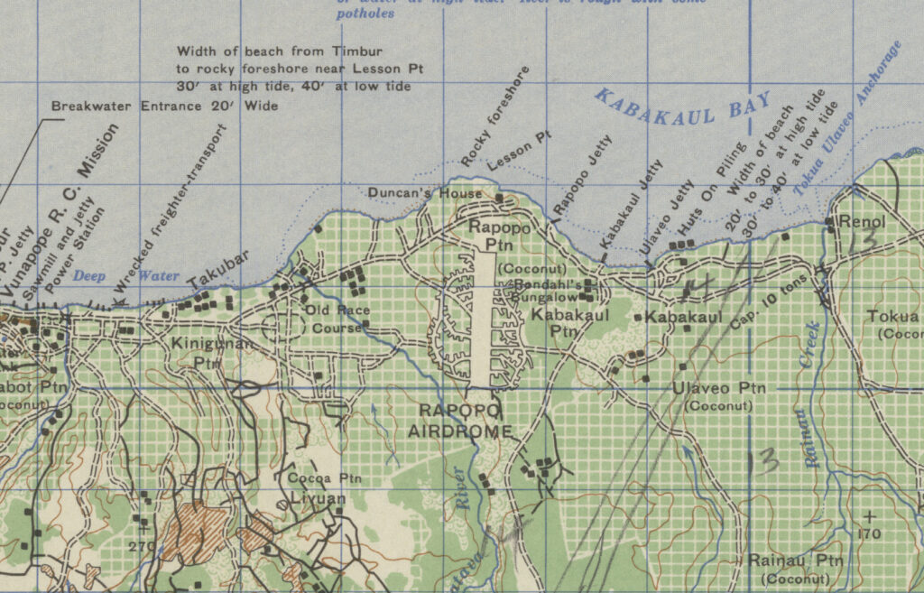
Rapopo was a fighter strip built in a coconut plantation. The fighters based here could intercept incoming allied airplanes or harass them as they were leaving a target.
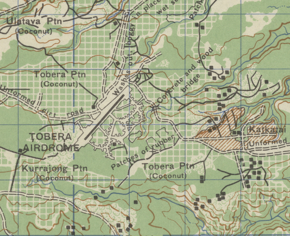
Tobera was the southernmost of the Rabaul airdromes. Located near the Warangoi River, which seemed to be a favorite landfall and insertion route for allied airplanes on missions to Rabaul. It’s position could have been chosen to intercept those bombers before they reached their targets.
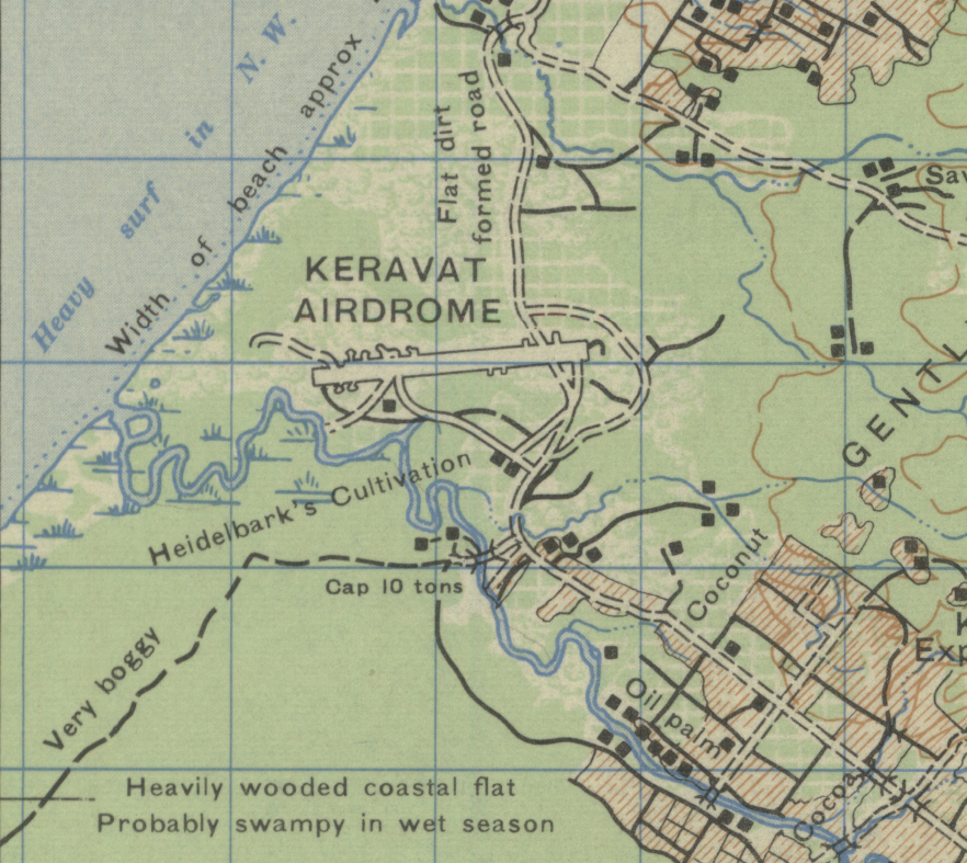
Keravat apparently had drainage problems that made it frequently unsuitable for use as anything more than an emergency landing strip. Those problems would seem to be confirmed by the terrain comments on this section of map.
Rabaul and the surrounding airdromes were important targets for the 345th during the last few months of 1943. By December of that year, the 345th had moved on to supporting the allied invasions of New Britain at Arawe and then Borgen Bay. Other Allied bomb groups and naval aircraft continue to bomb and strafe the Rabaul area to make sure it withered on the vine and did not become a threat again.