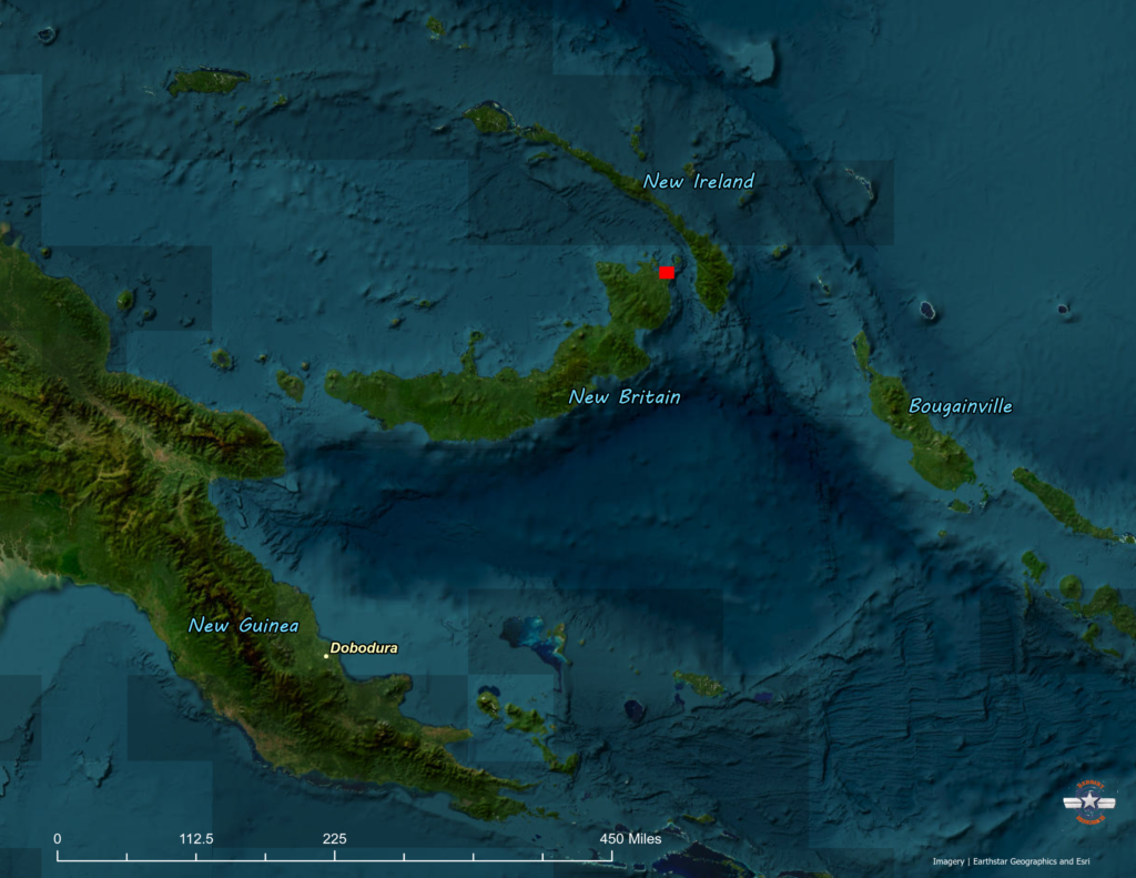
At 10am on October 18, 1943, nine planes of the 500th Bomb Squadron, 345th Bomb Group took off from Horanda Strip at Dobodura, New Guinea. They joined in formation with the other three squadrons of the 345th and headed north across the sea on a mission to attack targets on the Gazelle Peninsula of New Britain island.
One flight of three B-25’s turned back after finding that the gun turret in the flight leader’s plane was not functioning. The remaining six planes of the 500th continued on through rough weather and emerged from the storm near the southeastern coast of the Gazelle Peninsula. Finding that their fighter cover and the heavy bombers that were to precede them had turned back, the squadrons of the 345th continued on toward their targets, unescorted.

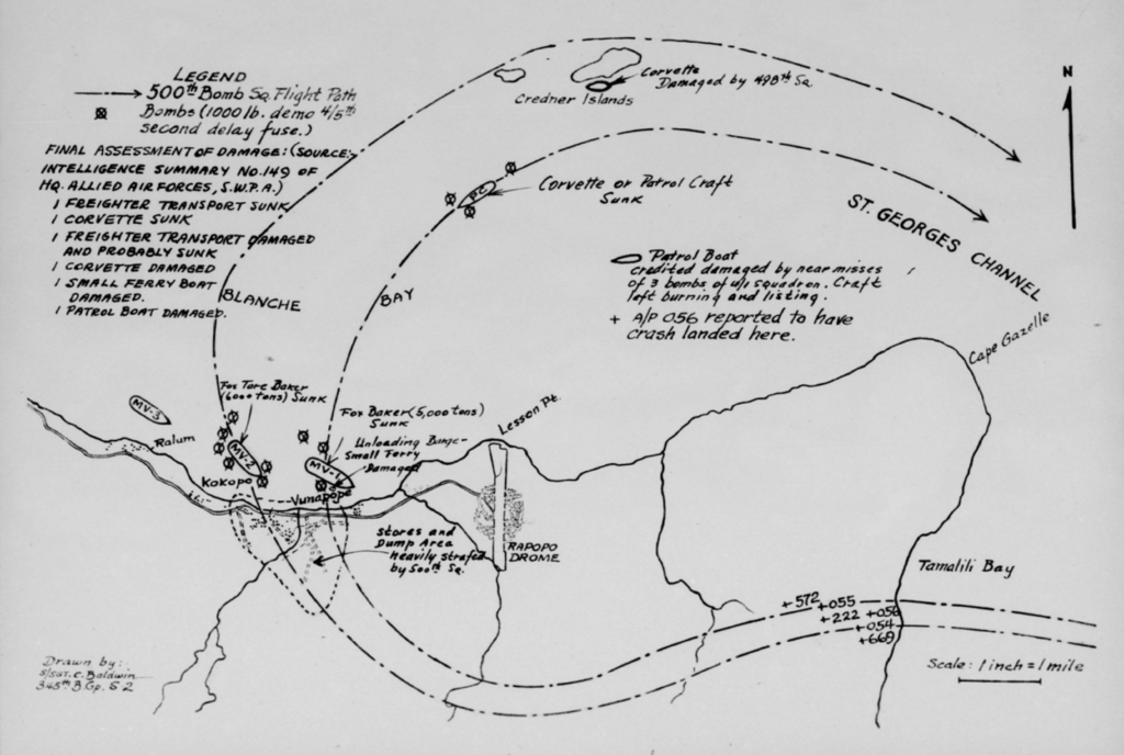
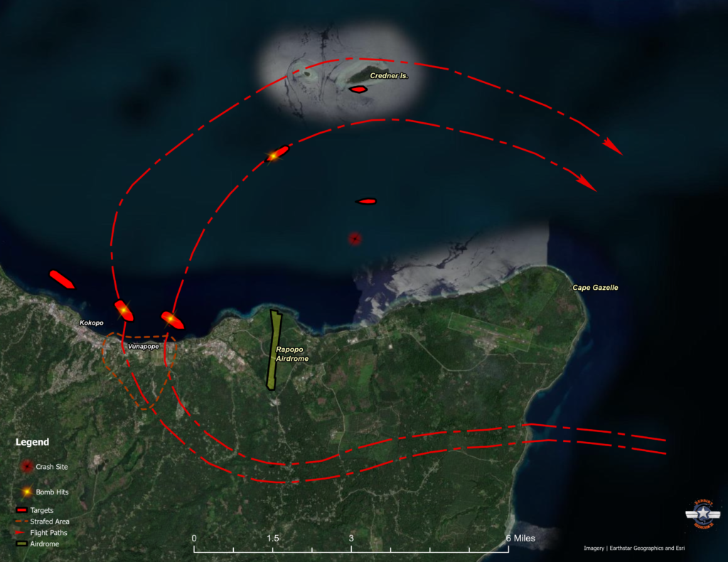
The target assigned to the 500th Squadron was shipping in Vunapope Harbor. A map included with their mission report shows their approach to the target and their flight paths through the harbor. Before crossing over the shore at Vunapope, they strafed supplies that were stored along their flight paths. Flying at minimum altitude over the harbor, the two flights of three B-25s strafed and bombed merchant shipping and naval patrol craft.

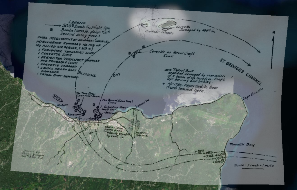
The mission map was georeferenced to satellite imagery using the spline transformation method provided in mapping software. Several dozen control points were entered in order to fit the map coastline to the imagery. Distinctive curves along several rivers and the coastal roadway depicted on the mission map were also used as control points to improve the result of the georeferencing attempt.

Flight and target details were then traced from the mission map onto the imagery in order to display the mission clearly on the satellite imagery.

The mission resulted in the sinking of a 5,000 ton freighter and a 6,000 ton freighter transport anchored off Vunapope, the destruction of a corvette or patrol craft maneuvering in Blanche Bay, and the destruction of supplies encountered on shore near Vunapope.
Coming off the target, the squadron was set upon by forty or more enemy fighters that made repeated passes at the two flights of B-25s for over an hour.
Two airplanes of the 500th Squadron were lost during the mission: Lieutenant Harlan Peterson and crew ditched off Rapopo airdrome without any known survivors. Captain Lyle Anacker and his crew were attacked relentlessly during the running battle with the enemy fighters and ditched in the vicinity of Cape Kwoi near the north end of Jacquinot Bay, along the eastern shore of New Britain. Two members of the Anacker crew were able to swim to shore and were later returned to military control with the help of friendly locals and Australian troops.
