
The 501st Bomb Squadron of the 345th Bomb Group began combat operations in the South West Pacific Area (SWPA) in June, 1943. During the next six months, the squadron completed 44 separate combat missions (or to be more accurate, I have documents for 44 completed combat missions). 349 sorties, or flights by individual airplanes and crews, made up those 44 completed missions.
Missions were flown to a variety of notable locations, among them: Salamaua in support of allied ground operations; Lae in preparation for and support of that allied invasion and the capture of the airfields at Nadzab; Rabaul in the effort to reduce the threat of it’s airfields, naval fleet and port; Madang and Alexishafen where enemy air capability was destroyed; in support of allied invasions at Arawe, Gasmata and Borgen Bay on New Britain; and the Wewak, Boram, and Dagua airfields in a continuation of the pursuit of allied air superiority over New Guinea.
The interactive map above is different from previous versions in that each map dot represents one airplane and is placed as near as I could determine to the position at which it dropped bombs. As usual, clicking on a map dot will bring up a popup with mission information, airplane number, and crew names.
The Australian National University, Open Research Repository maintains an online collection of maps that includes sets of 1:63,000 and 1:253,440 topographic maps of the New Guinea, New Britain, New Ireland, and Admiralty islands. These maps can be very helpful in locating wartime locations, especially small villages no longer in existence, that are mentioned in mission reports or other documents.
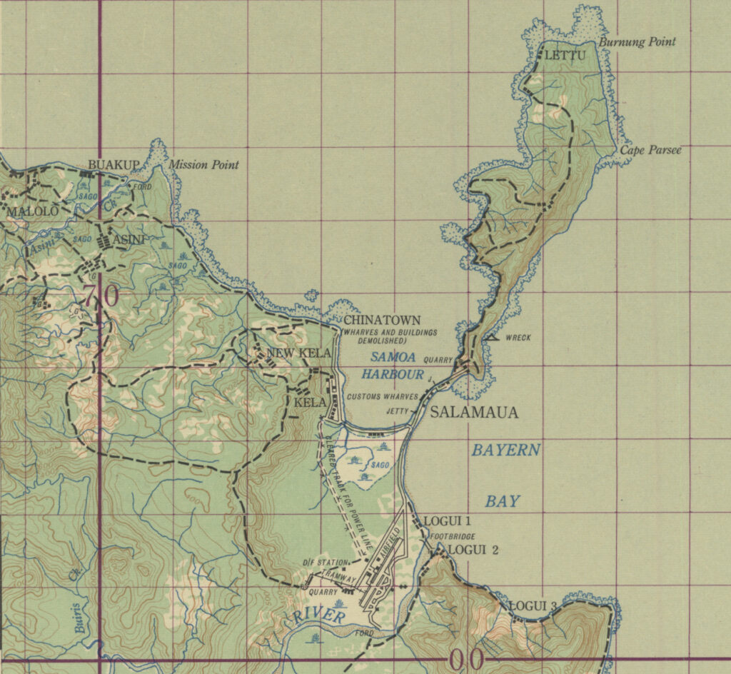
1:63,000 scale maps have an overlaying grid that represents one inch of map distance equaling one mile of earth distance. The piece of map below shows the Salamaua area where the 345th flew many of their earliest combat missions and shows the locations of the villages of Malolo, Kela, Salamaua, and Logui, as well as the airdrome.
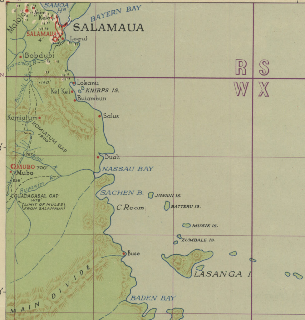
The 1:253,440 map for the same general area is scaled at 1 inch equals 4 miles. While the map lacks some of the topographic and geographic detail displayed in the 1:63,000 map, this map section shows the locations of Bobdubi, Komiatum, and Mubo, all of which are mentioned in various mission narrative reports.
The ANU Open Research Repository has nearly complete sets of both of these map series. I have found at least one of the two maps for every location targeted by the 345th during 1943. Each 1:253,440 map also has an accompanying index of place names with map coordinates to assist in locating them on the map sheet.
As I come across these maps, and use them in some particular context, I am often able to use them to update or refine map coordinates for the interactive maps on this site. Because of this occasional updating, it is possible that a map location for an event might change over time.