
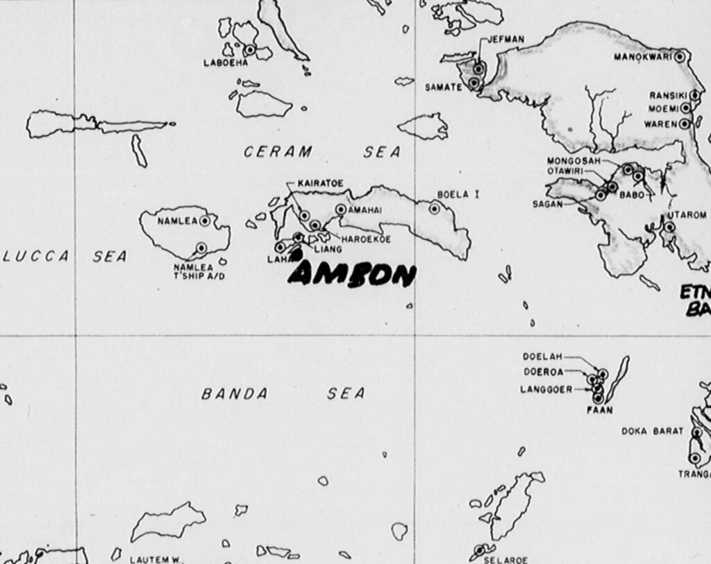
An interactive map of the Ceram, South Molukka area showing the locations of Japanese-held airdromes during WW2.
Ceram and the nearby islands of Boeroe, Ambon and Haruku were protected by eight airdromes. The 345th Bomb Group flew strike missions directly against four of them and coastal shipping sweeps near the others during the summer and fall of 1944. Ceram is also sometimes spelled Seram or Seran.
Unlike the Japanese-held airfields in the Bismarck Archipelago, which were involved in offensive operations, these airfields in the Spice Islands were defensive and protected raw material sources that were critical to their war effort. The Boela airdrome protected the oilfields and tanker loading facilities of northeast Ceram.
V Bomber Command (Fifth Bomber Command) kept a monthly journal of the activities of their attached bomb groups and included maps of the target areas. The section of that map shown below shows the approximate locations of the airdromes in the Ceram area. Using vertical aerial photos, more precise locations for the airdromes were made by georeferencing the photos to the satellite imagery. All of the airdromes were covered by aerial photos except for Kairatoe on the eastern shore of Piru Bay. Because of that, the location for that airdrome is only an estimate, based on the description of potential airfield sites for that area.
The airdromes at Amahai, Haroekoe and Liang were built under horrifying conditions using Allied POW’s as labor. The story of Gerrit Johannes van der Velden, a Dutch POW involved in the construction, is posted on the Dutch War Graves Foundation website (Oorlagsgravenstichting.nl) along with period photographs. One of those photos happened to be a very clear vertical aerial of the Haroekoe airdrome from August 1944. This turned out to be the only vertical aerial photo I came across for that airdrome and the helpful staff at OGS allowed me permission to use that photo for this post. The quality of the photo and the many distinctive coastal features made for a particularly exacting alignment of photo and satellite image. My thanks to OGS, not only for permission to use the photo, but also for keeping the stories alive.

Written within the V Bomber Command history narratives, there is a lot of speculation about the location of a theoretical line, the Main Line of Defense, beyond which the Japanese would not withdraw their aircraft. During the summer of 1944, this line was thought to pass through Halmahera, Celebes and Java, and lay to the west of Boeroe Island.