An interactive map of the mission flown by the 501st Bomb Squadron on May 27, 1945. Target and crash site locations are indicated with colored map dots.
On May 27, 1945, six B-25’s of the 501st Bomb Squadron, 345th Bomb Group, took off from Clark Field on the island of Luzon in the Philippines, and headed north to Formosa (modern-day Taiwan) to bomb the rail yards at Ensui. Their route to the target took them along the west coast of Luzon and into the Pescadores Straits to a point somewhere north of Tainan at which time they would turn to the east and bear in on the target. Some sort of unspecified error occurred and they did not attack Ensui. Instead they chose targets of opportunity to the north and south of Ensui and salvaged their mission.
Finding places with their old Japan-era names can be quite a challenge since satellite images utilize their current place names, and often display them in Chinese characters. Instead, I used the 1944 Army Map Service, Series L792, 1:50,000 scale map sheets and searched areas around the mission coordinates to find the locations with their Japanese names.
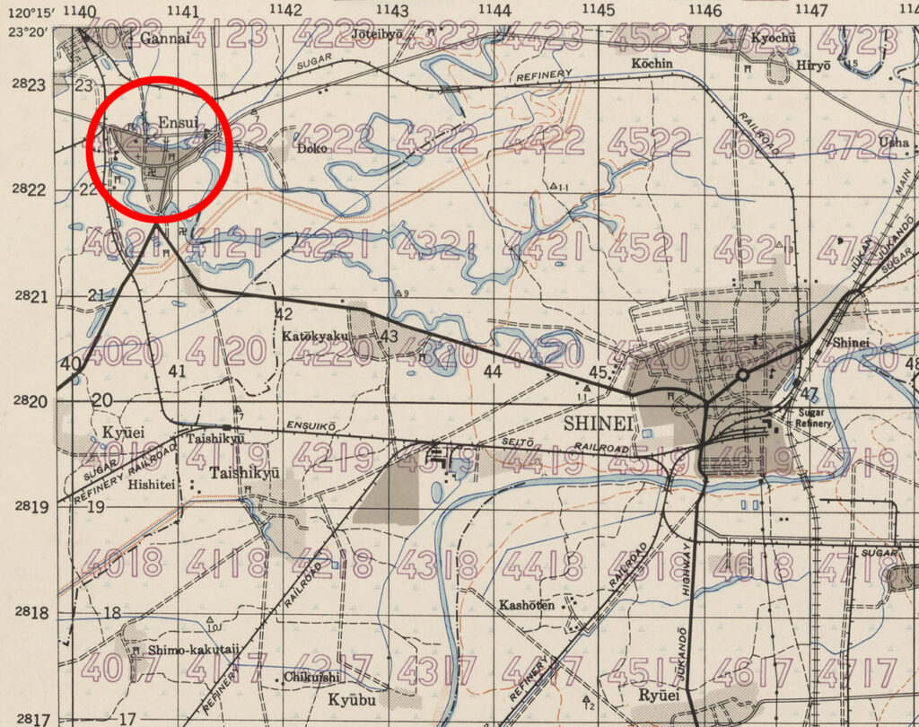
Ensui turned out to be a small town a few miles west of the city of Shinei (current name Xinying). No rail yards were indicated on the map sheet, but several rail lines converged just out of town and an examination of satellite imagery suggested an area that could have once been a rail yard. I used that area as my estimate for the attack location.
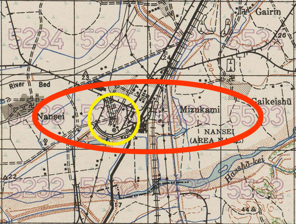
I found the town of Mizukami on another map sheet from the same series. The map does not call out the location of a sugar mill, but there was an area in the southwest corner of the town that had a rail yard and several large tanks, which is an indication of an industrial area on other maps. Examining satellite imagery for that area strongly suggested that area was the location of the sugar refinery. This area was used as my estimate of the Mizukami sugar mill attack location.
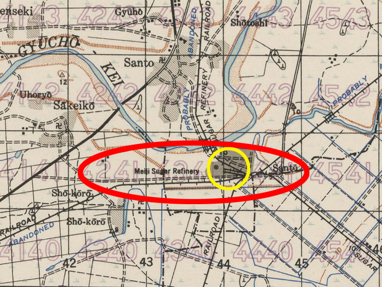
I found the Meiji Sugar Refinery on the same map as Mizukami. Meiji was the name of a sugar company and the refinery is called out near the town of Santo. Satellite imagery suggests that the site could still be a sugar refinery. This made for a more accurate estimate of the attack location.
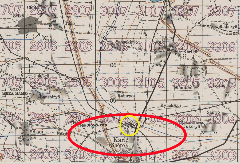
The third target of opportunity was a brick plant at Kari, about seven miles west of the city of Mato. The topographic map does not call out a brick plant, but using my limited knowledge of brick making, I made the assumption that a brick making factory would require a source of water and a rail line for incoming clay and outgoing shipments of bricks. An area just to the north of the town offered both, and indicated some large buildings, so I used this as my target location estimate. Satellite imagery suggests that it could still be a brick plant.
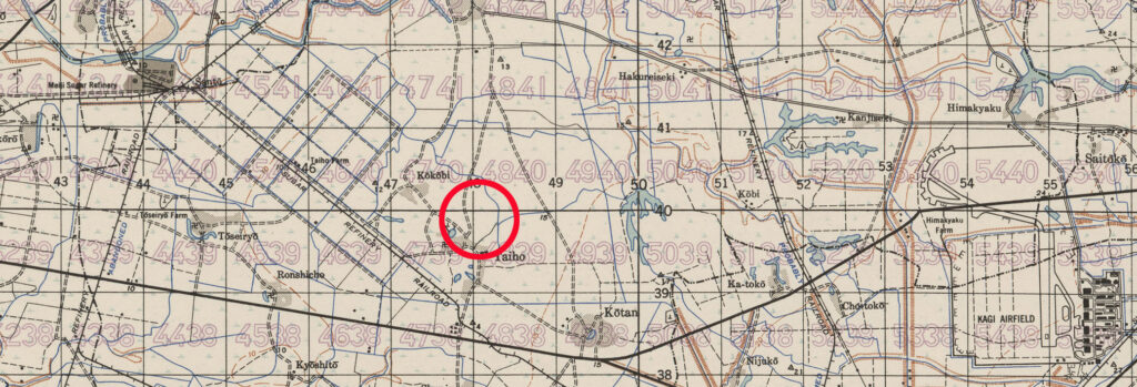
Both flights of the squadron flew using the “in trail’ formation which left the last airplane exposed with no covering fire from behind. This proved to be hazardous because that airplane, piloted by Lt. Ted Hart, was shot down without being observed by any of the rest of the flight. The crashed B-25 was observed, still in flames, about half way between the Meiji Sugar Refinery and Kagi airfield by the 500th Squadron as they passed over later. Four of Lt. Hart’s crew were taken POW and the fifth was KIA.
By this time in the war, the 345th had accumulated a lot of experience in searching for targets of opportunity. Missions against enemy naval convoys and coastal shipping involved searching vast areas from last-known coordinates. Missions against rolling stock would necessitate flying along railways and roadways until traincars or trucks were encountered. Their experiences helped to salvage disrupted mission plans and made their expended efforts worthwhile.
