
An interactive map showing the reported crash coordinates of B-25 #43-36041 that crashed south of Saigon, French Indochina on April 28, 1945. Imagery courtesy of Earthstar Geographics and Esri.
During the raid on shipping on the Saigon River on April 28, 1945, B-25 #43-36041, piloted by Lt. Andrew J. Johnson, was hit by a flak burst while egressing the main wharf area. The plane was on fire, but managed to gain some altitude before finally crashing about nineteen miles south of Saigon (seventeen miles south is stated in the Missing Air Crew Report) at coordinates reported as 10°30’N 106°39’E. No survivors were observed by the wingman. No map was included in either the MACR or mission report.
I was unable to obtain any 1940’s US Army maps of the Saigon area, but did find a digitised 1945 map printed by the Survey of India Office. By drawing lines between latitude and longitude tick marks present along the margins of the map and then adding a suitable grid, the crash coordinates were plotted on the map. While this map is not necessarily the one used by the 345th’s navigators that day, it does give a view of the area as it was then.

Plotting the crash coordinates on a 1962 Army Map Service 1:250,000 scale map placed the crash site about 1,000 yards west of the Survey of India location.
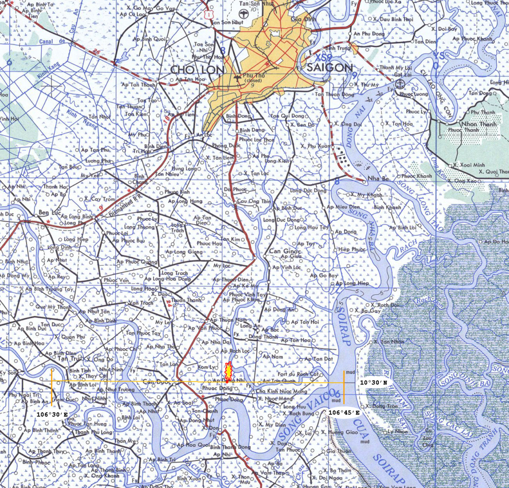
In trying to account for other possible locations, I changed the coordinate system of the live map at the top of this page between the several available Indian datums and also changed the map projection to Polyconic to match the Survey of India map. Those efforts all ended up in the same general area, very close together. Not knowing the map used to determine the crash coordinates makes all of the various map dots interesting but inconclusive.
A bounding box, one-half minute outside of the various map dots produced a rectangle that could be considered the possible crash area. I have to wonder if a local farmer might suffer an occasional mysteriously cut foot while working in a particular rice field, if there is a field that is never cultivated for reasons lost to history, or if there is an old grave that isn’t claimed by any family.
Lost in the crash were:
- 2Lt Andrew J. Johnson, pilot
- 2Lt Paul E. Langdon, Jr., copilot
- 2Lt Aubrey L. Stowell, Jr., navigator
- Cpl Lester F. Williams, radio operator
- Sgt Alfredo P. Paredes, aerial gunner
The entire crew remains on the DPAA Not Recovered list.