
Specific target numbers are often mentioned in narrative mission reports. While the target number location is sometimes noted in the text or on a mission map, in many instances there is no way to know where a specific target was located.
Attached to the Unit Histories of the 345th Bomb Group squadrons, there can be mission photos and target maps produced by V Bomber Command or some other agency. Some of the maps have printed target numbers. Due to the limitations of the microfilming or scanning equipment, the maps are usually split over several pages but have generous overlaps. The microfilmed versions also display varying degrees of optical distortion which can be perplexing when trying to fit the pieces back together.
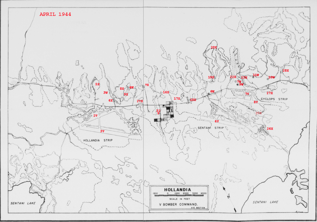
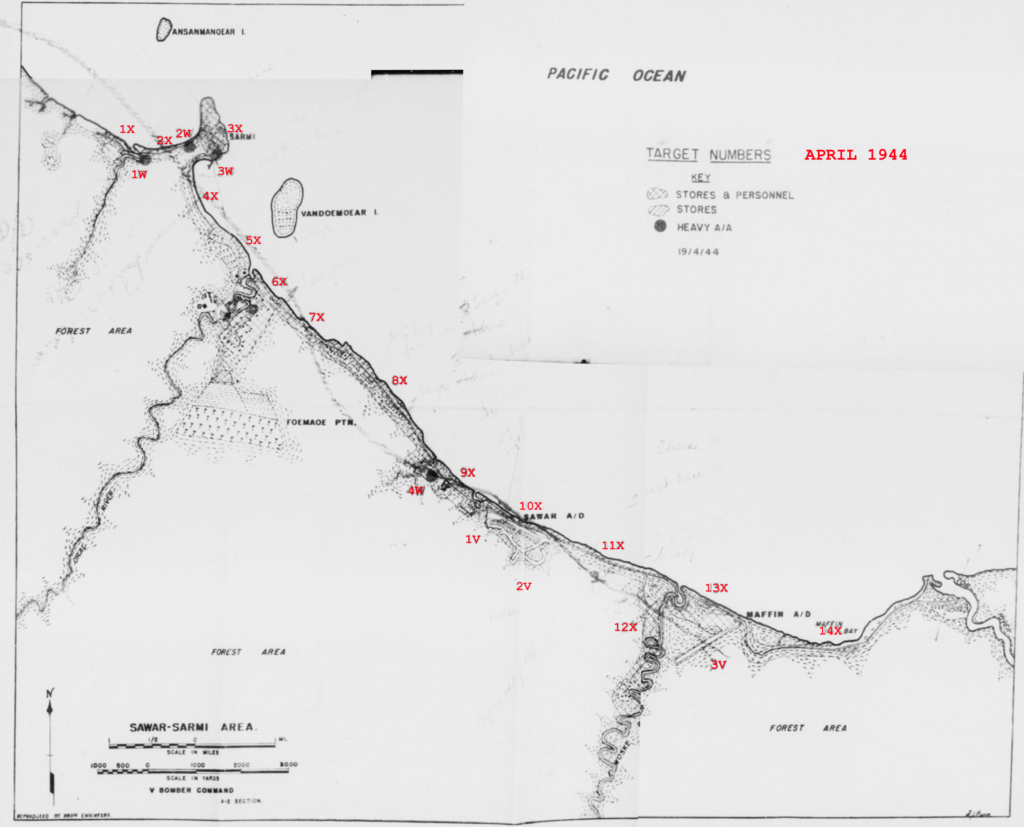
Three maps of the Hollandia and Sarmi-Sawar-Maffin Bay areas were among those attached to the April 1944 Unit History of the 501st Bomb Squadron, 345th Bomb Group.
A map of the three Hollandia airdromes was split into two halves and did not display noticeable distortion. Fitting the two pieces back together was a matter of aligning the line features, concentrating on the east-west road and the contour lines. Some target numbers were not legible so a “?” was substituted for illegible characters.
A map of the Humboldt Bay area east of the Hollandia airdromes was also included. This map was split into six pieces and did not fit back together very well. I ended up concentrating on creating a consistent shoreline and ended up with an ugly map. Despite the rough appearance, the map should still provide a general idea of where individual targets were located. The target numbers and the target number key have been highlighted for clarity.
Also attached was a map of the Sarmi-Sawar-Maffin Bay area. This map was split in quadrants over four pages that were distorted to varying degrees. This made for a less accurate reconstruction though the intent of the map is preserved. The date April 19, 1944 is printed below the target number legend.
The monthly Unit Histories of the 501st Bomb Squadron are contained on microfilm reel A0625, available as downloadable pdf files, through the Air Force Historical Research Agency, Maxwell AFB, Alabama.