
An interactive map of the crash site of B-24 #42-41081 on the southern slopes of Mount Thumb, New Guinea.
After writing the original Lost on an Admin Flight post, I received a digital copy of the Individual Deceased Personnel File for Lt. Raymond J. Geis, Jr. The file contains a considerable amount of information about the recovery mission and made it possible to write this update. Even with the new information, the crash location I have estimated remains a matter of conjecture, since the coordinates are given without providing the details of the map version or geographic coordinate system it was made in. At best, my estimate is a presentation of 1982 data on a 2022 satellite image.
The IDPF for Lt. Geis, who died in the crash of B-24 #42-41081 on March 22, 1944, gives coordinates for the crash site examined by technicians from the US Army Central Identification Lab (CIL), in 1982. Depending on how the map was used to plot the coordinates, there are several possible crash locations in the Mount Thumb vicinity. One would seem much more likely than the others.
A sketch of the debris field, made by a CIL technician in 1982, was included in the IDPF. The investigators’ camp site was on a ridge and from there they could see a propellor down the slope. This suggested to me that the long, wavy line along the top of the sketch was the ridgeline rather than the stream running at the bottom of the ravine. The dimensions of the debris field were reported (by Susan Sheehan in A Missing Plane, 1-Recovery, that appeared in the May 12, 1986 issue of The New Yorker magazine) to be thirty to fifty yards north to south (up and down the ridge), and one hundred-fifty yards east to west (along the ridge).
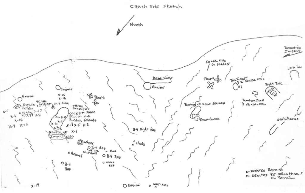
Reading the coordinates in the Military Grid Reference System (MGRS), the wreckage is along a deep ravine running to the southwest off the mountaintop. The description of the site in The New Yorker article places the wreckage on the east wall of a ravine at an elevation near 8,400 feet (about 2,560 meters). The shape of the ridgeline is generally similar to that shown on the sketch of the debris field shown above. The format of the coordinate string, 55LEL570090, supports reading them as MGRS, as a UTM (Universal Transverse Mercator) coordinate string would not contain the “EL” between the 55L and 570090.
To visualize the location of the MGRS coordinates, ten-by-ten grids were constructed over four of the 10,000 meter grid squares on the 1:250,000 scale maps (two 1965 Army Map Service 1:250,000 map sheets had been merged to produce a usable graphic for this post, and could be significantly different than the map used by the CIL team). The 570 is the “easting” component of the coordinates and is read by using the large 5 below the grid and then reading right to the small 7. Similarly, the 090 is the “northing” component and is read using the large 0 along the left of the grid and then reading up to the small 9.
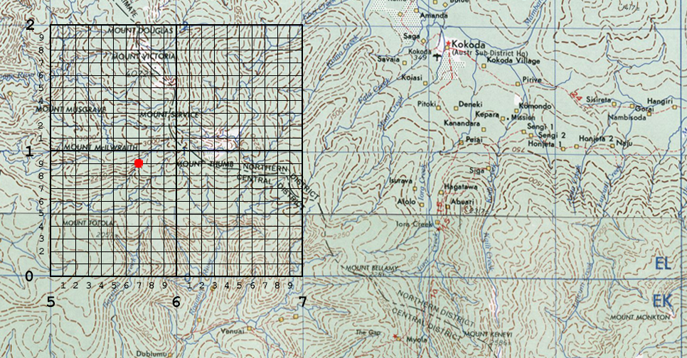
Acknowledging the possibility that using a small scale UTM map to determine a precise location could have led to errors, it could be that the coordinates were read in another way, using similar grid numbers along the borders of the map sheet. Both of the possible locations shown in yellow below would require significant map reading errors. The location due east of the red dot is at an elevation near 8,000 feet, but is on the north slope of the Mount Thumb area. The location in the lower right corner of the grid is at an elevation below 5,000 feet.

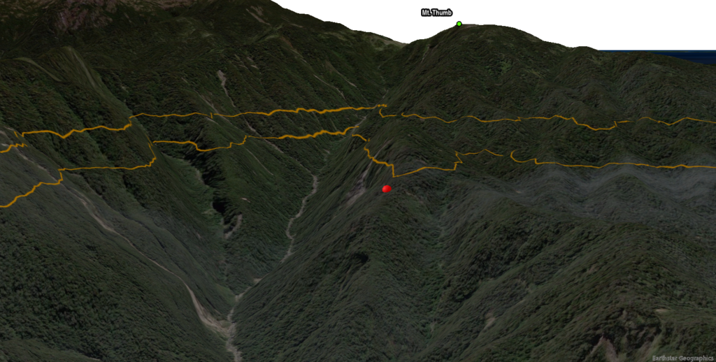
As with all speculation, there is the possibility of error. If the crash site shown in the static 3D view is incorrect, then I would expect the error to be on the order of 500 yards. Keeping the campsite and crash site descriptions in mind, I would suggest that the next ridge and ravine to the east (right) could be another possible location.