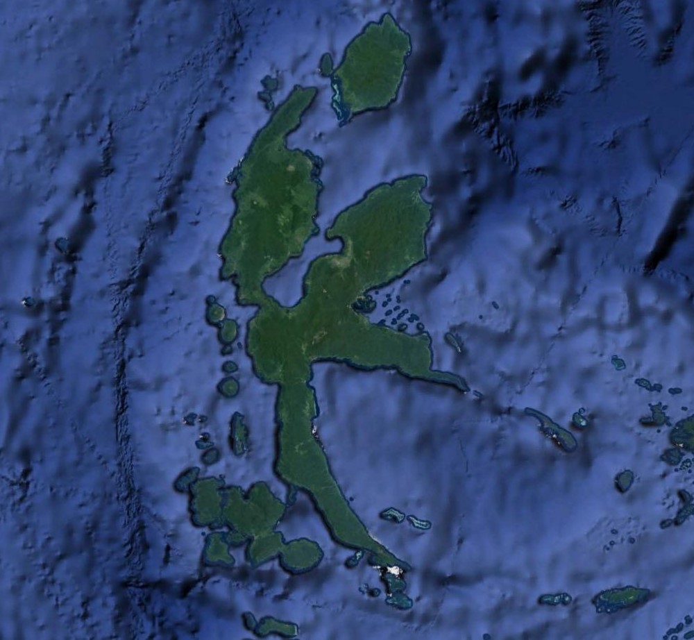
The island of Halmahera in the North Moluccas has some of the most exotic and alluring place names of anywhere in the southwest Pacific. Djailolo, Lolobata and Galela are among my favorites. The topic of this post took place just to the east of Lolobata, along the coast of the large bay that enters from the north. This island also bears an uncanny resemblance to the neighboring island of Celebes.
Midday on 13 August 1944, three squadrons of the 345th Bomb Group made a minimum altitude attack on stockpiled supplies and buildings along the northeast shore of Wasile Bay, Halmahera. They encountered intense anti-aircraft fire whose accuracy was only dampened by the simultaneous strafing of the gun pits by succeeding flights. The last flight of three B-25’s over the target did not receive the benefit of having a flight behind them helping to silence the A/A guns, so the barrage that they encountered was even more intense and accurate. The right wing airplane, #41-30084, flown by Lt. G.P. Voitier and his crew of five, took a hit that set the left engine on fire. The airplane was observed to make a forced landing in shallow water off the east shore of Wasile Bay and three of the crew were later observed out on a wing.
There is good deal of documentation for this incident as there is a copy of the original, signed Missing Air Crew Report (MACR) with a witness statement and map, as well as mission narrative reports with maps from all three of the participating squadrons. Despite all this information, they each paint a different picture of the situation as encountered that day, especially in regard to where the Voiter airplane crashed and the locations of landmarks that could help identify the location of that crash. Additionally, the 499th mission maps are poor quality copies and do not show critical details. This all combines for quite a lot of uncertainty.
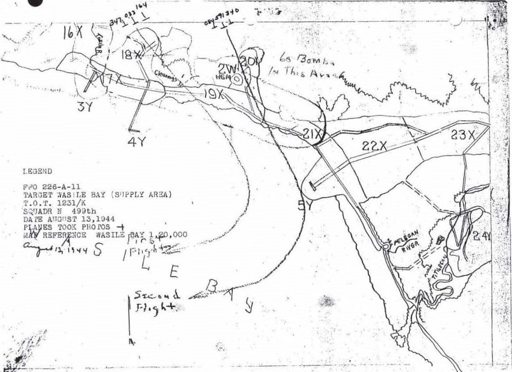
There are two mission maps accompanying the mission narrative for the 499th Bomb Squadron. The maps show different attack routes through the target area. One map has the target run beginning north of Pier “B” and continuing along the shore past Pier “A” and the Tililegan River mouth before turning out over the water. This map has a notation in the legend that suggests that there should be a mark indicating the crash location, but the quality of the copy renders any mark indistinct. There is a cross-like mark between the Lolobata Pt. and Pier “B” references, but I think that is the result of the adjacent A/A zone outlines merging. There is also a faded star shaped mark that is between Pier “A” and “B”. Other various unknown dots are also present on the map. The text of the mission report agrees with the attack route presented on this map.
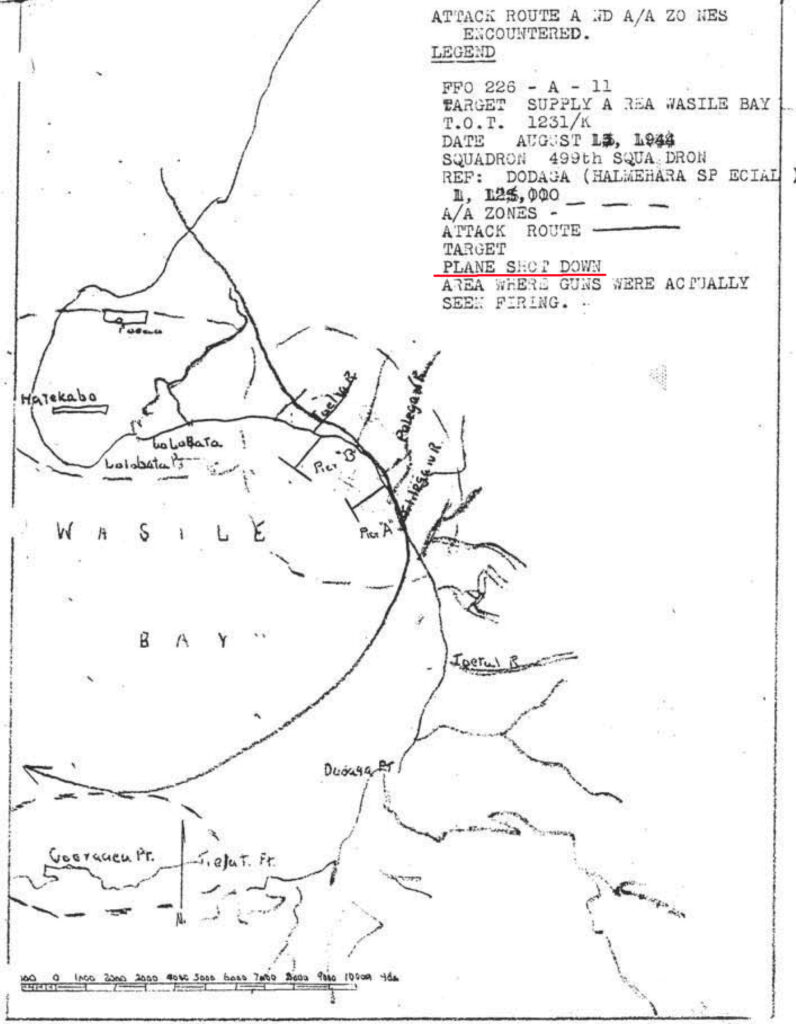
The other mission map in the 499th’s mission narrative shows the individual attack routes for each of the two flights. Both routes indicate that they were out over the water well before Pier “A” and the Pelegan River. This is significantly different than the route displayed in the other mission map. This map makes no reference to the crashed airplane but does have target numbers, some of which are referenced in the text of the mission report. The two piers, A and B, and a 500 foot pier are also drawn onto the map. The positioning of Pier A (target 5Y on this map) is shown to be farther north and is about a quarter of the distance between the distinct bend in the coastline at the 21X, and the Pelegan River mouth.
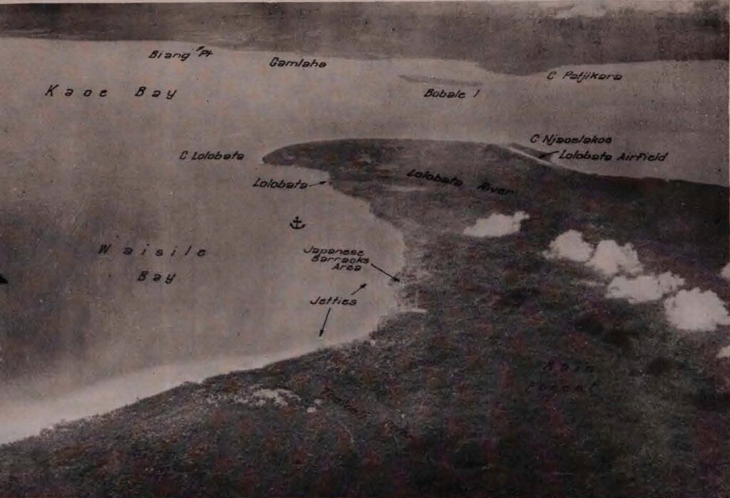
The 1944 Terrain Study Number 81, prepared by the Allied Geographical Section, Southwest Pacific Area, includes several aerial photos of the north and eastern shores of Wasile Bay. This photo has been annotated to indicate the locations of the two piers or jetties mentioned in the mission reports. Since the photo is an oblique shot, it could not be used as an overlay on satellite imagery. Still, it provides some useful detail regarding the shape of the shoreline in this area and where the piers were located. This photo tends to support the more northern positioning of Pier A as the second mission map suggests.
The topographic map sets for Halmahera are not as complete as some other areas, but I did find a 1943 1:125,000 Dodaga Sheet No. 8 topographic map included in the 1944 Terrain Study No. 81 for Kaoe Bay, Halmahera. This is most likely the same version of base map from which the first mission map was traced. There are no piers or jetties shown on the map but many of the rivers flowing into the bay are shown and named.
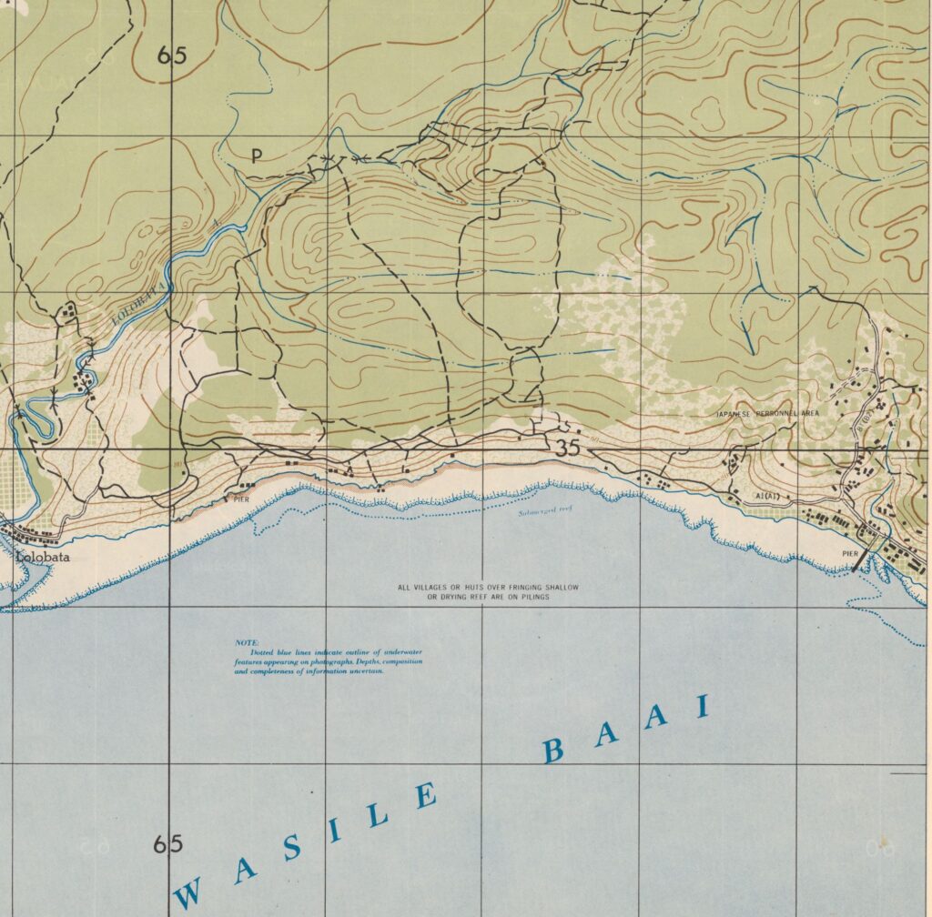
I also found one 1944 U.S. Army Engineer “Special Map” 1:20,000 topographic map (same scale as the second mission map) that covered the north shore of Wasile Bay but ended just yards to the west of the area of Pier “B”. While it would have been helpful to find the next map sheet to the east to see if the piers were located on them, this map sheet provided some helpful details of the small village, roads, and the location of a smaller pier mentioned in the mission reports.
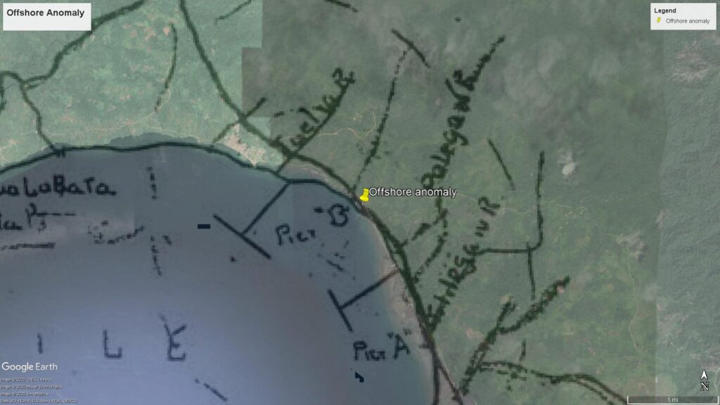
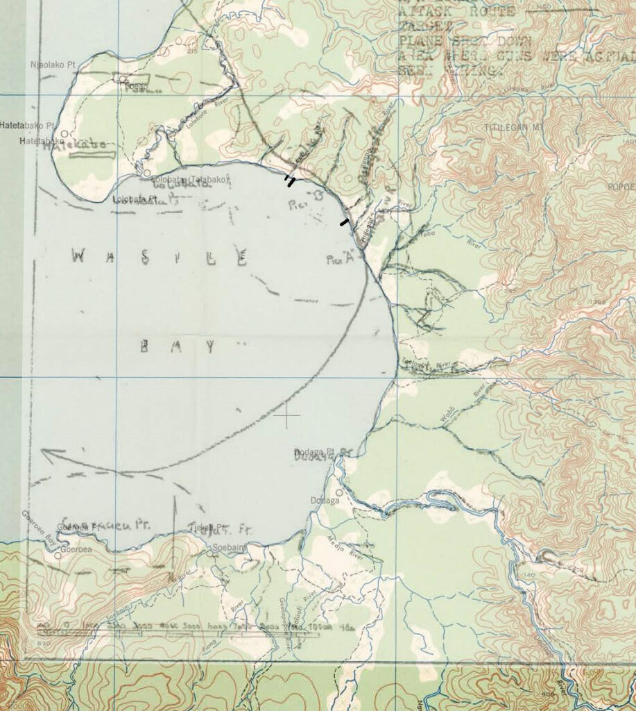
Overlaying the 499th mission map (1:125,000 scale) on the 1:125,000 Dodoga No. 8 topographic map allowed for the best positioning of the various landmarks. In the image below, the piers have been shown to scale and are shown in black. Using the 1:20,000 mission map as a reference, I measured the known length 500 foot pier and then used that same scale to determine the length of piers A and B. They were both about 1000 feet in length where as on the original mission maps, they are shown to be about 3000 feet in length – those would have been some long piers into some deep water.
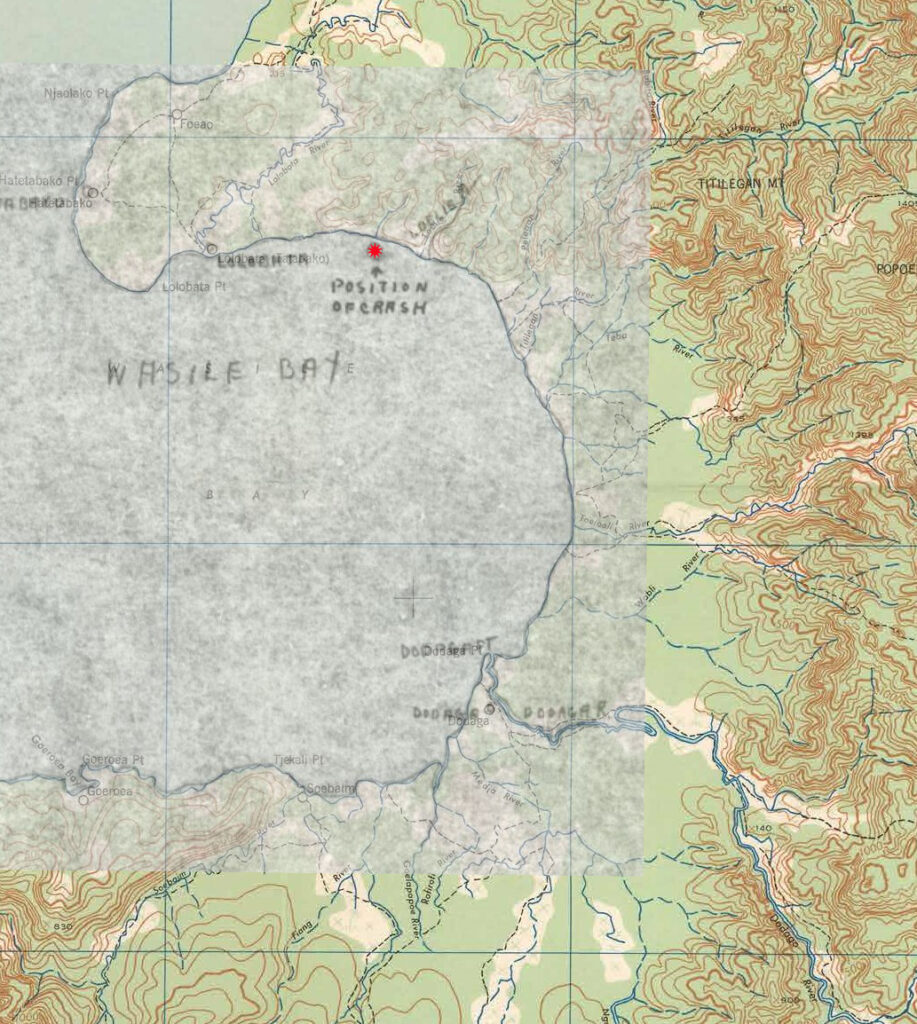
Below is the MACR map for the Voitier crash overlain on the Dodaga No. 8 map sheet. The ease of alignment of the two suggests that the original was also drawn on the 1943 1:125,000 Dodaga No. 8 as the base map. The crash site (indicated by the red star) is shown to be to the west of the target area and attack route. There is no explanation for the placement since the witness statement puts the crash site well to the southeast, after the target was cleared, when they began their turn out over the water.
Again using the mission map overlain on the Dodaga No. 8 topographic map, the various reported crash locations are shown by red 8 point stars with a short descriptor of their origin.
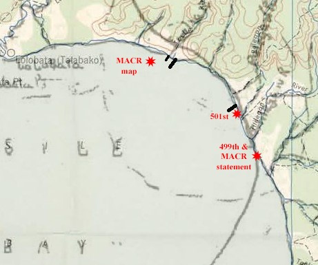
The MACR witness statement places the crash site at the point where the flight turned toward the water. The 499th mission report states that the airplane went down about 1 mile south of the personnel area (which was described as being just north of jetty “A” in the 501st report) which places it very near to where the MACR witness statement located it. The MACR map places the crash to the west of the target area and pier “B” for some unexplained reason. The 501st mission report states that the airplane crashed and sank about 200 yards southeast of jetty “A”. These possible crash sites are strewn along a length of roughly 4 miles of shoreline. The 499th and 501st mission reports and the witness statement all put the crash from 25 feet to 90 yards off shore, in shallow water.
I found no documentation as to whether this airplane was ever located and investigated after the war. The entire crew is still on the DPAA WW2 Not Accounted For list (as of April 2020) and are listed on the Tablets of the Missing at the American Cemetery in Manila.
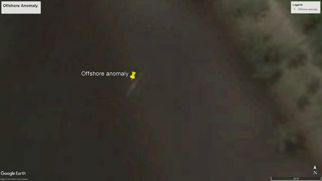
One interesting artifact that showed up on Google Earth while searching for remnants of jetty “A” in the water was this interestingly shaped and sized piece of something in the shallow water offshore north of that jetty. I have no idea if it is a coral formation (though the sediment load from the Pelegan and Tililegan Rivers make that seem unlikely), a big rock, a sand bar, a sunken boat, an artifact of satellite imagery, or a good sized part of an airframe or wing. The rough dimensions are 5 feet wide by 30 feet in length and it lies about 110 feet offshore at 1° 14.503’N 128° 10.797’E.
