
While researching my second trip to PNG, I came across a story that took place in the Wewak, New Guinea area during WW2. The article was titled “Walk Back to Wewak” and appeared in the January 2000 issue of The Whisperer, the newsletter of the Beaufighter and Boston Association of Queensland. While that association has since disbanded, that issue of the newsletter, and others can be found on the ozatwar website, under the RAAF side banner.
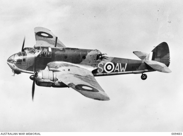
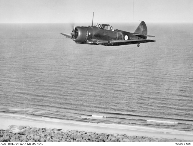
The story is about an Australian Beaufort aircrew that had their left engine shot out while strafing the But Mission during May 1944. Smoke filled the cockpit quickly and foiled their plan to ditch out at sea, so the pilot had to set the plane down 20 yards offshore. The narrator states that the plane was forced down just off the But Plantation, which begins several hundred yards east of the village and runs along the coast for almost a mile to the east. The crew of four managed to exit the plane and got into the life raft but as they moved away from the protection of the fuselage, enemy machine guns opened fire on them, killing first the navigator and then the pilot and destroying the raft. The enlisted gunner was last seen swimming out toward the open sea. The fourth crewman, a Flying Officer who was aboard as a wireless operator/gunner swam and floated to the west. That fourth crewman, Flying Officer (F/O) R.A. Graetz, is the narrator of this incredible story that begins on May 20, 1944. This post is my interpretation of the events in his story.
Being keenly interested in this part of the world during WW2, I read through the 345th Bomb Group mission reports to see if a crashed Beaufort was mentioned. I found a reference to a sighting of an “unidentified crashed airplane approximately 1 mile west of the west end of the Dagua Drome” in the 501st Squadron mission report for May 20, 1944 (FFO 141-D, pg. 4). In the reports for May 21, 1944, the 498th Squadron reported “one twin engine plane seen burning on beach near Dagua village” (FFO 142-C, pg. 3) and the 501st again reported a “crashed Beaufort on the beach 1 1/2 miles west of Dagua Drome” (FFO 142-C, pg. 2). The crashed Beaufort was further described by the 501st report as “still smoking” and they gave map coordinates of 935254 as the crash site.
One of the rewards of searching out and accumulating documentation is that I had gained access to the map collection of the Australian National University Open Research Repository. Included in this collection are digital copies of the same 1 inch to 1 mile map series that were used to draw the 345th mission maps for this period. Using the But East map sheet, I was able to plot the coordinates given by the 501st. It is not often that I am able to work with that kind of accuracy, and it was interesting to be able to do so. Using the But West and Suain map sheets allowed me to plot the progress of F/O Graetz as he escaped and evaded his way to the west toward Tadji.
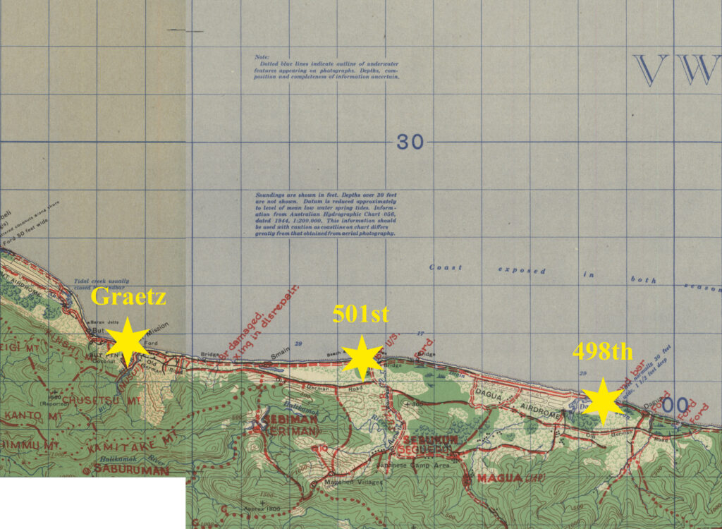
I won’t reprint the entire article in this post, but I will summarize his movements and activities and then present his progress on an interactive map. I should make it clear that with the varying accounts of where the crashed 2 engine airplane was reported, it is not possible to give a definitive start point for his journey. The distance between F/O Graetz’s account of his crash site and the 498th Squadron location of a crashed 2 engine plane is almost 7 miles and the distance between the But Plantation and the 501st coordinates is 3 miles. Any one of the reported crash sites could be the actual location and it is also possible, though unlikely, that there could have been more than one 2 engine airplane shot down along that beach that day. At a modest airspeed of 250 mph, the Beaufort would have flown past the But Plantation in 10 seconds and would have reached the vicinity of the 501st sighting in under 60 seconds. There is not enough detail in the written account to help determine the actual crash location more accurately. For the purposes of mapping, I will use F/O Graetz’s report as his start location.
An interactive map of the generalized path that F/O Graetz took during his eight days on the ground. Clicking on a green dot produces a popup that references a particular event mentioned in his story along with a brief description.
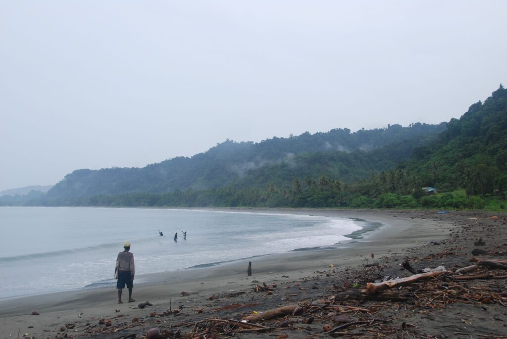
Finding himself alone in the water, bleeding from an earlobe that had been shot away by a .30 caliber bullet, Graetz swam and floated with the current about 200 yards off the shore, heading to the west. His account does not mention the time that he was shot down, but the 501st airplanes were over Dagua at 0910 hr on 20 May, so the Australian aircrew was already in the water by that time. Graetz made landfall just west of the But jetty at about 1400 hr and crawled across the beach into the scrub forest where he rested and spent that night.


On the morning of 21 May, he watched while P-40’s strafed his airplane until it burned in the surf. He spent that day resting in the same spot, alternating between sleep and delirium, and then spent the night there again.

On the morning of 22 May he started walking to the west with the intention of finding his way to friendly lines at Tadji. He spent several hours drinking water from bomb craters near Au Creek and then inspected the But airdrome until evening. He started walking west along the coastal track but encountered a sentry near the mouth of Manib Creek. The sentry did not challenge him, so Graetz crawled off to the beach where he spent the rest of the night.
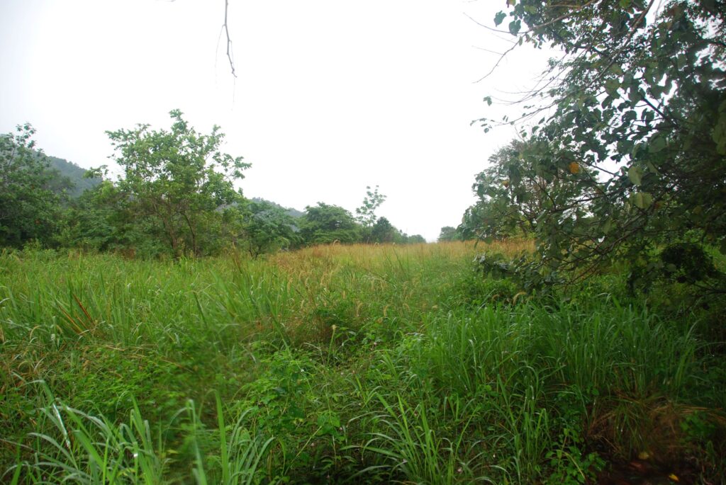
On 23 May, he attempted unsuccessfully to build a raft using empty drums, coconut logs, and some telephone wire that he cut from along the trail. He disabled a coastal gun by dumping sand into the breech mechanism and spent the rest of the day looking around the But airdrome where he salvaged a large piece of parafrag parachute. He spent the night under the wing of an airplane parked on the airdrome.
On the morning of 24 May, he headed west along the coastal trail and crossed Manib Creek where he saw the results of a strafing attack that had just finished. He continued walking to the west and pulled distributor wires off parked trucks he encountered along the way. Late in the morning, he hid under a tree while Wirraways strafed and bombed all around him. He spent the night in that area.
At 0730 on 25 May, he started out west along the coastal trail and encountered Japanese soldiers walking east that he avoided by stepping off the trail into the brush. Later that day he encountered weary, disinterested enemy troops who let him pass by without interference. He spent that night west of Bai village.
On 26 May he started out again and had to walk four miles south looking for a place to cross the Ninahau River. He finally crossed at Niguluwela (Muguluwela) village. He then walked along the foothills paralleling the coast and crossed the Anumb River. He encountered more enemy troops during the day but they did not attempt to restrain him. He spent that night under a large log on some high ground on the edge of the foothills.
He spent the morning of 27 May fighting his way through thick brush in order to get back to the coast. He hit the coast at Saliminara (Selamin) Creek and continued west along the trail. He spent that night off the trail in the bush.
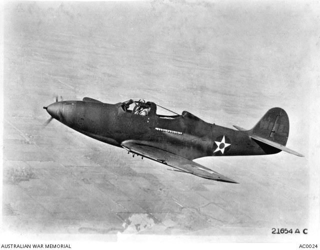
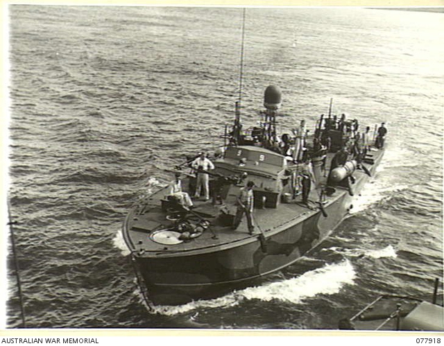
28 May found Graetz again walking along the coastal trail, crossing Dumbun (Nimbum) Creek, passing disinterested enemy soldiers, and walking through the deserted village of Neap (Niap). As he was trying to cross the Denmap (Danmap) River he was spotted by P-39’s that then circled him. He waved his piece of parachute silk and the airplanes waggled their wings before they flew away. He stayed on the shore until late afternoon thinking a Catalina would arrive for him but instead he was rescued by two motor torpedo boats, PT-128 and PT-131 (noted in the book At Close Quarters: PT Boats in the US Navy by R.J. Bulkley), that had to silence gunfire that had erupted from a nearby deserted village before two of the officers could swim ashore with a raft to get him.
F/O Graetz had covered a distance of over 27 miles, barefooted, during his eight days on the ground. The only food he had eaten were several small, furry-tasting, apple-like fruits on 25 May but water had been plentiful for drinking. Along the way, he had the presence of mind to sabotage vehicles as well as coastal artillery pieces. Quite a walk he took.