
An interactive map of the known details of the ditching of B-25 #41-30572 on November 20, 1943.
Not all aircrews that ditched at sea were rescued. Early during the war in the Pacific, rescue services were not well established and radio communications between combat flights and PBY Catalinas were not well coordinated.
Nine B-25s of the 500th Bomb Squadron, 345th Bomb Group flew to Hansa Bay, New Guinea on November 20, 1943 to attack shipping reported to be in the harbor. On reaching their target, they found no ships, so they instead strafed and bombed anti-aircraft positions and barges around the harbor before heading back east along the coast on a barge sweep.
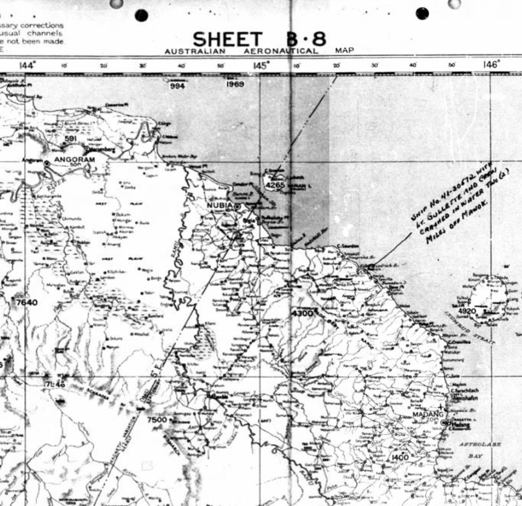
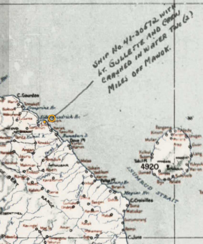
Passing close to Uligan Harbor, B-25 #41-30572, flying on the right end of the formation, was hit by anti-aircraft fire that tore large holes in the left wing and engine nacelle. The damaged plane kept pace with the rest of the squadron for forty miles, but then began falling behind and losing altitude. It finally made a good water landing about two miles off the village of Mawok.
Five or six crewment were observed in the water by other planes of the flight, who were circling the downed plane, dropping life rafts and emergency supplies for the downed crew. Immediate radio calls to the Catalinas went unanswered, but a rescue mission launched late that night found no sign of the rafts or crewmen.
The Missing Air Crew Report (MACR) for this ditching has a copy of Australian Aeronautical Map B-8 attached. The ditching site is marked on the map along with a short description. The map had been cut into four quadrants during the microfilming process, so the top two sections had to be aligned and joined in order to have a map of the area.
I then happened across a digitised original of the same map sheet on the website of the National Library of Australia. The digitised version was much more legible and clear.
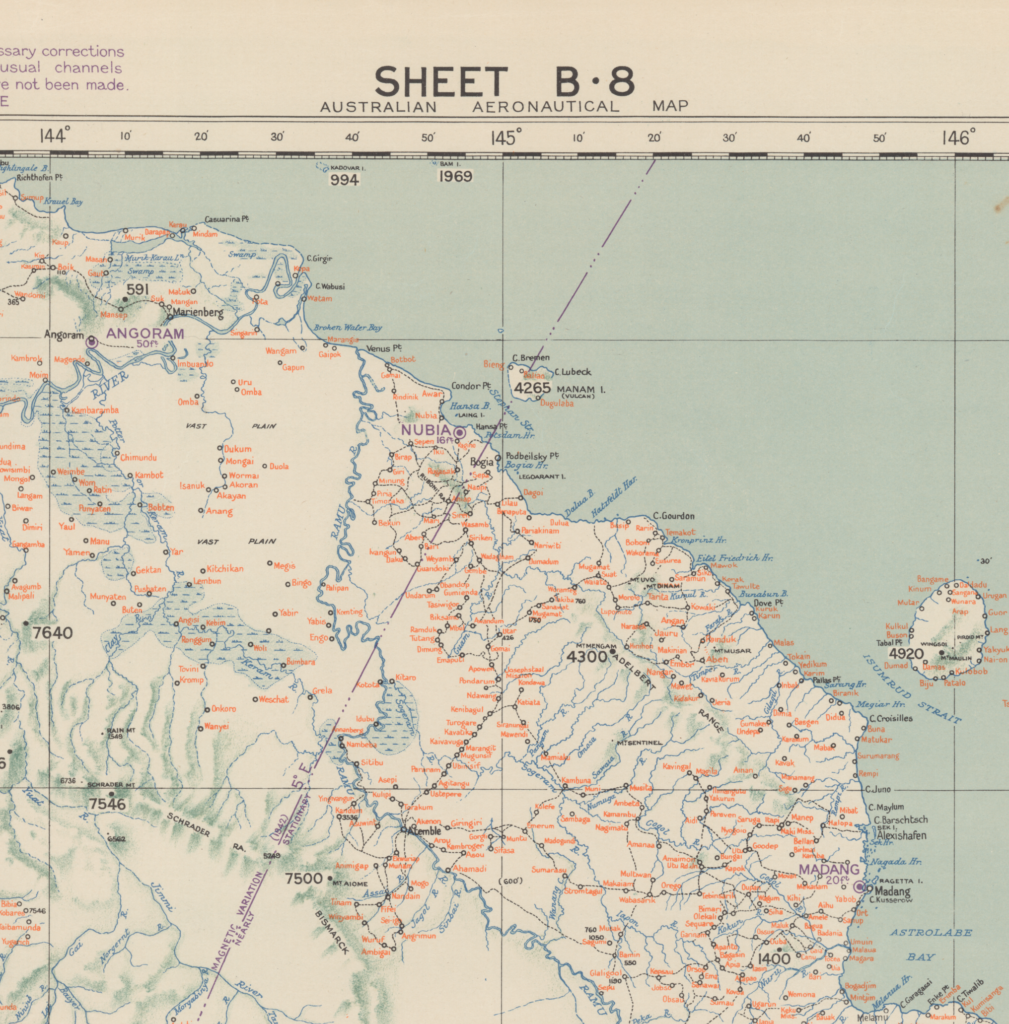
After overlaying the MACR map on the digitised original, the ditching site marker was transfered to the digitised original for use in georeferencing to satellite imagery. The map location of Mawok village was more clearly shown on the digitised original.
The highlighted, digitised original B-8 map sheet was then georeferenced to satellite imagery, paying particular attention to the alignment of shoreline features along the coast between Hansa Bay and Cape Croisilles. The location of the ditching site was then transferred to the satellite imagery for use in the live map at the top of this post.
Lost in the ditching of B-25 #41-30572 were:
- 1Lt Frank E. Gullette, Jr., pilot
- 2Lt Jackson D. Harbert, copilot
- 1Lt John R. Duggins, navigator
- SSgt Glen A. Lamb, engineer
- TSgt Charles H. Mahan, radio operator
- Sgt Jack G. Hallack, aerial gunner
The remains of all except Sgt Hallack were recovered for individual burials in 1952. Sgt Hallack is memorialized on the Tablets of the Missing at Manila American Cemetery, and remains on the DPAA Not Recovered list.