
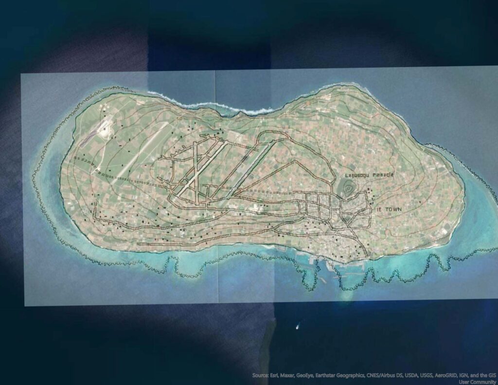
An interactive map showing the location of Ie Shima airfields used by the 345th Bomb Group.
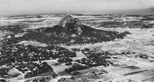
Upon arrival at Ie Shima, the 345th Bomb Group set up camp to the northeast of the island’s only major terrain feature: a prominence that they called “The Pinnacle” or “The Rock”.
According to the Engineering Reports included in the Unit Histories, the hardstands for the 345th airplanes were a considerable distance from the runways. The coral that had been used to surface the roads and taxiways caused more than the usual amount of wear to the brakes and tires of the taxiing B-25’s. The situation was remedied, in part, when they were assigned hardstands closer to runway B.
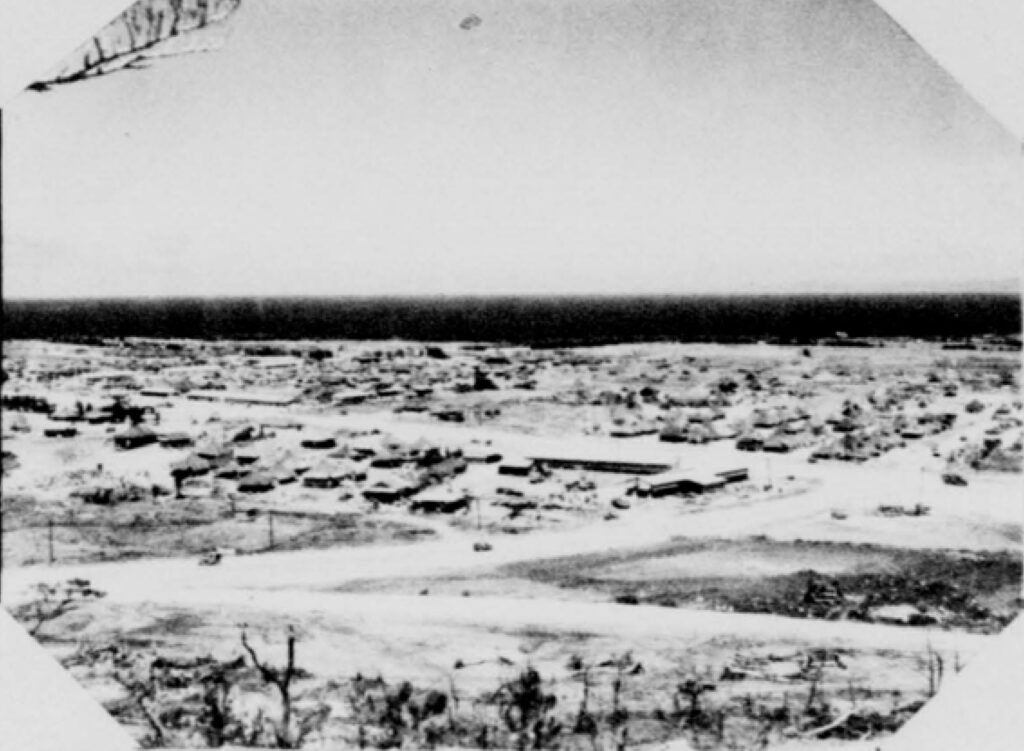
Ie Shima had three airfields prior to the allied invasion on April 14, 1945. In the photo below, two of the runways are seen to run in parallel while the third runs across the nearer parallel runway, forming an X shape.
Wartime topographic maps of Okinawa and Ie Shima are scarce, but I found the map below in an ebook chapter about the capture of Ie Shima. The map shows the locations of the three runways and has enough shoreline detail to allow georeferencing to a satellite image; creating an overlay from which to highlight the wartime airfield locations on the satellite image.

Before attempting to georeference the Ie Shima invasion map, I photoshopped out the invasion data to produce a map that was less cluttered for the purposes of this post.
This satellite image shows three parallel runways, each in excess of a mile in length. The two airstrips on the right were constructed by Japanese forces while the airstrip on the left was constructed by US forces during the invasion. I found no reference to names for these runways, but one document refers to a “Runway B”, so perhaps they were simply referred to as runways A, B, and C.

Below is the the cleaned up invasion map overlayed on the satellite image. The map fits well to many of the prominent shoreline features as well as to the Japanese airfields. From this imagery, I was able to draw in all three of the Japanese runways for use in the interactive map at the of this post.
During the few weeks before the end of hostilities, the 345th flew many combat mission over the Japanese island of Kyushu, the Inland Sea, and along the Korean penninsula. After that, they flew armed patrols to ensure compliance with the cease-fire, and search missions looking for downed aircrews. Veteran airmen became eligible to return to the US after the surrender, beginning with those with 85 or more service points.
The 345th stayed on Ie Shima until early December 1945, when it moved to Camp Stoneman, California.