An interactive map showing the locations of the two airdromes near Djailolo, Halmahera.
On September 5, 1944, all four squadrons of the 345th Bomb Group raided an airdrome located near the village of Djailolo, on the island of Halmahera. From reading those mission reports, it is clear that they had difficulty finding the airdrome and even after the mission it seems they weren’t altogether sure where they had been. Accordingly, when I was putting together my first map of target locations for the 345th, I could only provide their approximation for the location. A recent discovery in the unit history of another bomb group now allows for resolution of this inaccuracy.
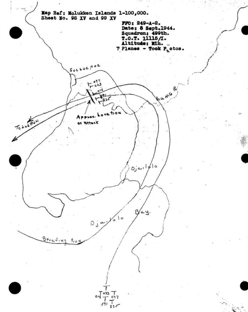
The mission map below shows an approximate location for the airdrome, but searching satellite imagery for that area gives no hint of any remnant of a large cleared area and cannot be reconciled with the larger scale maps in the other squadron’s reports. The 1:100,000 base map referenced on this map does not show the location any airdrome.
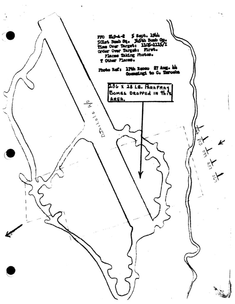
In the mission report of the 501st Squadron, a map of the airdrome and path over target is included. This map does not include landmarks that could help in pinpointing the location of the Djailolo airdrome. It did, however, prove useful in corroborating other clues.
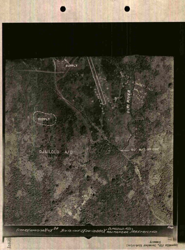
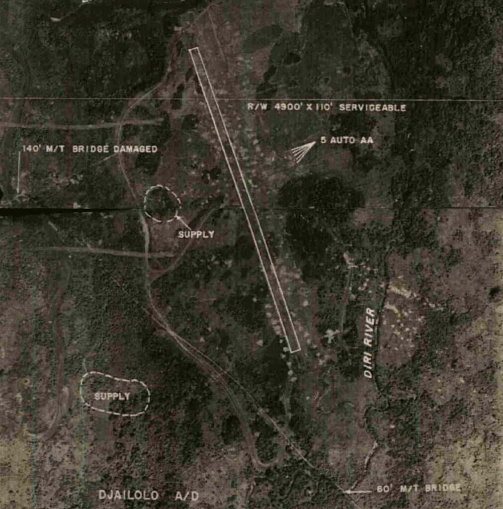
While working with the unit histories of the 38th Bomb Group last month, I came across an annotated aerial photo of the Djailolo airdrome. The photo had been split over two pages during the microfilming process, but held some important clues that proved helpful in geolocating the image. This first photo shows the Diri River, one end of the airdrome (white rectangle), a roadway, and a 60 foot bridge across the river.
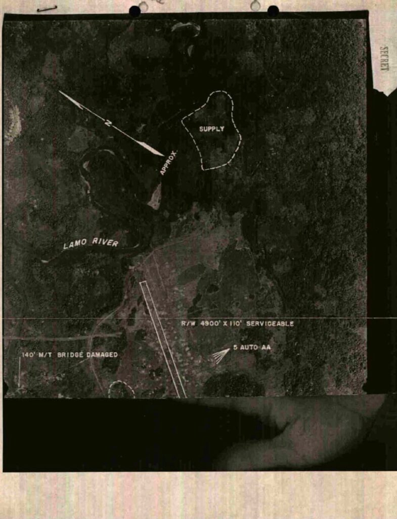
This second photo shows an arrow indicating north, the Lamo River, the other end of the airdrome, a road, and a 140 foot bridge across the Lamo.
By lining up the two halves of the airdrome and then adjusting the size of the upper photo until the road near the round supply area was aligned, this image of the Djailolo drome was produced. The shape outlined by the runway, dispersal areas and taxiways is a nearly identical match with the 501st map of the airdrome, strongly suggesting that the 345th had attacked the same airdrome shown in the aerial photo from the 38th Bomb Group. The northwest to southeast orientation of the runway in the aerial photo and in all the 345th mission maps leaves me with the impression that while they knew they attacked this airdrome, they weren’t at all sure where they were or what direction they were flying.
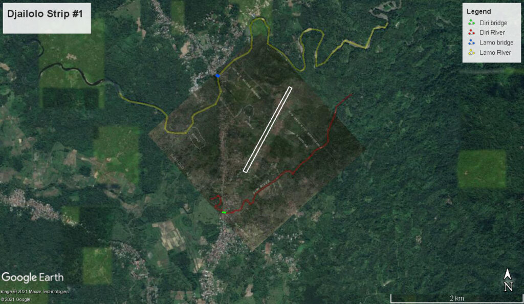
In the 1943 Northern Molukkas Terrain Study #71, two references to pre-war landing areas north of the town of Djailolo led me to try to fit the aerial photo to a satellite image. With some rotating, resizing, and looking for bridges across the two rivers, it became possible to fit the photo to the imagery with a good degree of confidence. Lining up the bridges with those on the satellite image brought many of the bends of the Lamo and Diri Rivers into alignment and placed the airdrome in a long, flat area that is still cleared today.
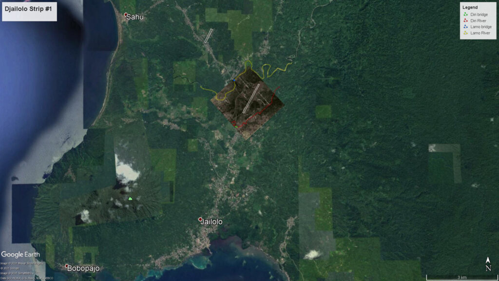
A map in Terrain Study #71 placed Djailolo Strip #2 to the northwest of Strip #1. By matching the bends in the road on the map and satellite image, a good approximation of it’s location was made on the overlay imagery.
As always, I could be wrong in my interpretation of the clues to the locations of these airdromes. But, the information from the 38th Bomb Group unit history and North Molukka Terrain Study are archival documents and there aren’t many bridges across the Lamo and Diri rivers to be confused by.
This is just the kind of situation that I use as an excuse to keep following links, reading old documents, and searching for new information. Archival documents from other units can be helpful in solving problems or filling in details in the history of the 345th Bomb Group during WW2..
