While reading through the unit histories of Fifth Bomber Command (VBC), I came across a good quality vertical photomosaic of the jetties in Wasile Bay, Halmahera, where the Voitier crew was shot down in August 1944. Thinking that it might make for a more accurate depiction of the locations of the jetties, and a clearer idea of the possible crash sites, I georeferenced the photo to satellite imagery.
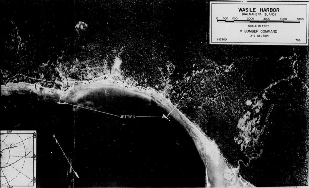
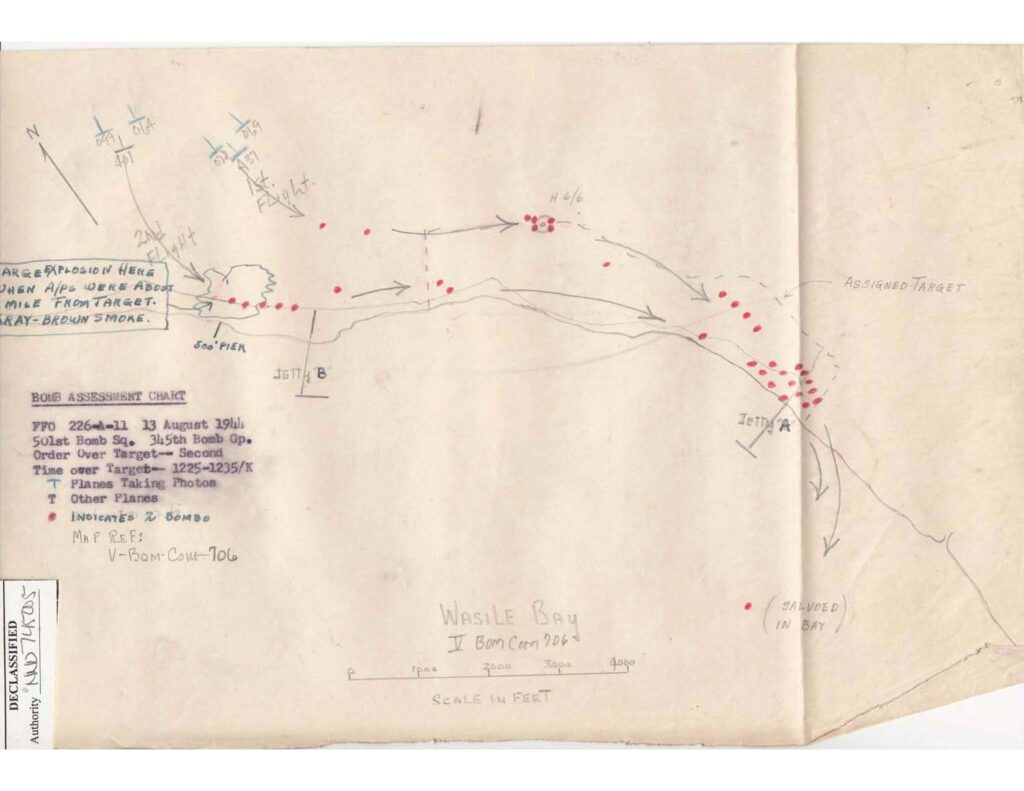
It is interesting to note that the Wasile Harbor photo has “V Bomber Command” and “706” in the information box in the upper right corner. Both are referenced on the 501st Squadron Bomb Assessment Chart (as V-BOM-COM-706), which suggests that a copy of this photo was traced for use as the base map of their bomb assessment map.
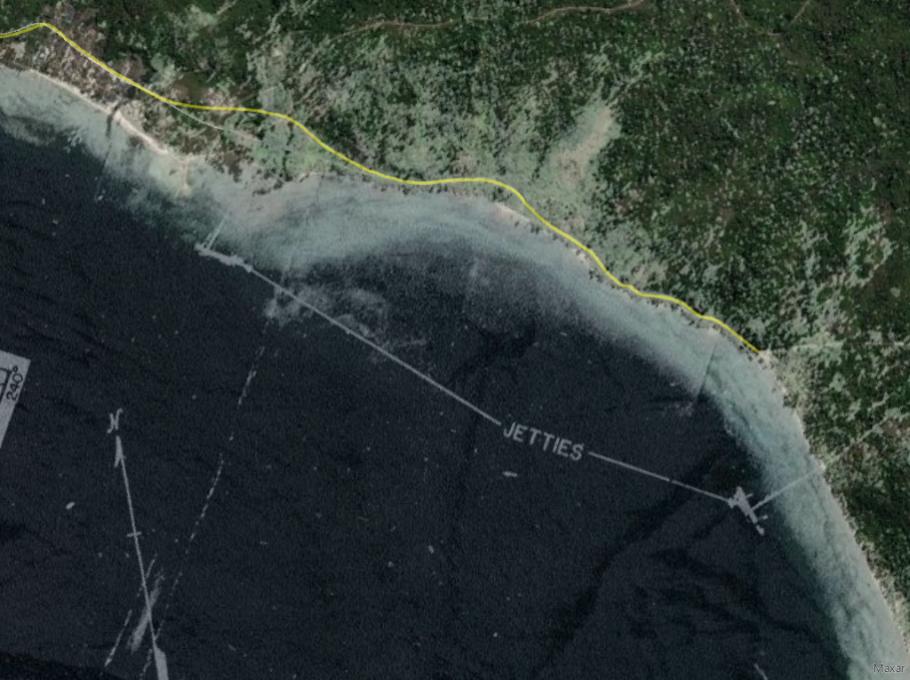
Without any significant terrain features or distinctive street intersections on the Wasile Harbor photo to use as control points in georeferencing, the Titilegan River mouth and several bends along the coastal road were chosen for use as control points. The image below shows the result of georeferencing and places the jetties accurately on the satellite image.
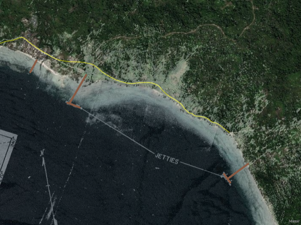
With the georeferenced photo still visible over the satellite image, the two long jetties and the 500 foot pier were traced in brown to create features that would stay with the satellite imagery once the photo was removed. The results of all this georeferencing talk are displayed on the live map at the top of this post.
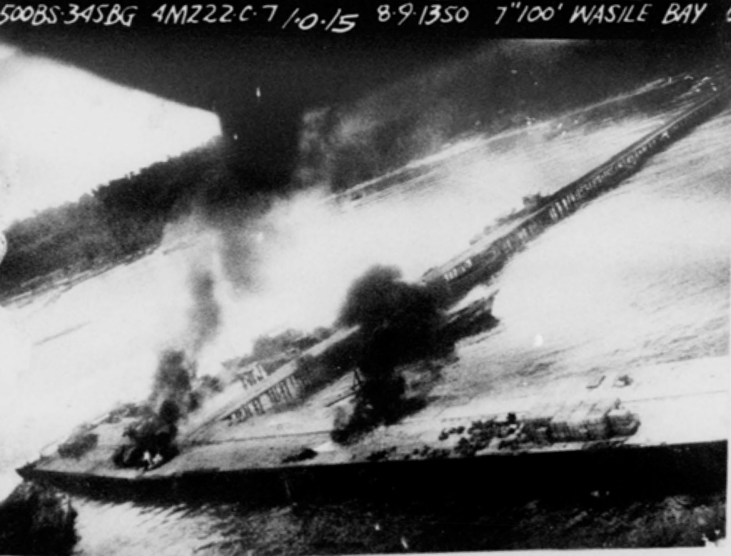
The 345th had completed a successful raid on Wasile Harbor on August 9th. Oblique photos taken during that operation were analyzed and revealed additional personnel and storage areas that became the basis for the August 13th raid.
The only location information in the MACR itself describes the crash site as “NW of Loelie R. in Wasile Bay”. An eyewitness statement in the MACR indicates only that the Voitier plane came to rest “approximately 75 feet off shore in very shallow water”. Two post-war documents included in the MACR state that the plane “crashed into the water approximately 90 yards off shore”. The MACR map places the crash site to the west of the 500 foot jetty, hundreds of yards off shore.
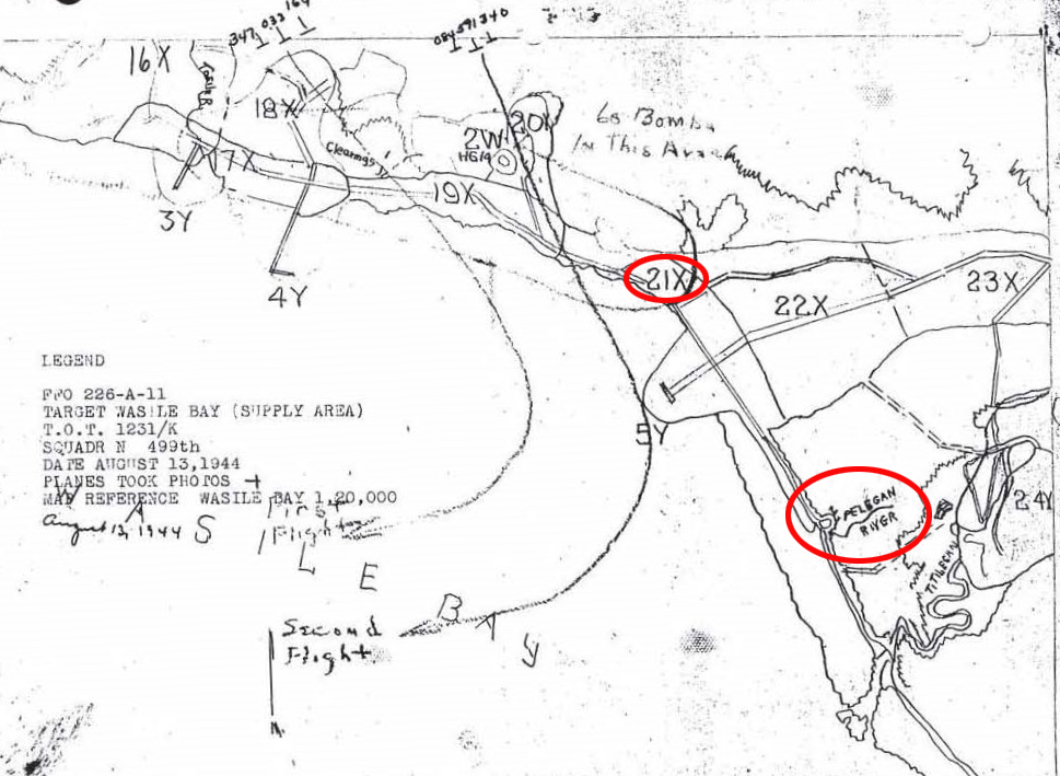
The 499th Squadron mission narrative places the crash site “near shore one mile south of the personnel area”. Using their target map and noting where the 501st’s bomb assessment map placed their bombs that were described as being dropped in the personnel area, it appears that target 21X was part of the personnel area. Measuring one mile in a southerly direction from the south edge of target 21X, and keeping the endpoint near the shore, puts the crash site in the vicinity of the mouth of the Pelegan River. If the south edge of the personnel area instead abutted Jetty “A”, then the 499th’s crash site location would be extended south to a similar position near the mouth of the Titilegan River.
My initial interpretation of the smudged, fuzzy text of the 501st Squadron’s mission report was that it said the plane crashed “200 yards southeast from Jetty A”. In reading through the report again (after spending the past year transcribing other 5th Air Force documents and becoming very familiar with the Courier typeface) I believe that it instead states “800 yards southeast from Jetty A”. 800 yards southeast from Jetty A would put their estimate of the crash site in the same vicinity as that of the 499th. It seems odd that neither observer used the Pelegan River mouth as a landmark in their description, but maybe it is not very distinguishable from minimum altitude.
The missing aircrew of B-25 #41-30084 was made up of the following personnel, who remain unaccounted for:
- 2Lt George P. Voitier, pilot
- 2Lt Carl D. Broman, copilot
- T/Sgt Americo Santillo, radio operator
- S/Sgt Arnold A. Smith, engineer
- S/Sgt Don F. Estep, photographer
- Sgt Dean S. Kraps, aerial gunner
