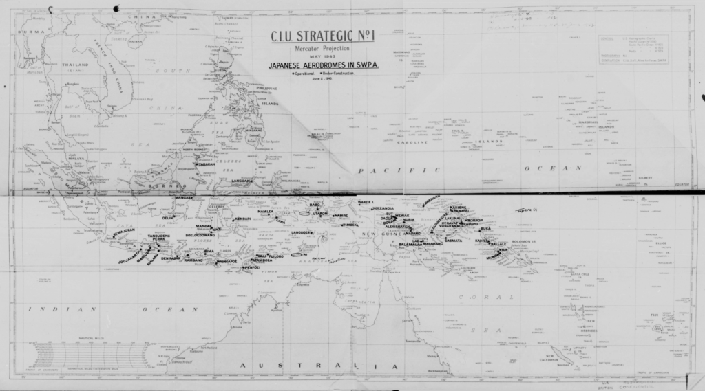
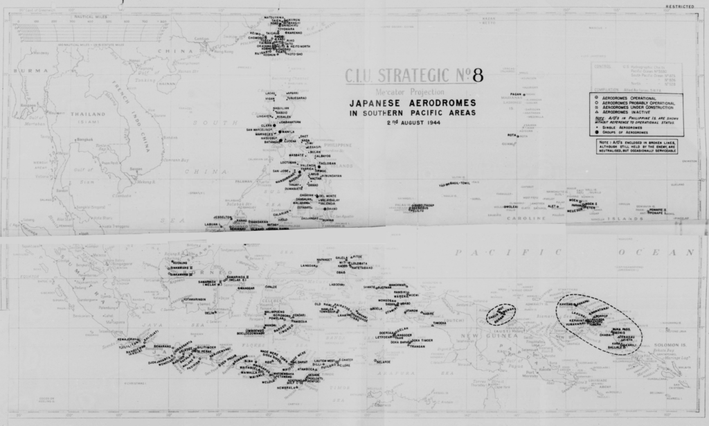
On microfilm reel A7511 (the unit history of V Bomber Command), I came across two maps of Japanese airdromes in the Southern Pacific Areas. The maps were authored by the Central Intelligence Unit (CIU) of the 5th Air Force and made assessments of enemy air installations during the first fifteen months of the 345th Bomb Group’s time in New Guinea.
The maps had been scanned in six pieces, with generous overlap between horizontal sections but lacking in overlap between the upper and lower sections. Some distortion is apparent along the horizontal centerlines and in the upper right quadrants. I used four pieces from each of the sets to reconstruct the maps shown on this page.
The May 1943 map has about a half a degree of latitude missing at the mid-line overlap, but the airdromes visited by the 345th Bomb Group are all visible below the gap.

The August 1944 map has the same overlap deficiency and some airdromes are missing from that area. Of interest are the two areas surrounded by dashed lines. These areas represent the Rabaul-Kavieng and the Wewak airdrome complexes that were bypassed after being minimized as air threats. The remainder of the New Guinea airdromes had been captured during airborne assaults and amphibious landings made by American and Australian forces.

These two maps provide a good overview of the extent of the Japanese presence in the Southern Pacific and might be helpful to locate a particular area of interest.
