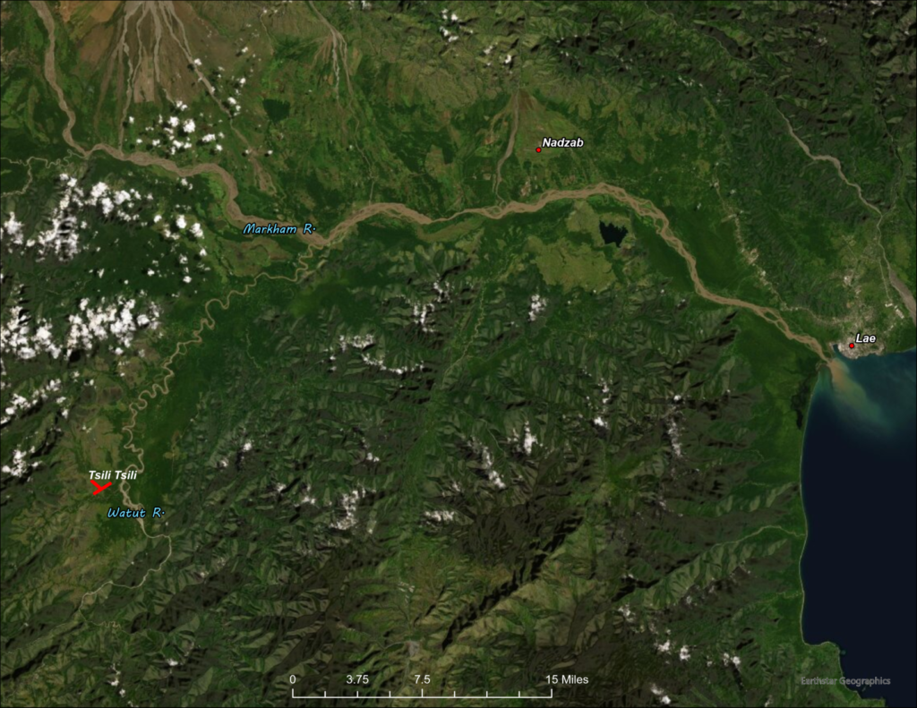
A map of the proposed development of an airfield at Tsili Tsili, New Guinea was included on a reel of microfilmed documents relating to 5th Fighter Command. The map had been copied in four pieces and after fitting it all back together, it provided a good idea of what this airdrome looked like.
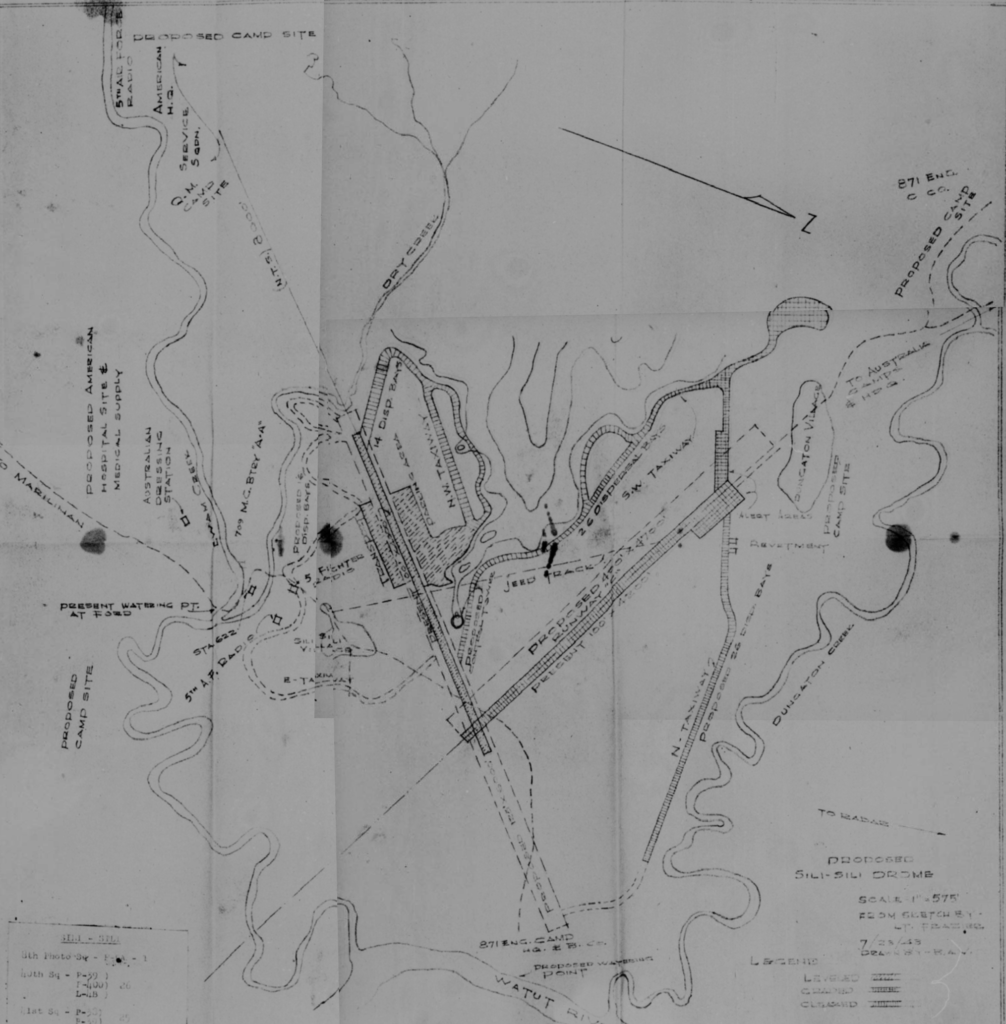
Army Engineers began work at Tsili Tsili in mid-June of 1943. Each piece of heavy equipment had to be disassembled and loaded onto several C-47 cargo planes for the flight from Port Moresby. Upon arrival, the equipment was reassembled and put to work clearing wooded areas and leveling landing strips, taxiways and dispersal areas. The first fighter mission was flown from the new base about six weeks after work began.
The initial mission of this forward base was to provide fighter cover for bombers flying from the airfields at Port Moresby to distant targets like Wewak. The Japanese became aware of Tsili Tsili by mid-August and flew several missions against it.
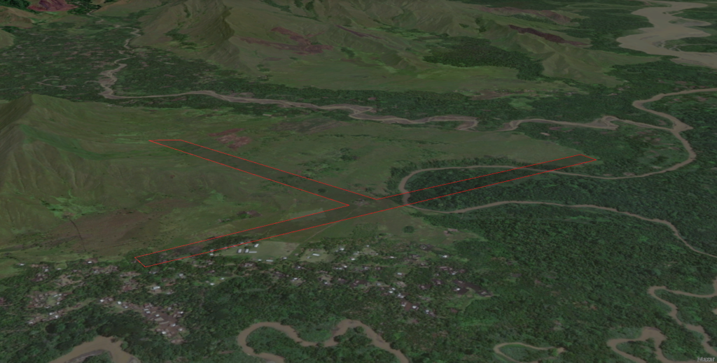
In order to locate the Tsili Tsili airfield on satellite imagery, a 1944 Australian Army map (No. 1671 Roamer 1 Inch Series, 1:63,360 scale) was used to first find the general location. The map had been drawn from vertical aerial photographs, so the accuracy was considered to be good, and the shape of the airdrome was included. Georeferencing the 1 Inch Series map to satellite imagery was only marginally successful but did allow for the tracing of the airdrome outline onto the imagery.
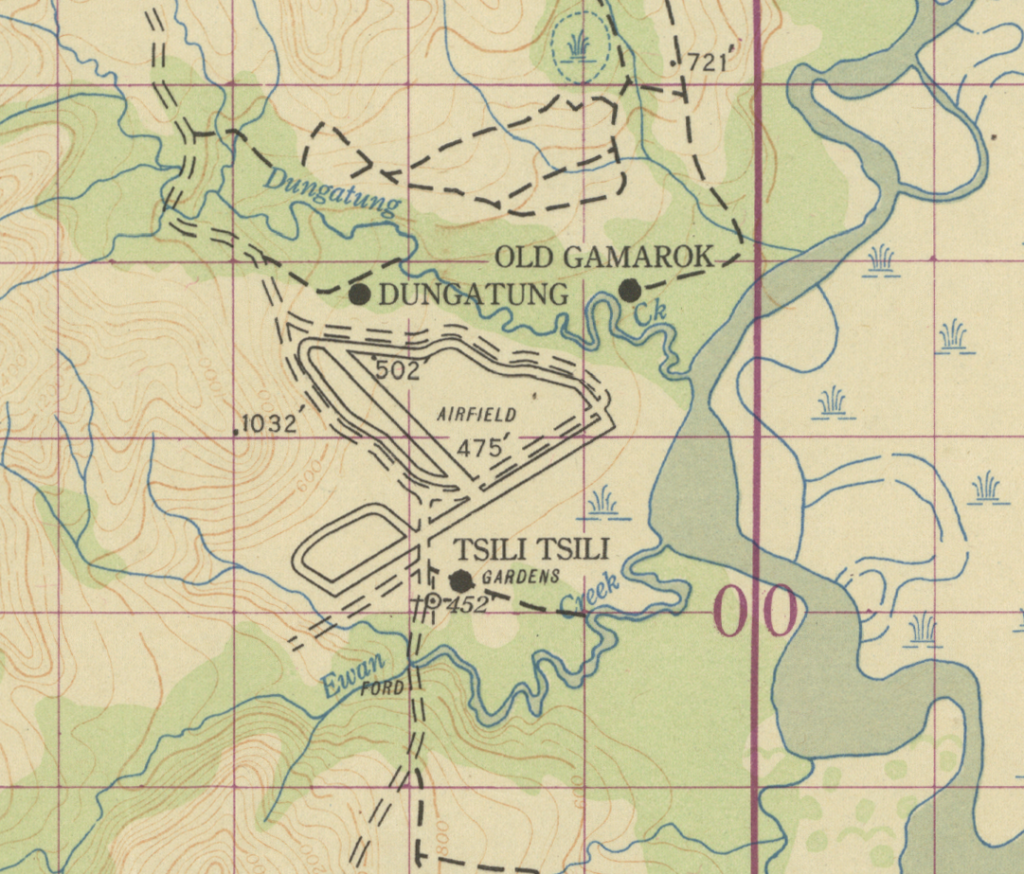
Changes in the courses of the Watut River and the Ewan and Dungatung Creeks erased landmarks that could have been used to position the airfield with more precision and accuracy. The course of Ewan Creek has changed significantly since 1943 as it now meanders to the west and north for hundreds of yards, cutting through part of the 6,000 foot runway, before joining with Dungatung Creek.
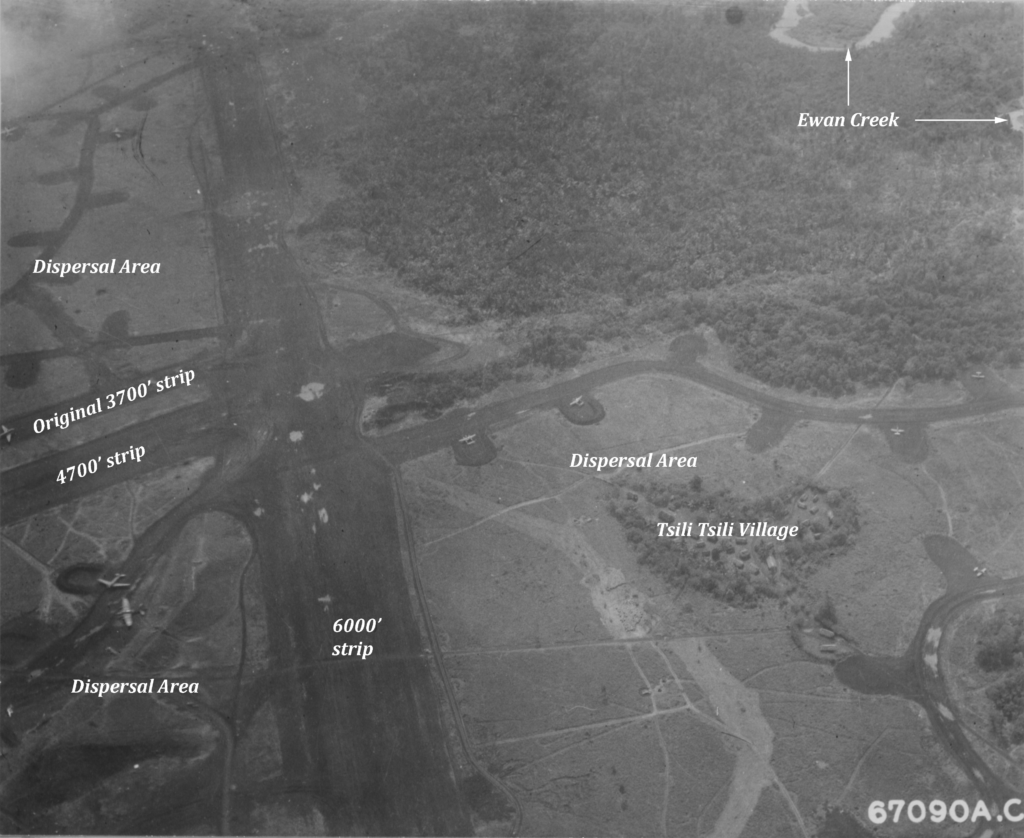
With the airdrome shape created in mapping software, it was then used in a 3D scene of the area and repositioned until it did not cross abrupt rises in elevation. The result was a reasonable estimate of the location and orientation of the Tsili Tsili airdrome.
Tsili Tsili continued to be used as a major forward operating field until after the Allies had captured Lae and established a new base at Nadzab. Once the war moved farther west, to Hollandia and beyond, other airfields were created for use as advanced bases.
