An interactive map of Hansa Bay, New Guinea, and the loss of B-25 #41-30594 on January 30, 1944.
The 345th Bomb Group staged raids against shipping in Hansa Bay, New Guinea on January 30, 1944. The 501st Squadron, along with one flight of 3 planes from the 500th, encountered anti-aircraft fire as they approached the bay from the southwest. B-25 #41-30594, piloted by Captain John Manders, was hit before crossing the beach and exploded as it hit the water beyond the larger of two freighters at anchor in the bay.
There is no data strip on the crash photo, it could have been cropped away for publication or the photo could have been a reprint. Knowing some of those photo details, namely the altitude, lens length, and camera type could have made it possible to calculate distances to shore and between the ship and explosion. There was no cameraman included on the load list for the right wing plane, so the picture would seem to have been taken by the tail mounted camera.
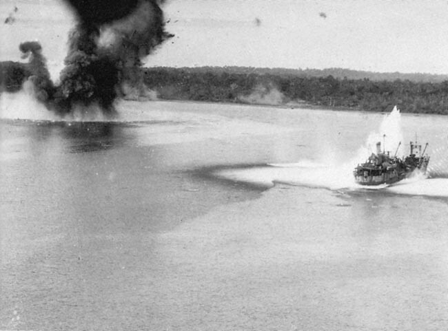
I always thought that the picture above showed Captain Mander’s plane crashing after bombing the ship on the right. After reviewing the available information about this mission, it became apparent that my assumptions were incorrect. I will detail my thoughts and methods in the rest of this post.
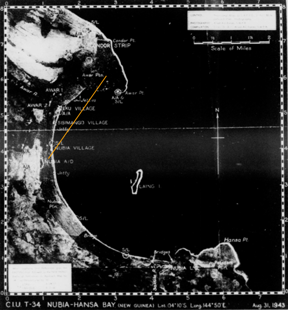
No Missing Air Crew Report is available from the usual sources and the map included in the mission report does not indicate a crash location or show details of the attack. The mission report does indicate that the flight crossed onto the bay south of Nubia on a thirty degree heading. The narrative from the 500th Squadron flight states that they saw a plane crash in the bay near Nubia Mission.
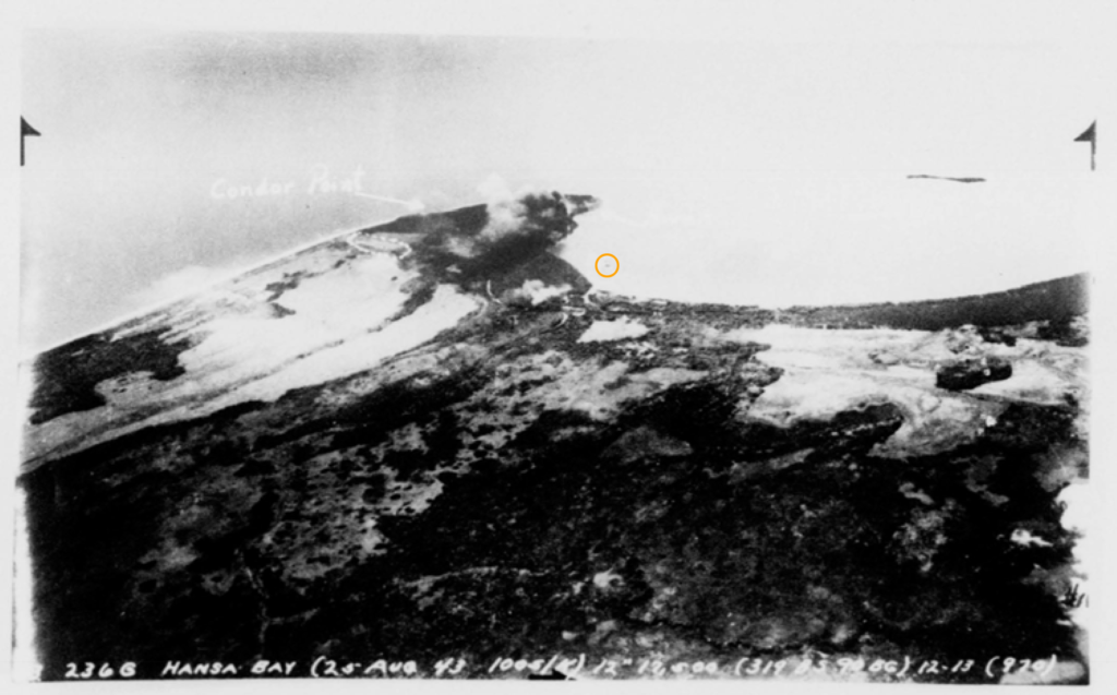
The aerial oblique photo below gives an idea of how far from shore freighters were anchoring in Hansa Bay. The orange circle indicates the position of a ship (although it is possible that the ‘ship’ might only be a smudge on the photo) that is anchored close to the line of flight of the January 30 raid.
Jetties are shown on the merged 1944 maps of the Hansa Bay area below, suggesting that an anchorage in the previous photo could be reasonable and accurate. It was noted in the mission report that the jetties between the Awar River and Awar Point were “heavily loaded with supplies”.
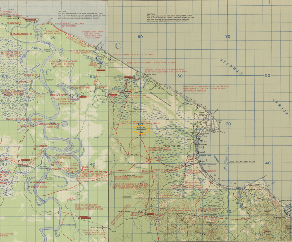
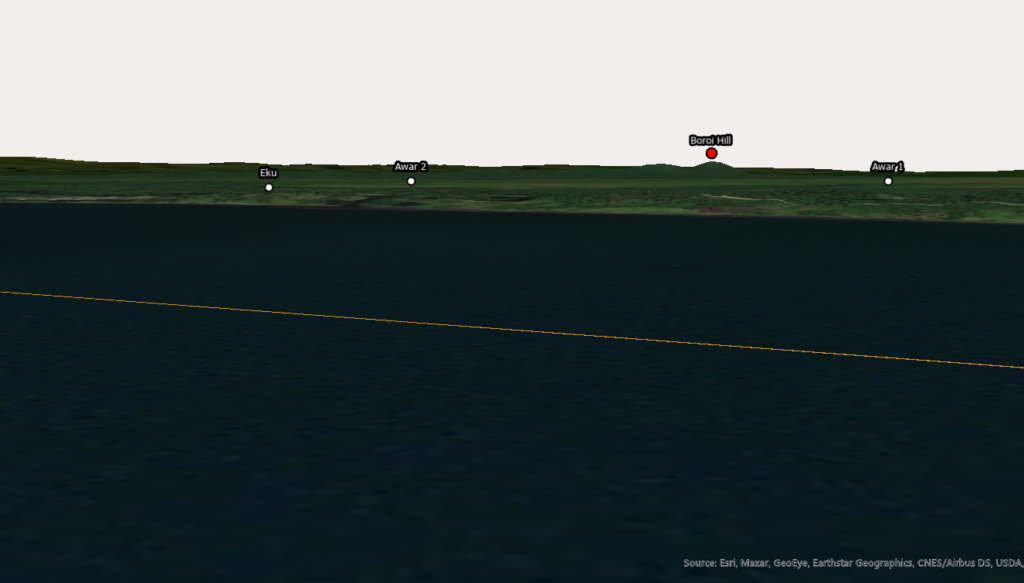
Studying the horizon in the crash photo shows two distant, low hills in the upper right quadrant. Using a 3D view of Hansa Bay and viewing altitude of 100 feet, a couple of small hills were observed to the west and identified as Boroi Hill, which is called out on the topographic maps, about six grid squares to the east of Hansa Bay. Increasing the view altitude shows other small hills, but minimum altitude attacks were performed at about 100 feet off the water for protection and bombing accuracy.
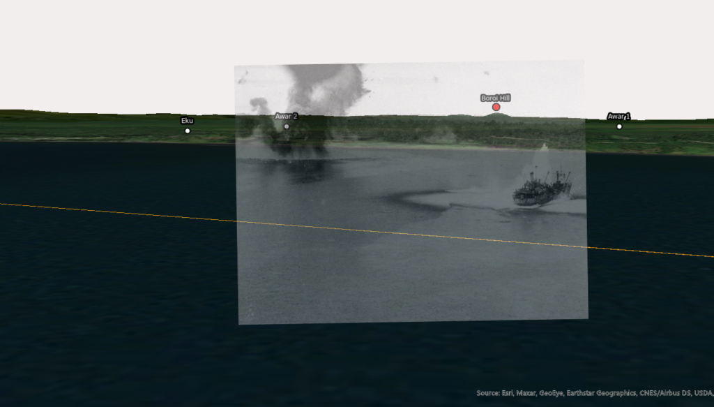
Out of curiosity, I overlaid the crash photo onto the 3D image. Lining up the hill with Boroi Hill and rotating the crash photo two degrees counter-clockwise produced the image below. I do not know if this is a legitimate or accurate technique, but the alignments of the shores and horizons were unexpectedly good and put the crash site and damaged freighter in perspective.
There is also a hill farther to the right (north) that appears above the horizon. That hill turned out to be Mount Malangis on Kairiru Island, off Wewak, about one hundred miles to the northwest. Trying to align the crash photo to that hill did not produce a good fit of the shoreline or horizon.
Unfortunately, this crash analysis is rife with conjecture. Because of that, the live map at the top of this post shows the crash area as being in Hansa Bay between Nubia Mission and the area suggested by the overlaid imagery.
Lost with B-25 #41-30594 were:
- Capt. John M. Manders, pilot
- 1Lt Thomas P. Clark, Jr, co-pilot
- 2Lt Stephen P. Toth, navigator
- SSgt Henry C. Rensink, engineer
- SSgt Fred J. Tencza, radio operator
- SSgt James L. Brown, aerial gunner
All six members of the crew remain on the DPAA Not Recovered list.
