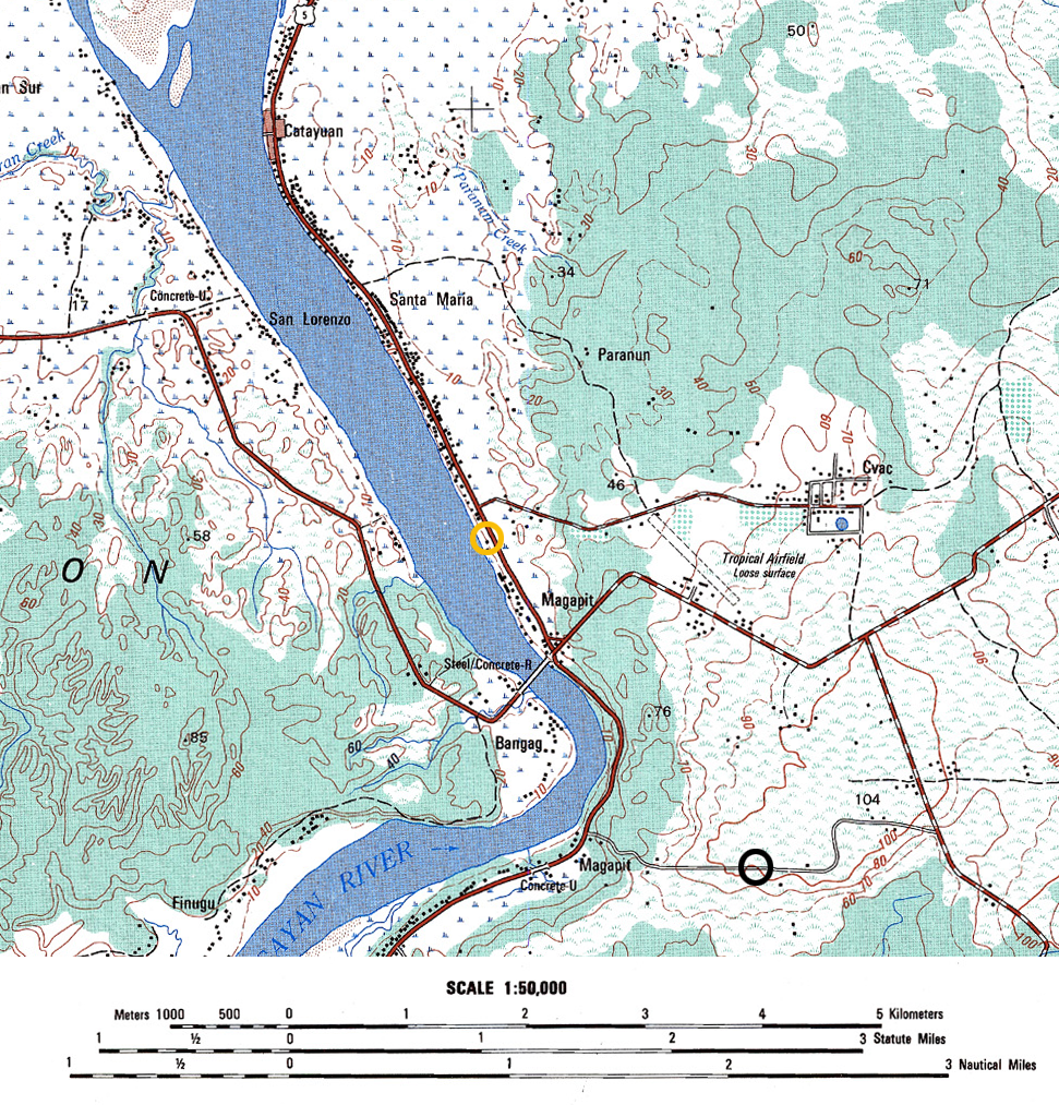
An interactive map of the area and events surrounding the crash of B-25 #44-29780 near Magapit, Luzon.
The 345th Bomb Group flew a mission to northern Luzon on May 29, 1945 with orders to destroy enemy supplies and personnel in the Magapit area. Six planes from the 501st Squadron attacked the wooded areas near the town from the north in two flights of three airplanes. At the start of their second run over the target area, B-25 #44-29780, piloted by Flight Officer W.R. Lobaugh, was hit by fire from a machine gun that was located 3000 yards north of the town, between the roadway and river. A fire broke out in the waist section of the plane, it went out of control, hit some trees where the tail broke off, and then exploded as it hit the ground. The wreckage was such that it was presumed that no one could have survived the crash. A handwritten note included in the Missing Air Crew Report, written postwar by another 501st enlisted man, suggests the possibility that the tail gunner could have survived the crash.
The MACR that is available for viewing is a collection of typed and handwritten notes that have been substituted for an actual MACR form. There is no map among the documents.
To further complicate the matter, war-era Army Map Service maps for northern Luzon are not available on the usual websites. There are several series of topographic maps available on the NAMRIA site that were compiled using 1940’s AMS maps, so they were used to position the details of this crash.
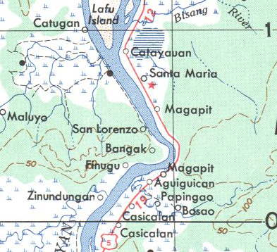
As seems common in the Philippines, there can be multiple towns sharing the same name within a close proximity. There are two Magapits in this area, several hundred yards apart along the road beside the Cagayan River. My initial inclination was to use the larger, more prominent village near the river bridge to represent the town referenced in the mission report and MACR.

Comparing the 1:50,000 scale map to the less updated 1:250,000 scale map below shows that the bridge and roadway crossing the river were built after the war. There are a set of coordinates for Magapit town given on the last page of the MACR that strongly suggest that the smaller, more southern Magapit, is the referenced town. In light of these details, I decided to use the southern Magapit to place the machine gun and crash sites. It would be interesting to see the map the 345th was using for their targeting or a mission map to know with more certainty which Magapit they were referring to.

Lost with #44-29780 were:
- F/O William R. Lobaugh, pilot
- F/O Arris Owen, co-pilot
- 2LT Wilbur W. Harper, navigator
- Cpl John Czechorowski, mechanic gunner
- Cpl Martin B. Sirota, armorer gunner
Corporal Czechorowski is listed on the DPAA Not Recovered list while the rest of the crew have graves in various cemeteries.
Included among the MACR documents is a page of handwritten notes that do not seem to belong, in that no reference is made to any of the crew or the loss location at Magapit. It appears to be a hastily jotted series of instructions for locating a small village about 25 miles to the southwest of Magapit. Whether that page was part of the postwar search for the remains of the crew of #780; was made while searching for Cpl Czechorowski; or was just misfiled would be interesting know.
