An interactive map of the details of the crash of B-25 #41-30042 on January 16, 1944. Placement of the machine gun position (orange marker) and crash location (red marker) are approximate, based on MACR 16498 and documents in the IDPF of Captain Snyder.
On the 16th of January, 1944, the 499th Bomb Squadron of the 345th Bomb Group was on an armed reconnaissance of the south coast of New Britain. Captain Jack Snyder was leading a flight of three B-25’s and found targets of opportunity within the Palmalmal Plantation on the south shore of Jacquinot Bay. During the minimum altitude run, his airplane was hit by machine gun fire originating from the point that he was strafing. The plane did a slow roll to the right, then crashed and exploded “a short distance off shore”.
The Missing Air Crew Report (MACR) for this loss contains a map of the crash area. The approximate crash site position appears to have been drawn directly offshore from Malmal village.

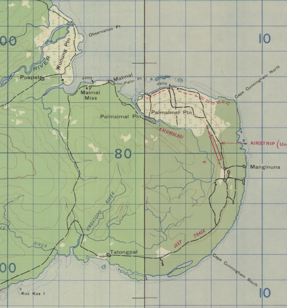
Also available are 1:63,360 topographic map sheets, dated 1943, that were produced by the US Army, GHQ, South West Pacific Area (SWPA). By merging two adjoining sheets, the places mentioned in the narratives can be better visualized.

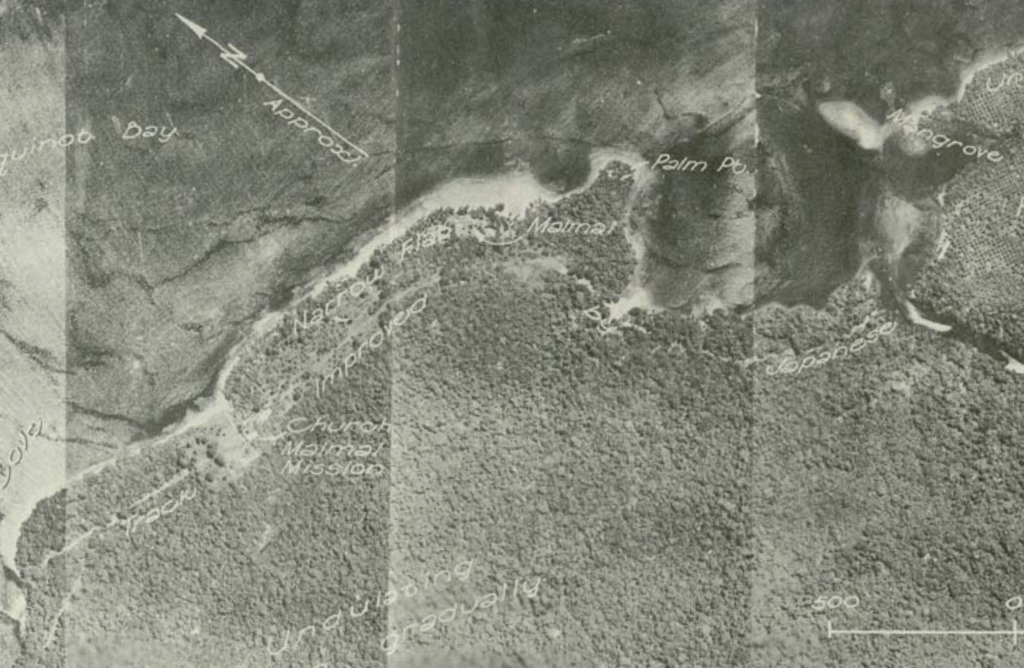
Special Report No. 63, produced by the Allied Geographical Section, SWPA, offers several mosaic aerial photos of the Palmalmal Plantation area. The aerial photo below corroborates the locations of Malmal village and Malmal Mission.

In March 1946, a Royal Australian Air Force officer investigated airplane wreckage located “approximately thirty feet off the beach southwest of Mal Mal village” and stated that the crash he investigated was consistent with the map reference of a crash at Palm Point noted in an Air Force report he was provided.
It would seem reasonable that the crash site of #41-30042 is somewhere along the 700 yard length of shoreline between Malmal village and the Malmal mission to the west, with some indication that it is closer to Malmal village.
Lost in the crash of B-25 #41-30042 were:
- Capt. Jack W. Snyder, pilot
- 2Lt Wylie E. Williams, Jr, co-pilot
- 2Lt Ernest A. Balla, navigator
- SSgt Hyman Prosten, engineer
- SSgt Lawrence W. Winterscheidt, radio operator
- SSgt John O. Huddleston, aerial gunner
All six of the crew remain on the DPAA Not Recovered list.
