An interactive map of the Suo Bay, Formosa area and the loss of B-25 44-30169 on July 11, 1945.
July 11, 1945 found four B-25s of the 500th Bomb Squadron, 345th Bomb Group flying a coastal shipping sweep along the east coast of Formosa. Formed up as two flights of two planes, they found no shipping during their flight north, so after turning around, they bombed a lighthouse on the northeastern tip of the island then continued south, searching for other targets of opportunity along the coastal plain.
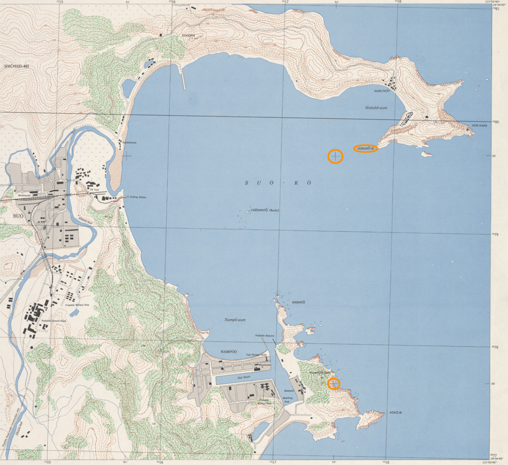
In the Suo Bay area (also referred to as Suo-ko, Su-ao, Su Ao, or Suao, depending upon the source) the lead plane took fire from several light and medium anti-aircraft positions that were strung along the ridge on Hokuho-o Point (coordinates given as 24°36’N 121°52′). A 40mm shell hit #44-30169 and caused it to cartwheel and then crash and burn in shallow water near the shore at coordinates given as 24°35’N 121°52’E. The remaining three planes dropped bombs on and strafed the A/A positions and were all damaged during the run.
As is often the case, there is no mention in the mission narrative or casualty report of which map was used to determine the coordinates and they are presented in degrees and minutes, without the precision and accuracy provided by the addition of seconds of latitude/longitude. I came across two Army Map Service maps dated 1944 that share the same map projection so coordinate placements match. Plotted directly in the WGS-84 coordinate system, the coordinates fall about eight hundred meters to the west northwest of the 1944 map locations.

I was undecided on how to position the anti-aircraft positions and the crash site until I noticed on the Formosa City Plan map for Suo (Army Map Service, 1:10,000 scale, 1944) that Hokuho-bi was called out near the end of the peninsula forming the northern edge of the bay. The glossary on the bottom of the map translated -bi to cape or point, so perhaps it was the Hokuho Point mentioned in the texts. This point was in close proxity to the coordinates for the A/A positions (well within a bounding box of 30 seconds of latitude/longitude), so it made sense to me to depend on the map coordinates to place the locations on a live map.
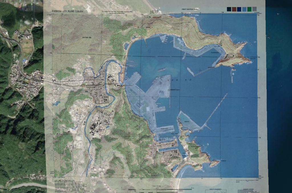
The Formosa City Plan map for Suo was georeferenced and the wartime coordinate locations were transferred to the satellite imagery for use in the live map at the top of this page.

Lost with B-25 #44-30169 were:
- Maj Robert B. Canning, pilot and Commanding Officer of the 500th Bomb Squadron
- 2Lt John W. Graham, copilot
- 2Lt Clarence E. Swallow, navigator
- SSgt Charles L. Kistner, engineer
- Sgt Gordon A. Schierman, radio operator
- Capt Robert Reeves, passenger, 5th Air Force Public Relations Section
The remains of the crew were recovered after the war and reinterred in a group burial at Fort McPherson National Cemetery, Maxwell, Nebraska, except for Sgt. Schierman, who was reinterred in a private cemetery.
