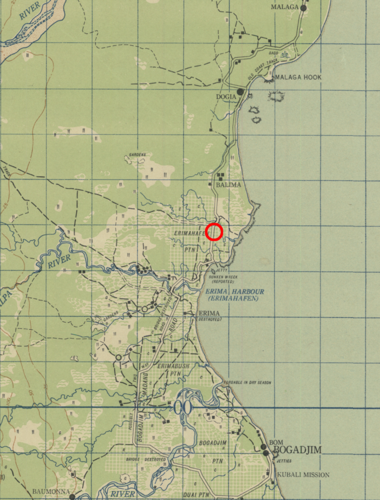
An interactive map of known information regarding the downing of B-25 #41-30017 on October 5, 1943.
Twelve B-25s of the 499th Bomb Squadron took off from Schwimmer Drome in Port Moresby on the morning of October 5, 1943. Their mission was to conduct a barge sweep along the north coast of New Guinea from Fortification Point to the mouth of the Gogol River, south of Madang.
Turning around after reaching the end of their sweep, the squadron then bombed and strafed the Erima area as three separate flights from an altitude of fifty feet.. They were met immediately with light and medium anti-aircraft fire from several positions that was exploding at two hundred feet and lower.
The third flight, made up of four planes, flew over Erimahafen Plantation from the northeast in a line abreast formation. Plane #41-30017 took a direct hit in the nose wheel nacelle and the cockpit and navigator compartment were immediately engulfed in flames. The plane was observed to nose over and fly into the ground, where the wreckage continued to burn.

The Missing Air Crew Report (MACR), which is quite dark and smudged, has an attached map that, while faint, can be read. That map has a notation that a BOGADJIM B55/6 map was used as a basemap. The Library of Congress has two digitized maps that match that description and I was able to overlay the MACR map over them by adjusting the size, while preserving the aspect ratio. Once fitted to the base map, the crash site location was then transferred digitally from the MACR map.
The annotated BOGADJIM map was then georeferenced to satellite imagery to place the crash location. That result is displayed in the live map at the top of this post.
Lost in the crash of B-25 #41-30017 were:
- 1Lt Chandler S. Whipple, pilot
- FO Royce E. Tuttle, copilot
- SSgt Walter C. Shultz, Jr., engineer
- TSgt Hubert A. Camper, radio operator
- SSgt James B. Mixon, gunner
The entire crew of five remains on the DPAA Not Recovered list.
