An interactive map showing the locations of Japanese-held airdromes in the North Molukka islands during WW2.
Northern Molukka is made up of several island groups that are located between Celebes and the Vogelkop Peninsula of New Guinea. Halmahera, Morotai, and Ternate Islands, the Sula group, and Obi Island form this archipelago, along with their associated smaller islands.
The Japanese established a naval base at Kaoe, Halmahera and according to commentary recorded in one of the monthly histories of the 500th Bomb Squadron, Halmahera was intended to be the major defensive position against any Allied drive toward the Philippines from the south Pacific.
As part of that defensive plan, the Japanese built eleven airstrips at seven distinct locations on and around Halmahera. The 345th Bomb Group flew missions near all of them during the summer and fall of 1944.
Morotai Island had one airfield, Pitoe, located on the southwest corner of the island, with a runway oriented northeast to southwest. On the map above, I refer to it as “Old Pitoe” as it was deemed unsuitable by engineers after the Allied invasion of that island. Those engineers then proceeded to build two new airfields on the same corner of the island that were oriented east to west and paralleled the coastline. Those new airfields were called Pitoe and Wama.

Galela had two airfields that were connected by taxiways and dispersal areas. More than any other Halmahera location, this one received the most attention from the 345th.

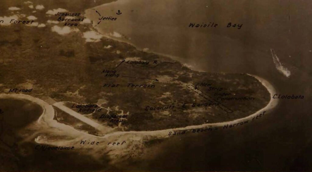
Cape Lolobata had two airfields: Lolobata and Hatetabako, which were also referred to as Lolobata #1 and #2 respectively. These were the closest airfields to the harbor facilities in Wasile Bay, where several intense missions were flown.

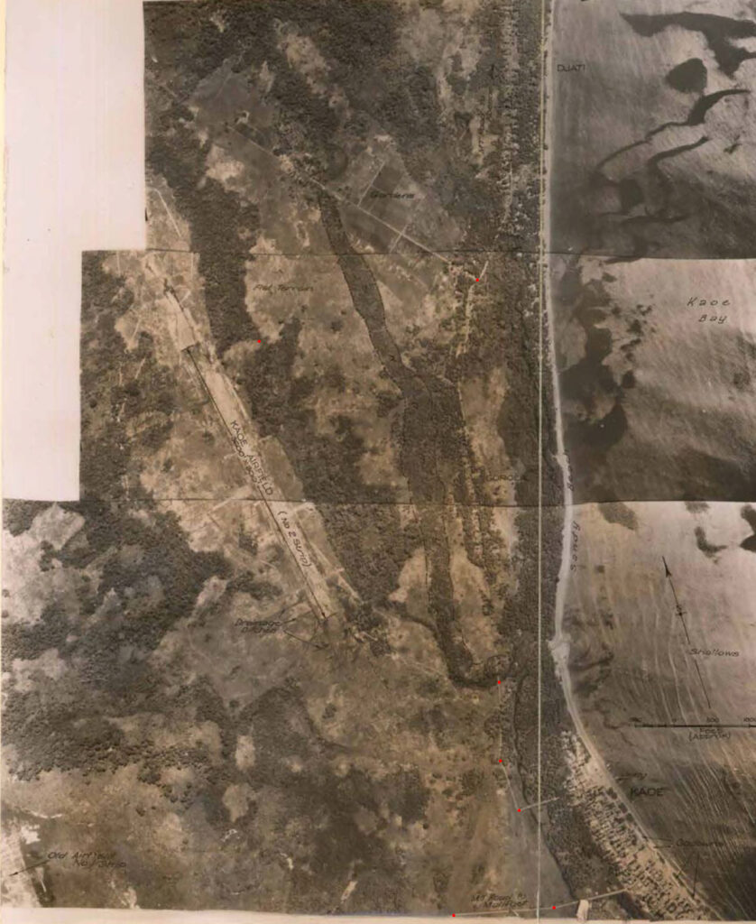
Kaoe Bay had two widely separated airfields, referred to simply as Kaoe #1 and #2. Kaoe #1 was apparently abandonded by the Japanese forces, perhaps because of drainage problems that made it unserviceable. Locating this airdrome on the satellite image was performed using the distinctive bends in the Kaoe River and the straight road from the village of Kaoe, which still exist today.

The photomosaic below shows Kaoe #2 and was georeferenced to satellite imagery in order to determine the location of the airdrome. The red dots were added to the image to use as control points in georeferencing. Kuabang airport occupies this site today.

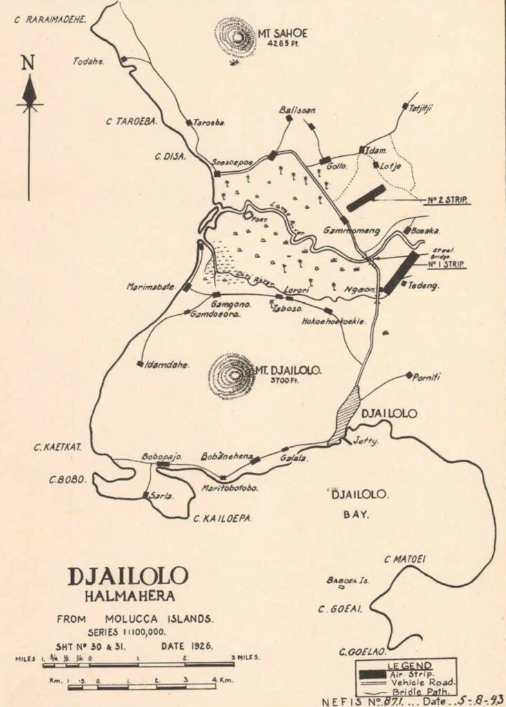
Djailolo, on the western coast of Halmahera, had two widely separated airfields, referred to as Djailolo #1 and #2. Determining the precise locations of these airfields was the topic of a previous post.

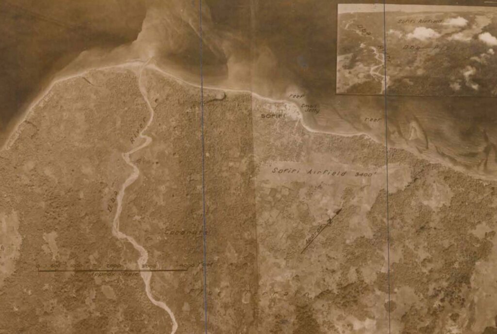
Sofifi (yet another exotic placename on Halmahera) was located along the southern approaches to Dodinga Bay and was the closest to the Japanese headquarters on Ternate Island, which lay about 14 miles to the west. I have no record of the 345th bombing this airfield specifically, but they flew barge sweeps along this coastline and found targets over the nearby Ternate Island and Dodinga Bay.

While the 345th was operating in the Northern Molukka area, it was rare for them to find serviceable enemy aircraft on these airdromes and even rarer for them to be intercepted by enemy fighters. The combined efforts of the Allied airplanes might have induced the Japanese to preserve their aircraft by moving them to other, less hazardous, island airfields.
