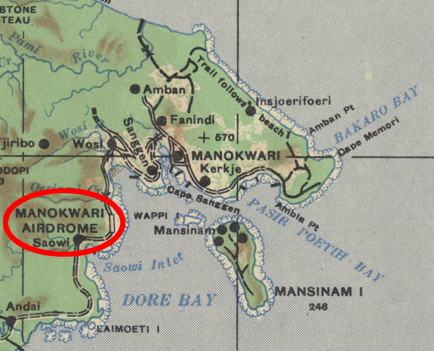
An interactive map showing the locations of the Japanese-held airdromes in the Manokwari, Dutch New Guinea and Noemfoor Island areas.
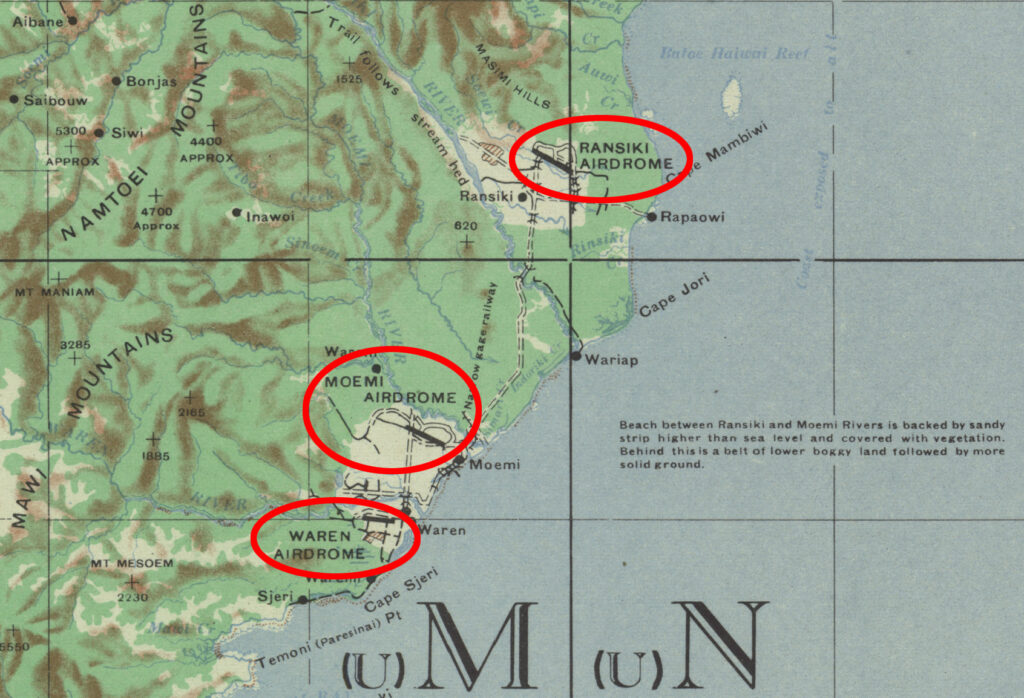
While reading through the unit histories of the 38th and 380th Bomb Groups, I came across references to airdromes in the Manokwari, Dutch New Guinea area that were not mentioned in the mission reports of the 345th Bomb Group. After some research, I came across a 1946 US Corps of Engineers map series that showed the locations of three airfields that were along the coast forty to fifty miles south of Manokwari. The Ransiki, Moemi, and Waren airdromes had all been built on cleared plantation land.

When the 345th started staging their missions out of Hollandia, and continuing after their move to Biak, Manokwari and Noemfoor were occasional targets. Manokwari is roughly 150 miles west of Mokmer, Biak.

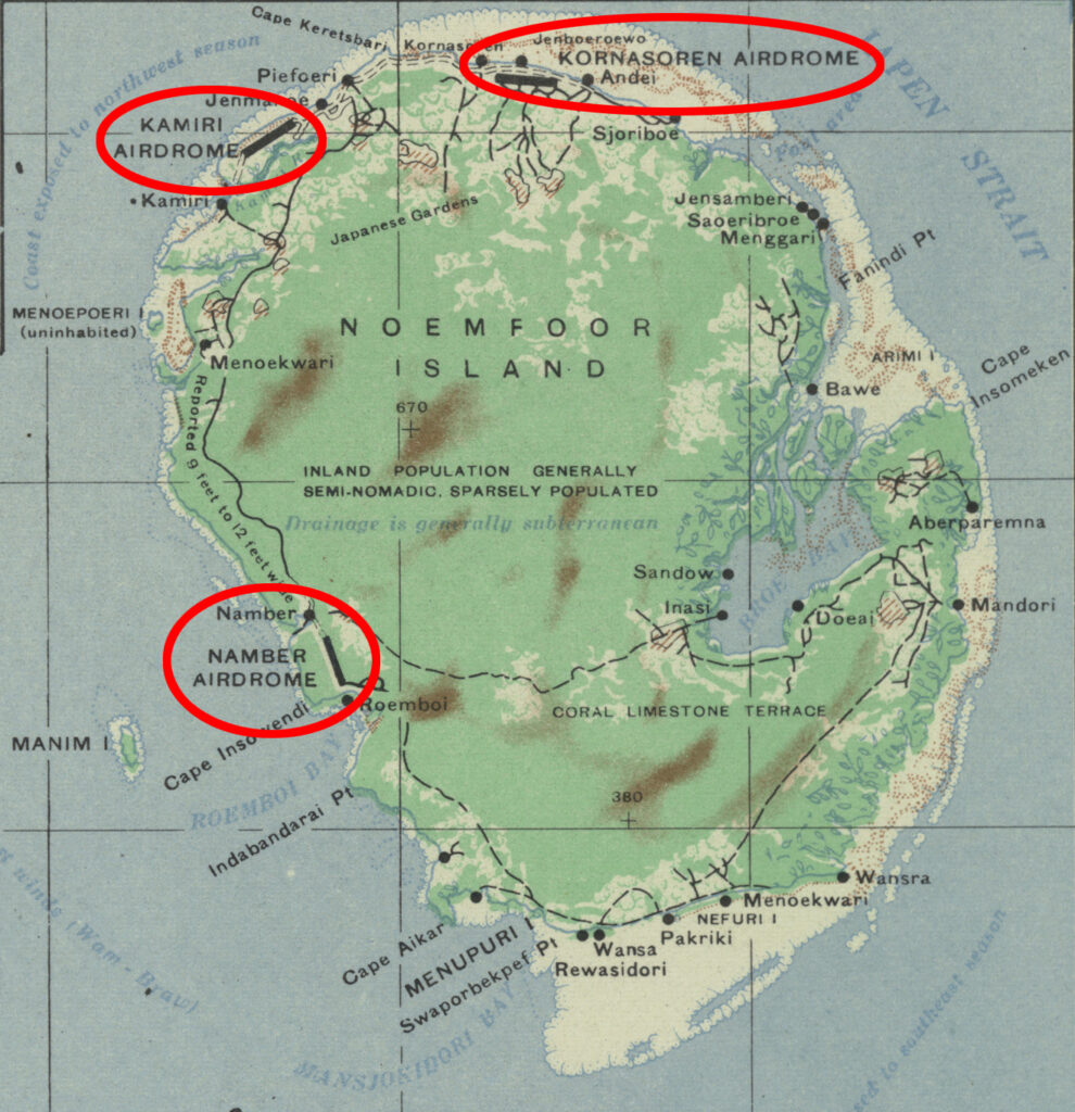
The Japanese also built three airdromes on Noemfoor Island. Kamiri, Namber, and Kornasoren dromes were all created by clearing jungle-covered coastal plain. I included them in this map because Noemfoor Island is only about fifty miles east of Manokwari. Noemfoor Island was invaded by the Allies in July 1944 and the airfields were taken over and then improved.

I don’t know if the Japanese forces built all these airfields as part of an overall policy of having mutally supporting bases; if they had that many aircraft that they needed the space; or if they were a response to frequent bombings by Allied aircraft. Whatever their reasoning, the effect was to require more effort by Allied forces to neutralize the airpower of the Imperial Japanese Army Air Force.
