
An interactive map showing the locations of Japanese airfields and seaplane bases on Kyushu Island as of August 1945.
While looking through a microfilmed reel of Fifth Fighter Command documents, I came across a map and data table for enemy air installations on Kyushu Island that was based on intelligence information current as of August 1, 1945. After piecing the map and chart back together from several separate pages, forty-seven airfields and nine seaplane bases were displayed. In a May 1945 Staff Study of the OLYMPIC Operations in Southern Kyushu, authored by General Headquarters, United States Army Forces in the Pacific, eighty-six air installations were listed, but most appear to be refinements of the basic list of forty-seven. For an island with a land area of about 14,000 square miles, which is roughly 2,000 square miles less than the Upper Peninsula of Michigan, it was certainly well provisioned with air facilities. Some of these airfields were used as bases or refueling points for kamikaze aircraft during the Allied invasion of Okinawa.
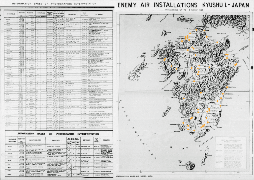
A reconstructed map and data sheet for the known airfields on Kyushu, Japan as of August 1945. Orange dots have been placed over the originals for clarity. From reel A7506 of microfilmed documents of the Fifth Fighter Command, provided by AFHRA, Maxwell AFB, Alabama.
Using an almost complete set of 1945 Army Map Service Kyushu maps, aerial reconnaissance photos from a 1945 Terrain Study, a 1945 Kyushu Special Strike map, and several target charts, the locations of the airfields and seaplane bases were plotted on the interactive map at the top of this post. Exact location details were unavailable for the Kumanosho airfield, so that airfield outline is only a guess, placed in flat terrain near the town of the same name.
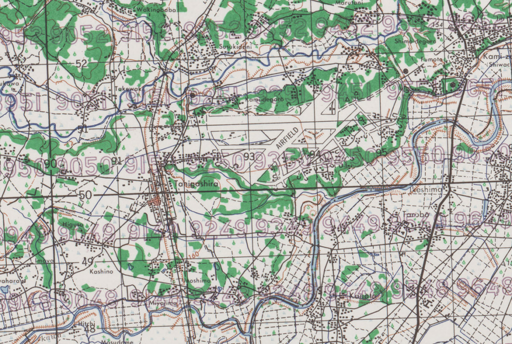
As an example of an airfield plotted from 1:50,000 AMS map data, the three runways of Miyakonojo North are shown below. The major roadways and the railroad bed are still visible on satellite imagery as are many of the prominent river bends.
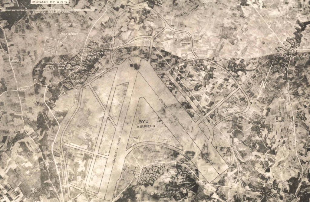
Special Report No. 130, S.E. Kyushu, published by the Allied Geographical Service in 1945, has aerial photos of many of the airfields listed on the Enemy Air Installations map. Below, Byu airfield is shown in a photomosaic and includes the tracings of various features made by photointerpreters.
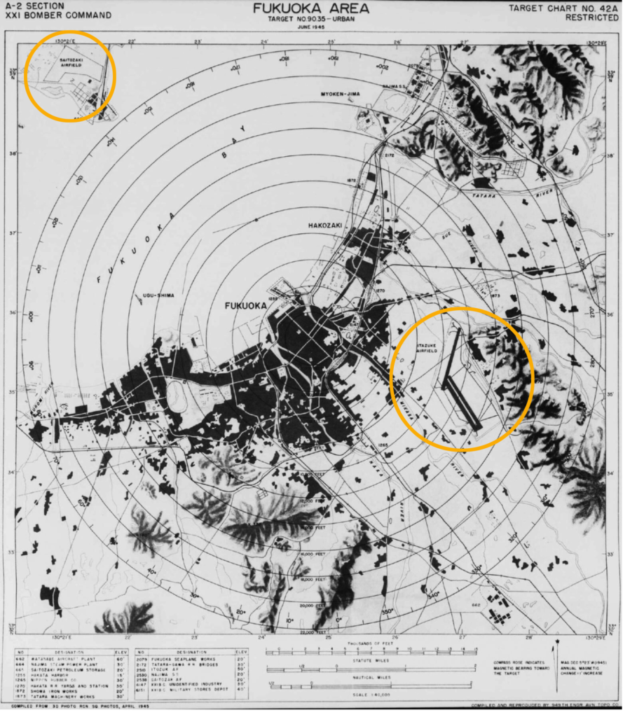
Target charts were another source of information for airfields. Itazuke and Saitozaki airfields near Fukuoka are shown on target chart number 42A below.
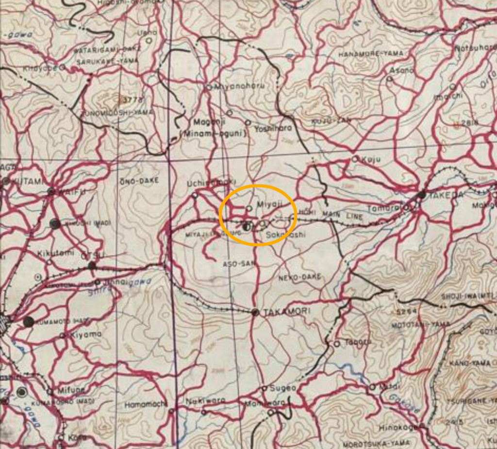
Miyaji airfield was only found marked on one map: a Special Strike Map of Kyushu. Produced by the engineers of the US 6th Army, it was also in use by navy pilots for their bombing missions. The map’s placement of the airfield in a distinctive curve in the rail line south of Miyaji was the only hint of where this airfield was located.
Navy aircraft and Air Force B-29 bombers flew many missions against Kyushu beginning in March of 1945 as part of the general strategy of reducing the number of enemy aircraft and in preparation for a planned Allied invasion of southern Kyushu.