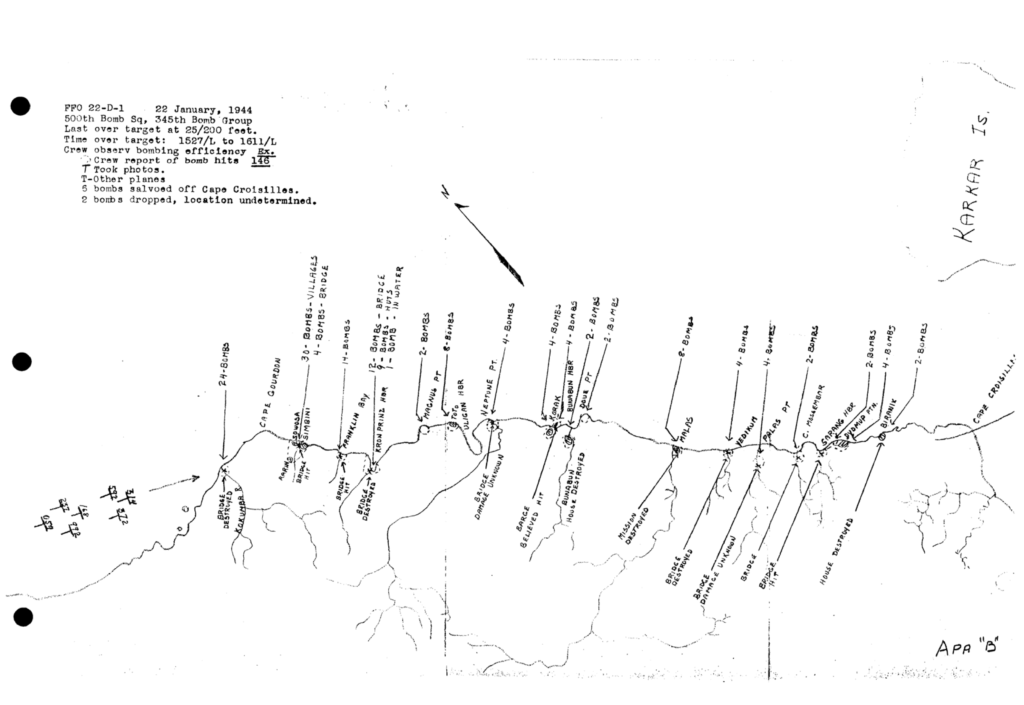
An interactive map of the coastal sweep mission flown by the 500th Bomb Squadron on January 22, 1944 along the north coast of New Guinea.
Sweeps of coastal areas for barges and targets of opportunity became a frequent type of mission for the 345th Bomb Group as they moved away from their original bases in Port Moresby, New Guinea. Many of these sweeps did not produce much but I came across one particular mission flown by the 500th Bomb Squadron on January 22, 1944 that was well documented and related an exceptional amount of bombing activity.
With the time spent over target just shy of forty-five minutes and covering a straight line distance of about fifty miles, seven B-25s, split into two flights, dropped 148 100-pound bombs on barges, bridges, and buildings from Cape Gourdon to Cape Croisilles along the north coast of New Guinea.

The live map at the top of this page incorporates the location, target and number of bombs dropped at each target. Bomb placements were made randomly to cover each target. Finding the target locations was assisted by using both 1944 Australian Army 1:253,440 and 1943 US Army 1:63,360 scale maps. Bridges and villages are positioned as depicted on those maps.
