
An interactive map of the last known sightings of B-25 #42-32293 over the Coral Sea.
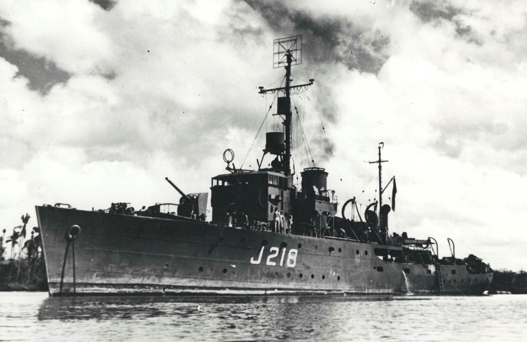
On July 14, 1943, the 498th Bomb Squadron, 345th Bomb Group, flew a single plane submarine patrol mission for the HMAS Kapunda, which was escorting ALAMO and COLORADO force vessels from Port Moresby to the Grafton Passage, off Cairns, Australia. While the ALAMO refers to US 6th Army forces in New Guinea, I have yet to find references for the codename COLORADO. The convoy left Port Moresby around 1400 hours on a heading of 176° at a speed of 7 ½ knots. The B-25 was to fly a random pattern around the convoy, looking for sign of enemy submarines, until dusk. At about 1630 hours, the convoy lost sight of the escorting airplane at some unspecified point between the convoy and the shoreline. When the B-25 did not return to Jacksons Drome that evening, a search mission was set up for the next morning, but no sign of the plane or it’s crew was ever found.
The Missing Air CrewReport (MACR), which was written fourteen months after the incident, includes a map of the last position of B-25 #42-32293 as reported by a naval vessel. The statement in the MACR indicates that the plane was not seen to crash, but was seen to “disappear from view”. Their sighting places the location to the southwest of the 11°S 148°E marker, and is about 80 miles south of Hood Point.
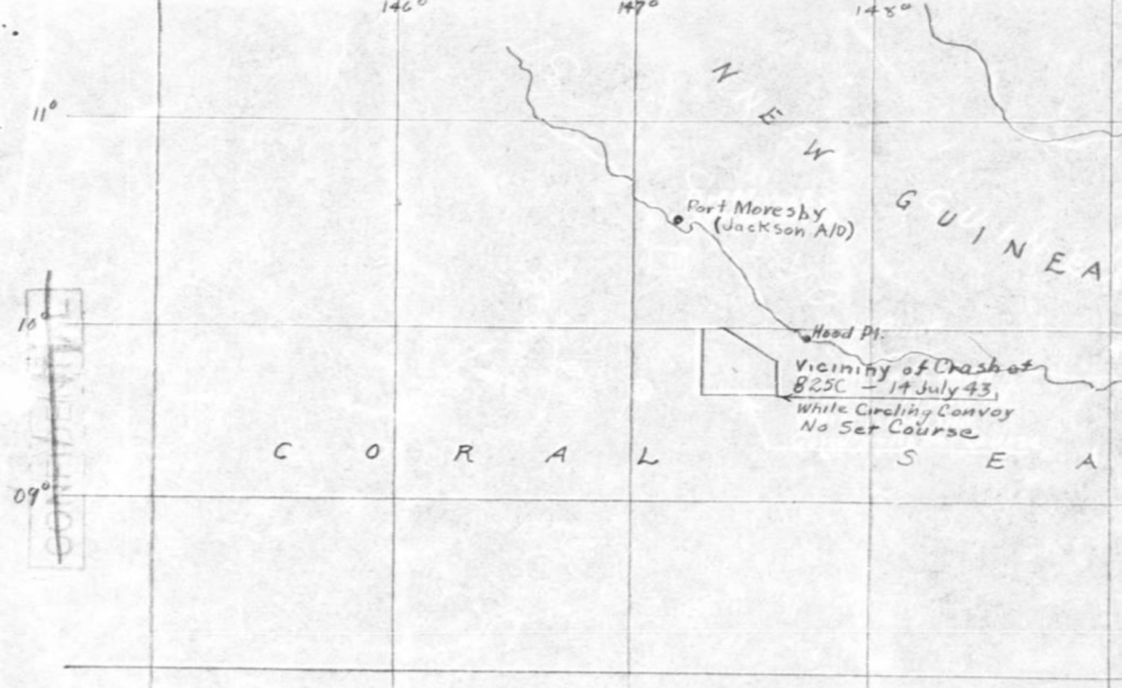
A second map included in the MACR shows the vicinity of the crash to the southwest of the 10°S 148°E position. The degrees of latitude along the left edge of the map are out of order, as being south of the equator, the lower latitudes should be toward the equator which is off the top of the map. To complicate matters more, the spacing of the lines of latitude are narrowed south of 10°S. Stretching the image vertically to correct the narrowed latitudes changed the shape of the vicinity of crash polygon, and also caused changes in the shape of the New Guinea coastline. Not knowing the originator’s intent of the narrowed latitudes, and in order to preserve the shape of the shoreline, I decided to not correct the latitude spacing.
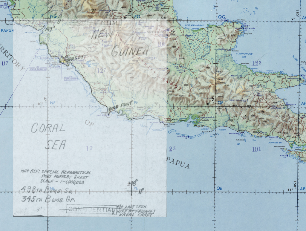
The naval “last seen” map was fit to an Australian Military Forces navigation chart by aligning the points where lines of latitude and longitude crossed. This provided a good fit of the shorelines and the locational features noted on the map.
The “vicinity of crash” map was fit to the navigational chart by aligning the corner coordinates of the grid square containing Port Moresby. This preserved a good fit of the shorelines and locational features, maintained the original shape of the vicinity of crash polygon, and placed the crash location to the southwest of 10°S 148°E.
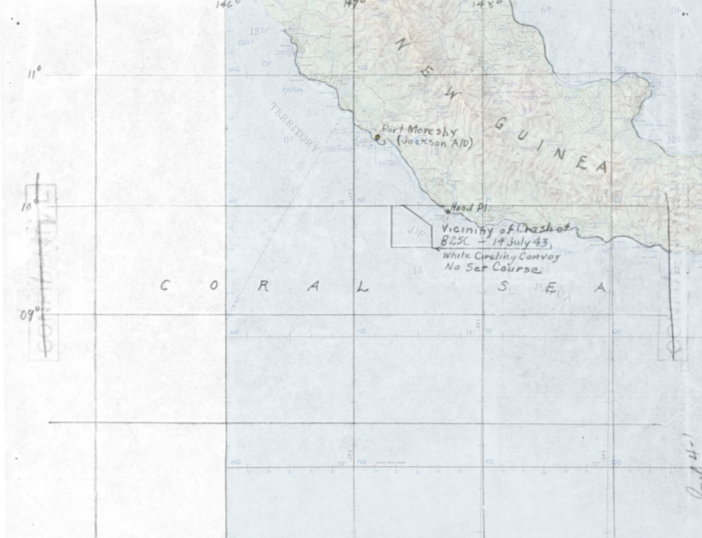
The “X” and polygon markers from the MACR maps were traced digitally onto the navigational chart to show their relative locations and for georeferencing to satellite imagery. The two sightings are about 80 miles apart, but the naval sighting was not specified as a crash site, only as a “last seen” position. The accompanying statement does say, however, that the plane was last sighted in close proximity to the New Guinea coast, which is more in agreement with the polygon marker, the center of which is 20 miles from the shoreline.
Using the heading, speed, and departure time of the convoy from Port Moresby, they would have proceded approximately 18 nautical miles in the two and a half hours before the B-25 went missing. Measuring from the outside of the harbor in Port Moresby to the nearest edge of the bounding box suggests that 33 nautical miles were actually covered during that period. It is possible that the ships in the convoy were capable of speeds beyond the reported 7 ½ knots.
From the sparse data provided, it would seem likely that the crash occurred between the north edge of the vicinity of crash polygon and the New Guinea coast.
Lost with B-25 #42-32293 were:
- 2Lt Victor V. Brooksby, pilot
- 2Lt Frank A. Gerber, Jr., copilot
- 1Lt Robert E. Gagen, bombardier
- Cpl Ephriam R. Poole, engineer
- TSgt Paul B. Drinkard, radio operator
- SSgt Adam V. Domijan, gunner
The entire crew of six remains on the DPAA Not Recovered list.