
An interactive map of the locations mentioned in the scribbled notes. Imagery credited to Earthstar Geographics and Esri.
In the documents that make up the Missing Air Crew Report for the Lobaugh crash at Magapit there was one page that seemed unrelated to that crash. After closer scrutiny, it became apparent that the handwriting had been made diagonally on the back or inside face of a manila folder or file jacket; as if it had been grabbed hurriedly to take down unexpected information about a location. There is a stamped block in one corner that bears a signature and is dated 7 Feb 1946, which suggests to me that it was included as an official document in some file after being written.
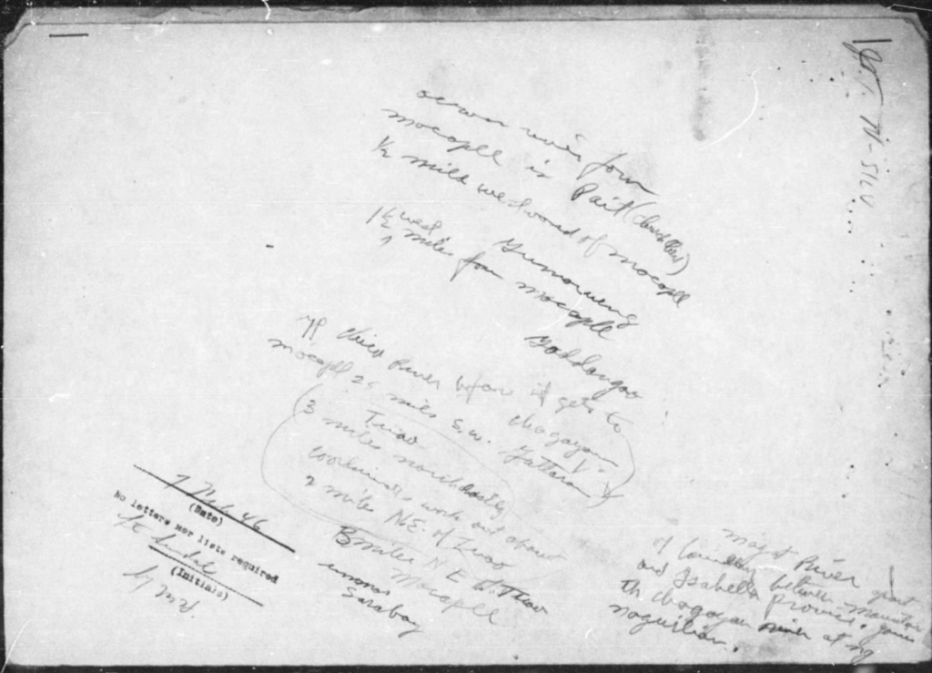
The locations described in those notes are about twenty five miles to the southwest of the Magapit area, so it would not seem to be directly related to the Lobaugh crash site. With no noticeable surnames or even a hint of what the topic of the document might be, it seems that it could have been filed incorrectly with MACR #15430 or was perhaps part of the post-war search for the graves and remains of US soldiers.
After reading the through the notes several times, it became clear that most of them were written to express the location of the village of Macapil (spelled Mocopel in the notes) in relation to other villages in the area.
War-time maps of this particular area are not available from the online map collections I use, but several map series that were produced from 1940’s map data were found.

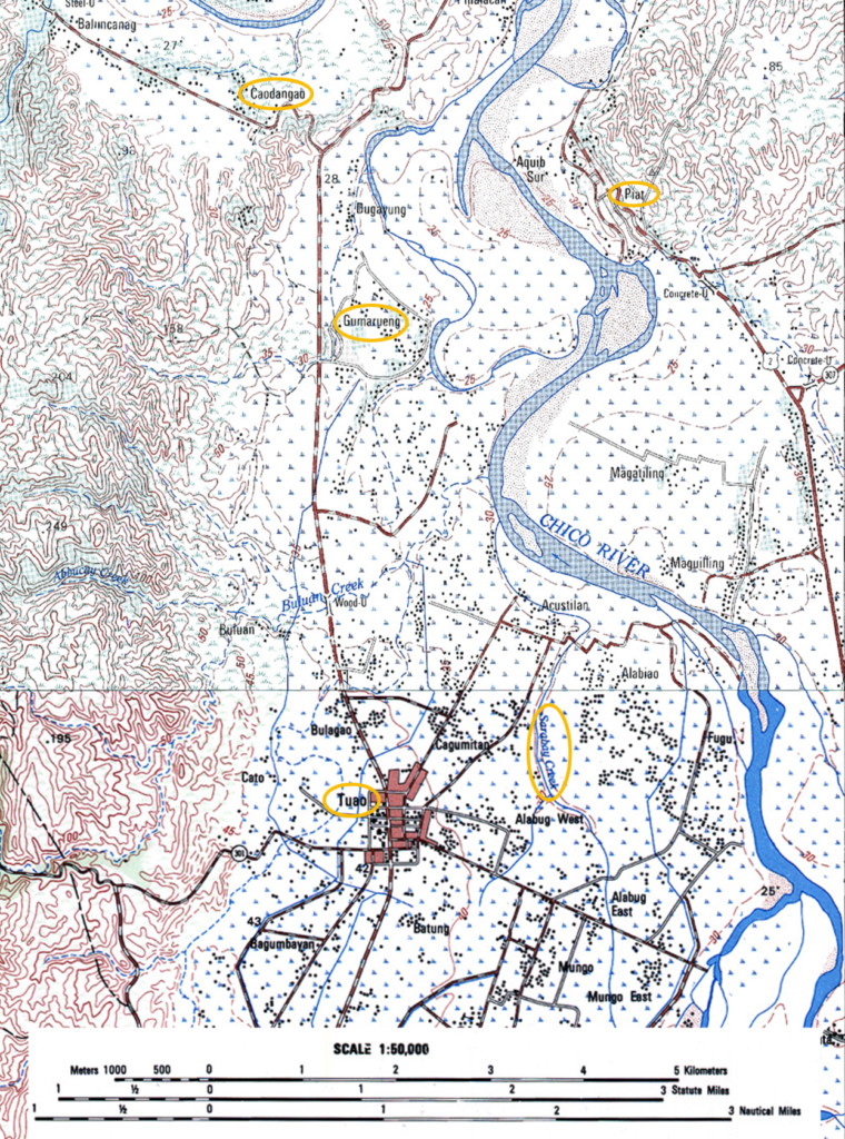
Because the Chico River channel has changed over time, I georeferenced the undated 1:50,000 map sheets to satellite imagery to get an idea of where it used to be. The screenshot below shows the overlay and the former and current riverbeds. The Macapil village location has changed from the west to the east bank of the Chico River, and was presumably consumed as the river bank eroded.
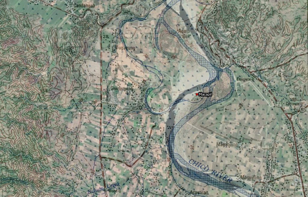
Below is the same screen shot with the map overlay removed and the village locations made viewable to show more clearly the 1940’s locations on the current landscape.

None of this helps to shed any light on who or what the scribbled notes were meant to reference, but it is interesting to be able to place war-time places onto a present day map with some degree of accuracy.