
An interactive map of the Japanese-held airdromes on Borneo and Celebes during WW2.
During WW2, there were at least 37 Japanese-held airdromes on Borneo and Celebes. Many of those airdromes were being built by the Dutch just prior to the beginning of the war. As the Japanese consolidated their hold on the Netherlands East Indies, they set about improving the existing runways and building more to suit their purpose.
From August through October, 1944, the 345th Bomb Group flew quite a few missions to northeastern Celebes in general, and directly against several airdromes in particular. They flew only one mission to Borneo when ten airplanes staged out of Morotai and raided the harbor at Sandakan.
The airdrome at Langoan, Celebes, as well as towns and buildings in the same vicinity, were targeted by the 345th Bomb Group during September and October, 1944.
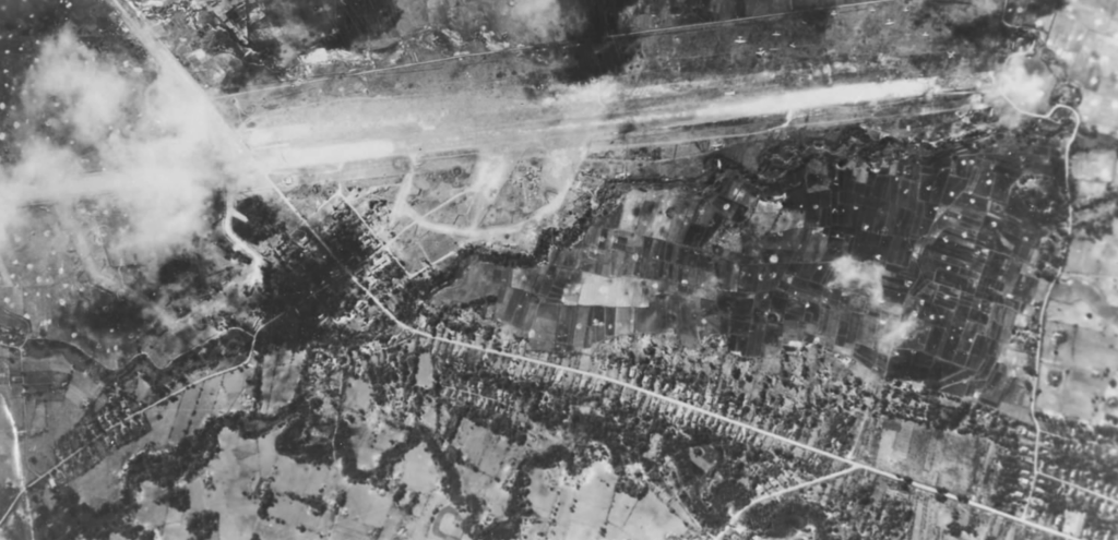
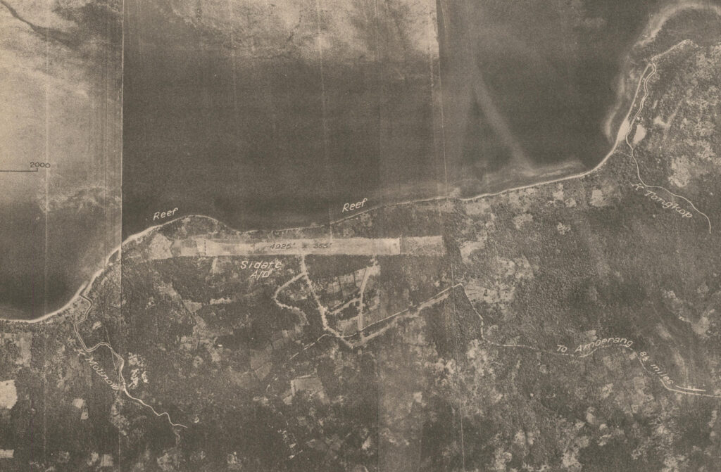
Sidate airdrome, on the northern coast of northeast Celebes was targeted several times during September and October 1944 by all four of the 345th’s squadrons.
This is not to say that the other airdromes were neglected. Long-range heavy bomber units and other medium bomb groups of the 5th Air Force, as well as units from other US and Allied air forces, flew mission all across this area.
The interactive map at the top of the page displays more detail the closer you zoom in on a dot, at first displaying the airdrome name and then finally displaying the shape and orientation of the runways themselves. Popups provide runway lengths and miscellaneous information.
The location and layout data for the map were taken from eight separate war-era terrain studies that covered parts of each of the islands. Most airdromes had vertical aerial photos in the terrain studies that could be georeferenced to the satellite imagery for a more accurate representation of their layout. A few only had maps displaying the locations and a couple had neither, as they had never been observed closely enough to gather intelligence. Those locations have notes in their popup indicating that the location is only an estimate based on a description in the terrain study.
One airdrome was particularly difficult to georeference, mainly because the area had been built up considerably since the aerial photo was taken. The Kuching dromes were in the same general area as the present Kuching International Airport, but there were no significant terrain features with which to place it on the satellite imagery. After starting over several times, and then studying the road map, rail map and the vertical mosaics included in the terrain study, I was finally able to recognize three minor transportation features that still exist today: a bend in a road; a bend in a railway line; and a distinctively-shaped road junction. Those features are highlighted with red ellipses in the image below.

The terrain studies were produced by the Allied Geographical Section, South West Pacific Area (SWPA), from 1942 through 1945. Digitised copies of many of the studies are available for viewing or download through the Monash University Collections Online.